Mount Wilson Hike: Observatory, Trails & Views
DISCLOSURE: This post may contain affiliate links. If you purchase after clicking one of my links, I may earn a small commission at no extra cost to you. As an Amazon Associate, I earn from qualifying purchases. For more information, see my disclaimer.
Mount Wilson has a reputation, and it’s well earned. As part of the SoCal Six Pack of Peaks Challenge, this hike dishes out a serious climb, dramatic scenery, and the kind of summit views that remind you why you hike in the first place. I took on the Mount Wilson trail from Sierra Madre, climbing through shaded canyons, past waterfalls, and up to the historic observatory. It was tough, beautiful, and full of surprises. In this post, I’m sharing the full experience, trail details, personal highs and lows, and everything I wish I’d known before hiking Mt Wilson.
About Mount Wilson
Mount Wilson isn’t just another SoCal peak; it’s a mountain steeped in history, science, and magnificent views. At 5,713 feet, it’s one of the most iconic summits in the San Gabriel Mountains and a cornerstone of the Southern California hiking scene.
Home of the Mount Wilson Observatory
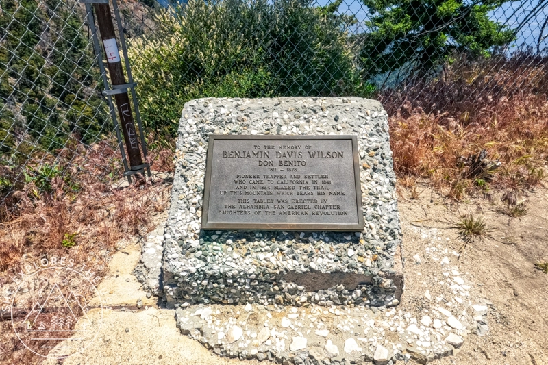
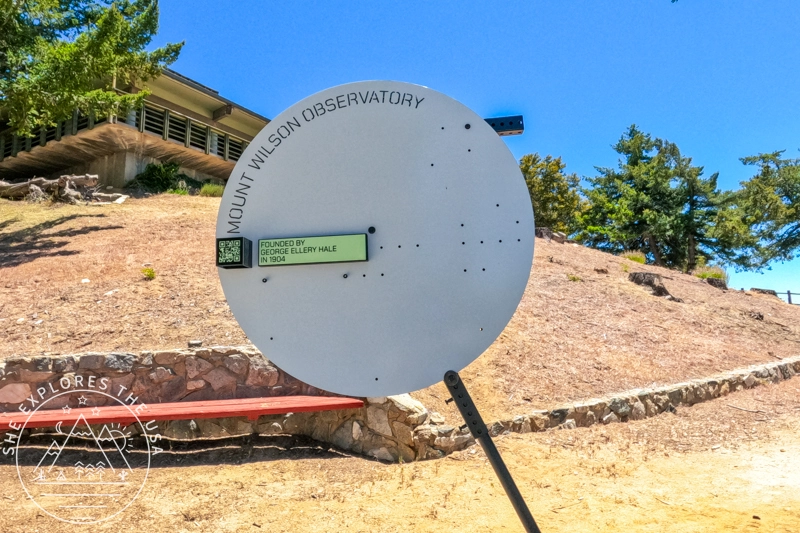
What really sets this peak apart is the Mount Wilson Observatory, perched right at the summit. This historic site played a pivotal role in shaping modern astronomy, housing the renowned 100-inch Hooker telescope, once the largest in the world. Edwin Hubble made groundbreaking discoveries here about the expanding universe, and even today, the observatory remains an active research site. It’s open for public tours on select days, and just walking around the grounds feels like stepping into the past.
Panoramic Views
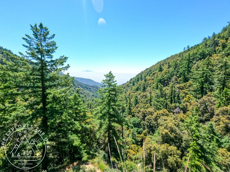
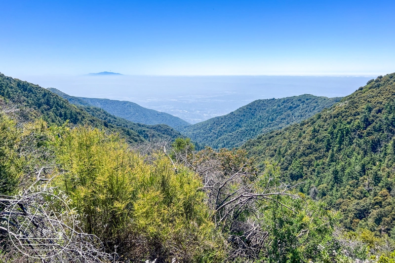
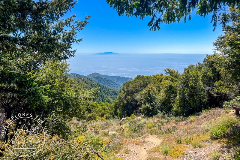
From the top of Mount Wilson, you get some of the best views in all of Los Angeles. On a clear day, you can see the San Gabriel Valley, downtown LA, Catalina Island, and even the Pacific Ocean. And when the marine layer rolls in, it’s not uncommon to find Mt Wilson above the clouds, with only distant peaks poking through a sea of white. Sunrise and sunset hikes here? Absolutely next level.
A Challenge for Hikers
Mount Wilson is a rite of passage for local hikers for good reason. Most routes to the summit are long and steep, including the popular trail from Sierra Madre via Little Santa Anita Canyon. You’ll earn every mile, but you’ll also earn those views.
Nature and Wildlife
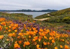
Despite being so close to the city, the mountain is teeming with life. Expect dense forest, seasonal waterfalls, wildflowers in the spring, and the occasional deer, snake, or curious squirrel along the trail.
A Hub of Connectivity
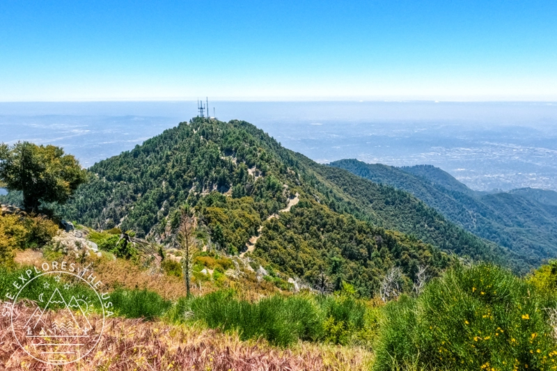
The summit is also home to a forest of broadcast towers. It’s not the most “wilderness” vibe, but those towers serve as a major transmission point for radio and TV signals across Southern California, and they give Mount Wilson its own kind of industrial-meets-natural character.
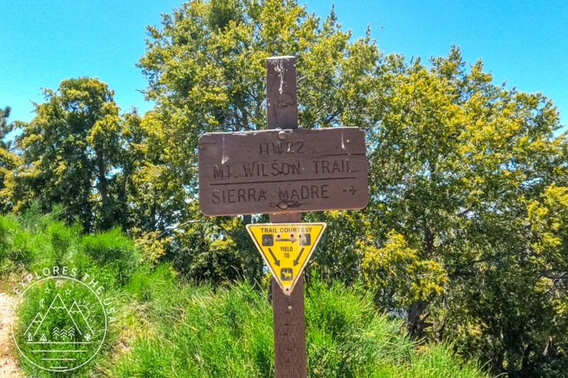
About Mount Wilson Trail
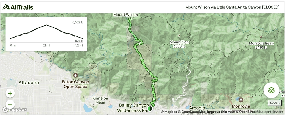
I hiked to Mount Wilson via the Little Santa Anita Canyon route, a 14.2-mile out-and-back trail known for being both challenging and rewarding. With 4,852 feet of elevation gain, it delivers a serious workout through lush canyon scenery and shaded forest.
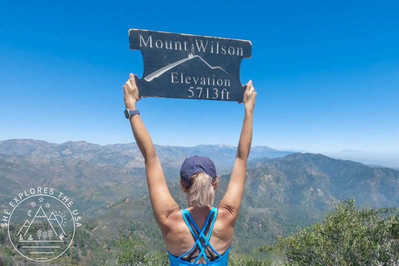
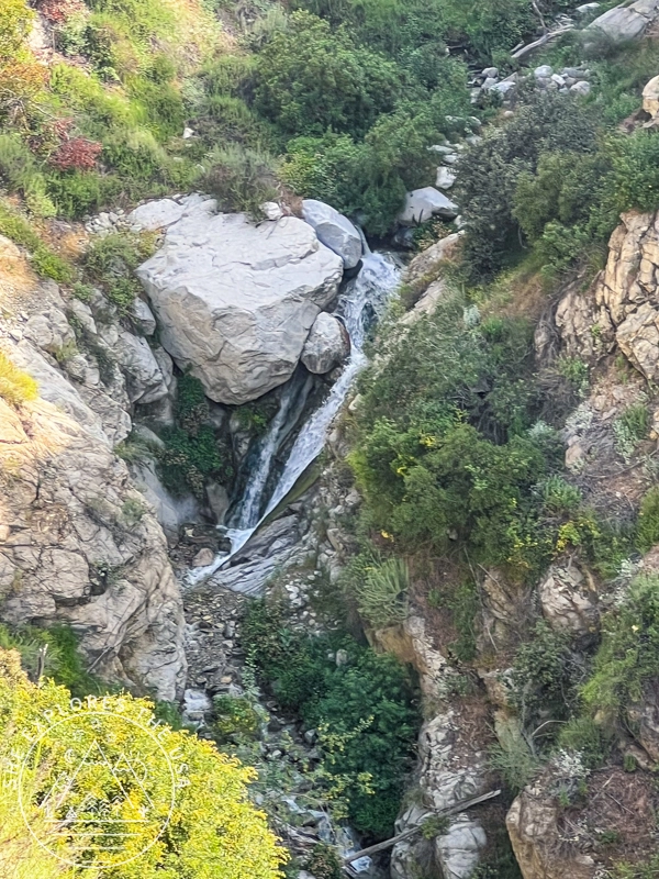
The trail winds along rocky ridges, past waterfalls and scenic overlooks, with steep switchbacks that keep you on your toes. It’s a beautiful but demanding route that really shows off what Mt Wilson has to offer. And if you’re aiming for a summit photo with the wooden sign, be prepared to add an extra mile to your hike.
Free on-street parking is available near the trailhead.
Mount Wilson Quick Facts
- Elevation: 5,713 ft (1,741 m)
- Trail Distance (Sierra Madre Route): 14.2 miles round trip
- Elevation Gain: ~4,850 ft
- Trail Type: Out-and-back
- Other Routes: Chantry Flats, Eaton Canyon (check status)
- Known for: Observatory, broadcast towers, panoramic views, historic significance
Mt Wilson from Sierra Madre Trail Map (Reopened as of January 13th, 2026!!)
Click the map to view the full route on AllTrails.
🥾 Plan Smarter Hikes with AllTrails
AllTrails is my go-to for trip planning, from checking trail reviews to downloading maps, navigating from my phone, and sending routes straight to my Garmin 67i. Offline maps, alerts, and AI route planning make upgrading to Plus & Peak worth it!
Alternate Route to Mount Wilson
If the Sierra Madre route is closed or you’re looking for other options:
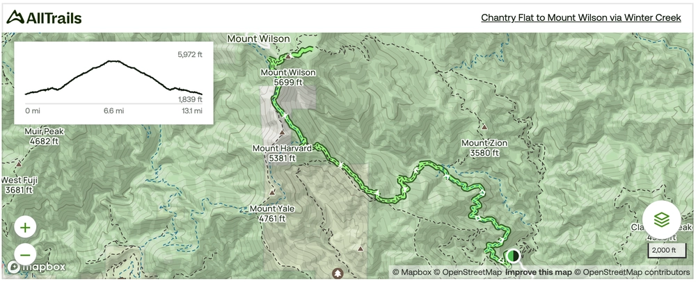
- Chantry Flats to Mount Wilson: This 13.5-mile loop features cascading waterfalls, shaded trails, and beautiful canyon views. Open as of April 2025.
Always check current trail conditions before you go.
Chantry Flats to Mount Wilson Trail Map
Click the map to view the full route on AllTrails.
Gear Recommendation for your Mt Wilson Hike


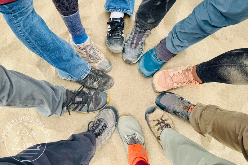
How to Choose the Best Hiking Shoes (& Top Picks)
Choosing the right hiking shoes is key to comfort, performance, and safety. The right footwear prevents discomfort on rugged […]…

Garmin GPSMAP 67i Review & Which InReach Suits You?
Review of the Garmin GPSMAP 67i and comparison to the GPSMAP 66i, Mini 2 and InReach Messenger plus[…]…
Hiking Mt Wilson from Sierra Madre
The Ascent to Mt Wilson
Starting the Hike
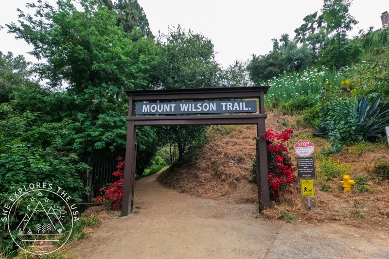
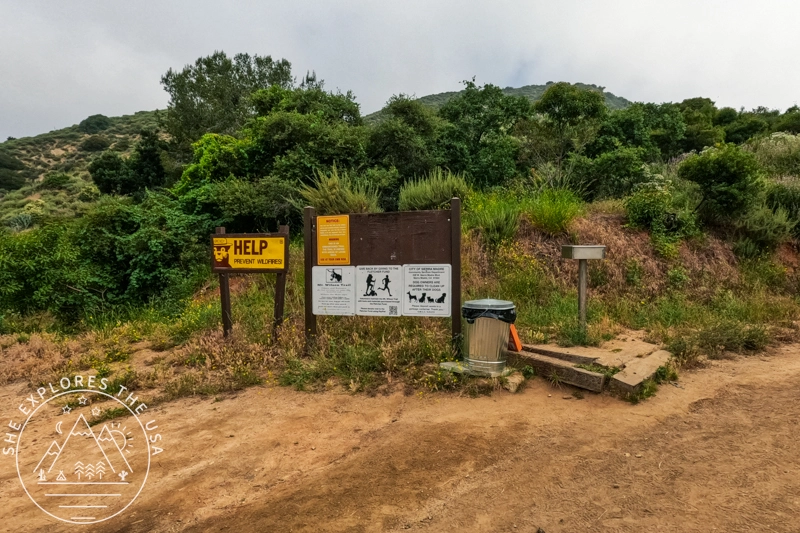
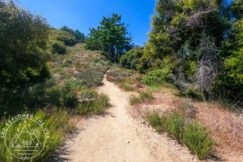
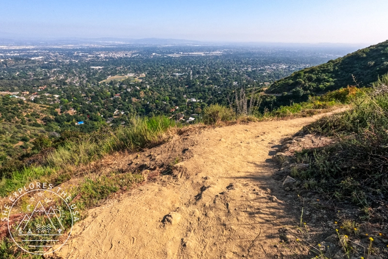
I started my hike at 8:40 am after driving up from San Diego. The trailhead is marked with a wooden gate, which makes a great photo opportunity! It also comes with several warning signs related to heat danger. The first part of the hike is very exposed, so carry enough water and know your limits. Reaching the top is not worth compromising your health. There is also a sign that the trail is dog-friendly but requires dogs to always be on a leash. However, I noticed that the people I saw on Monday did not comply with that rule!
Trail Description
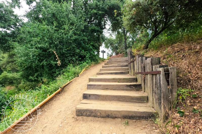
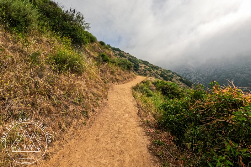
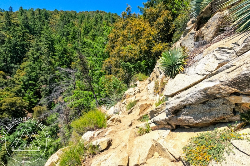
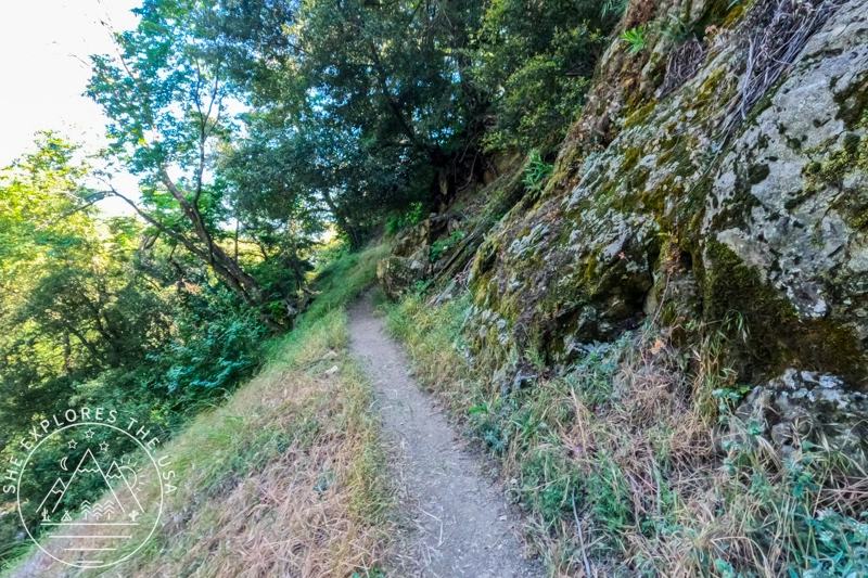
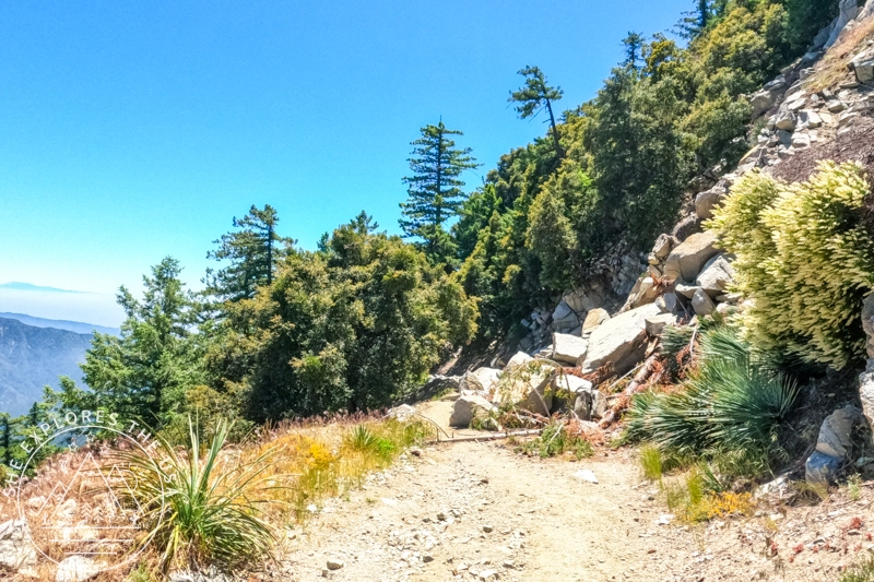
The ascent is a steady uphill, with seldom flats and downhills. Don’t be fooled by the occasional flat stretch; a steeper uphill usually follows! It’s quite a brutal 7.1-mile climb to the top.
Shade and Scenery
Despite the trail’s reputation for being exposed, I was surprised by how much shade was available. I could always find a stump or rock to rest on in the shade when I needed it. Much of the trail is in the forest, surrounded by trees. Of course, since you’re outdoors, there is some exposure to the elements, but it’s not in the sun the whole way up.
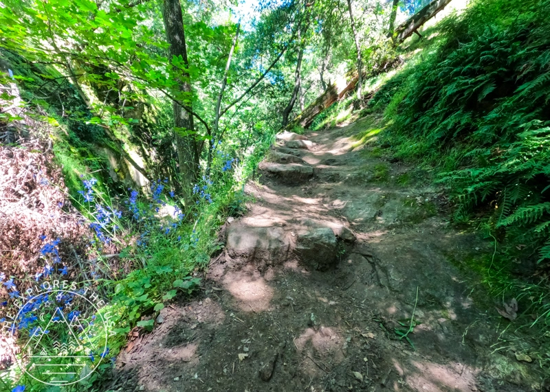
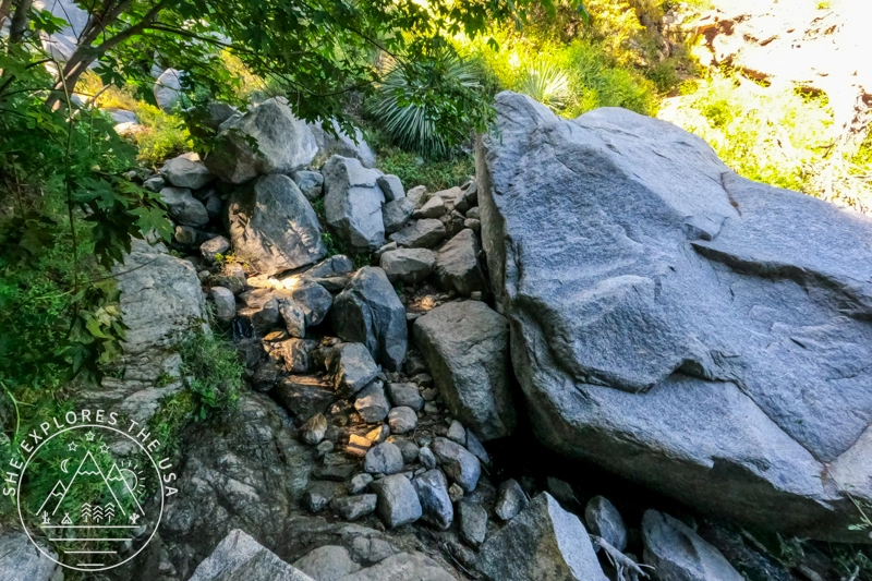
Stream Crossings, waterfalls, and scenic views
I encountered two stream crossings and saw three waterfalls.
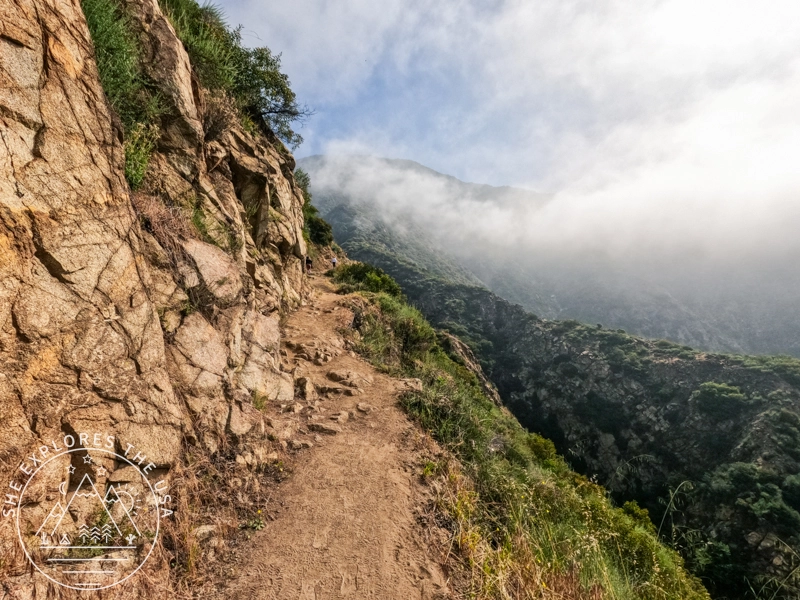
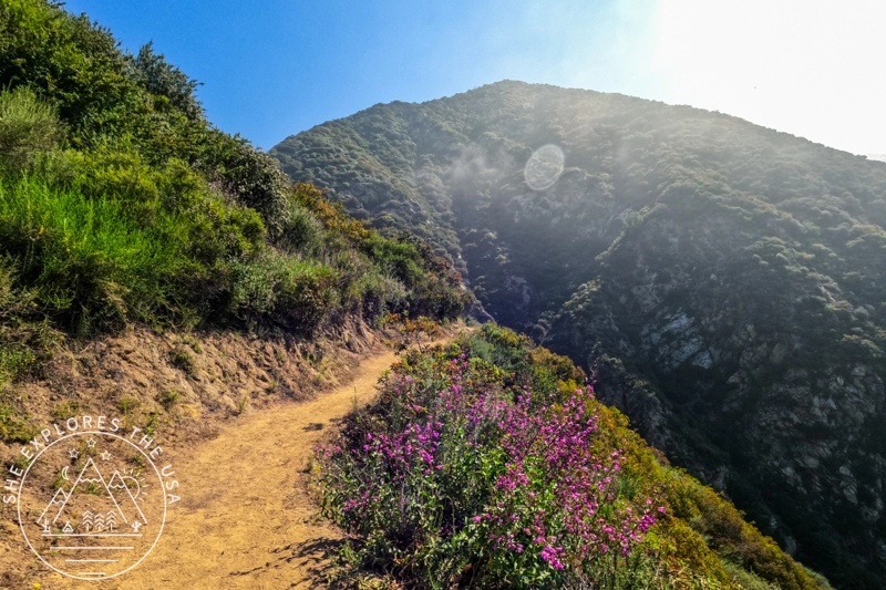
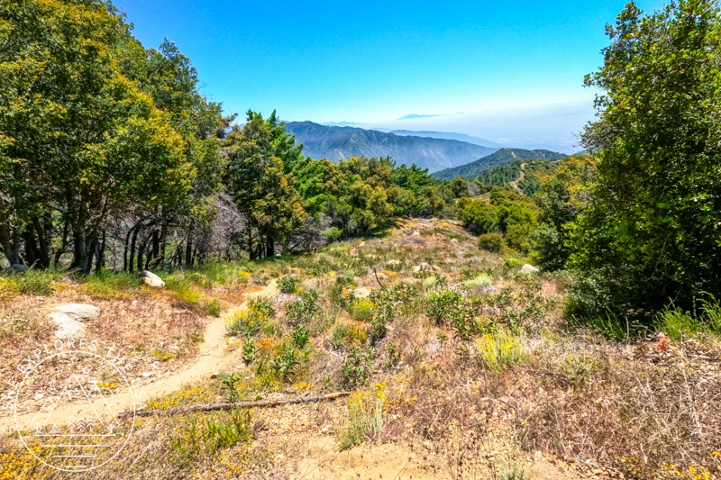
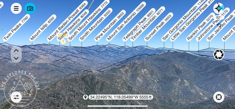
As you climb, the views get better and better. You’ll see LA, but then you’ll start seeing Santiago Peak, Hot Springs Mountain, and High Point.
Santiago Peak was sticking out above the clouds on the day I went, which was quite scenic. Higher up, you’ll start seeing San Jacinto, Baldy, San Gorgonio, Mount Baden-Powell, and more. I can only imagine how even more picturesque it must be when these are all covered in snow, but even in spring, the views were worth the hike.
The Final Stretch
The last two miles were the most grueling for me. I felt like they were never-ending. As a typical sunset hiker, I’m not too fond of morning hikes due to the food intake early in the day. This one was tough towards the end, but after 4h 35mins, I cannot express how accomplished I felt when I finally reached the parking lot at the top of the trail! Many summit visitors who drove up were amazed by the hikers who walked up. It was a great feeling.
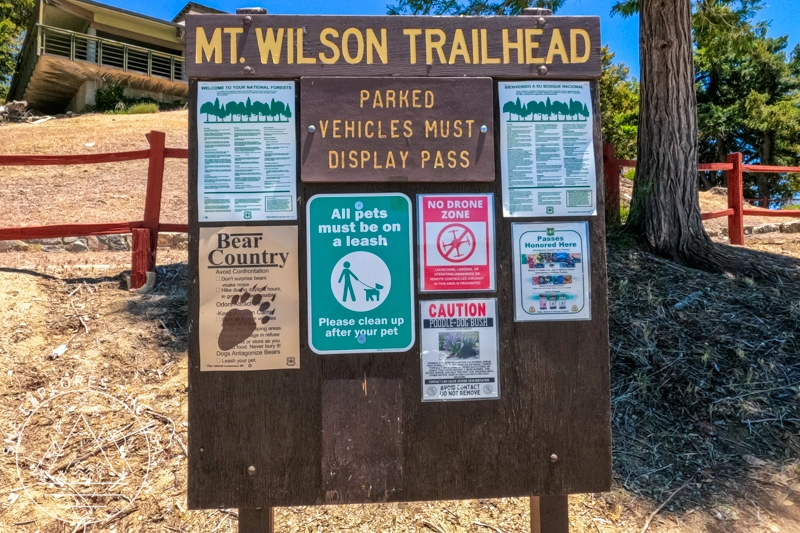
The Summit at Mt Wilson
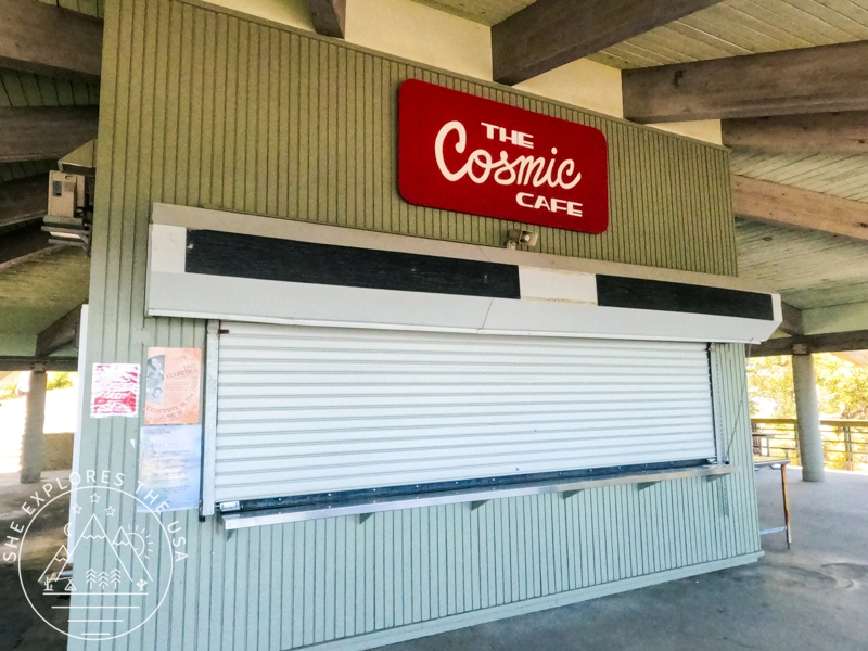
You arrive from the trail into a large parking lot with beautiful views over the city. Just a few steps away, you’ll find the Cosmic Cafe, closed when I visited. There is also a water refill station and a large picnic area with many tables available in both the shade and the sun. Many bugs were around the picnic area; a bug net is highly recommended!
Facilities
One of the highlights of reaching the summit was discovering the real (and clean!!) toilets. These restrooms have disposable toilet seat covers, toilet paper, hot water, and soap. It might sound silly, but this was quite the treat! Having such amenities on top of a summit after a tough climb was a luxury. The only thing that could have made it better would have been the cafe being open to enjoy a cool drink or ice cream.
Exploring the Summit
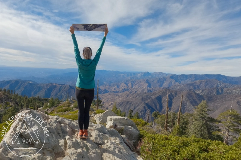
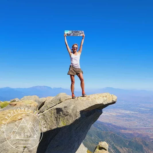
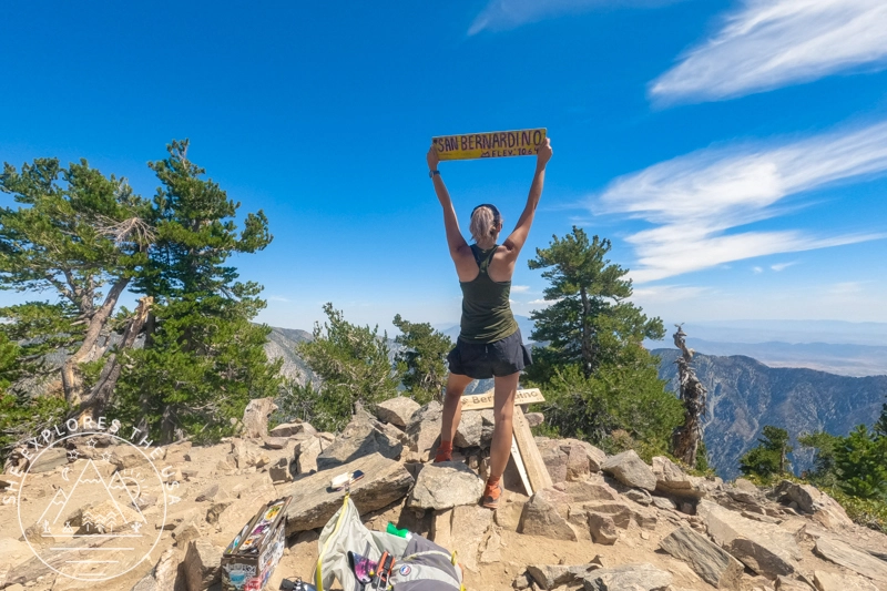
After enjoying lunch at a picnic table, I explored the summit and looked for the wooden sign for my obligatory summit photo. If you want to take your picture with the wooden sign, head to the observatory and follow the signs to “Echo Park.” This adds another mile for the return trip, but it’s totally worth it for the great views of the San Gabriel and San Bernardino Mountain ranges.
On my way to the observatory, I also came across the Astronomical Museum. This single-room museum features historical photographs taken by the Mount Wilson telescopes, as well as photographic histories of the observatory and vignettes of current research programs.


The Descent
The descent back to Sierra Madre was easy peasy and a lot more pleasant than the ascent! During the ascent, I thought I might regret not having my trekking poles with me, but I was actually completely fine without them.
Of course, I was wearing my new-ish Lone Peak 8, so I had a good grip on my soles. That accounts for a lot! Some areas can be sketchy, and I still would recommend bringing trekking poles if you prefer extra stability.
After 2 hours and 20 minutes, I was back down at my car and ready to drive home after many stretches!!!
Wildlife Encounters
One of the highlights of my hike was the diverse wildlife I encountered along the way.
While taking a break on a stump, I had an eerie feeling of being watched. When I looked to my left, I was delighted to see two deer a few yards up the trail, calmly observing me. I managed to capture this serene moment on film.
Later, after crossing the second stream, I spotted a snake slithering across the trail. This sighting made me jumpy for the rest of the hike, as every rustling lizard had me bracing for another snake.
On my way back down, I encountered the most charming squirrel, who graciously posed for a photo and a short video, adding a delightful end to my wildlife sightings.


My Stats
I completed my hike from Sierra Madre to Mt. Wilson in 6 hours and 8 minutes of moving time. The ascent took approximately 4 hours and 35 minutes, while the descent took about 2 hours and 20 minutes. I did not record the additional mile round trip to the wooden sign for my photo, which also added some elevation gain.


Relive my Mt Wilson Hike
Check out my Mt Wilson hike on Relive! It’s a fantastic platform for adventure lovers to capture and share outdoor experiences like never before.
Mount Wilson Hiking FAQs
How long is the Mt Wilson hike?
The hike via Sierra Madre is 14.2 miles round trip with about 4,850 feet of elevation gain.
What is the elevation of Mount Wilson?
Mount Wilson stands at 5,713 feet (1,741 meters).
Can you hike to Mount Wilson from Chantry Flats?
Yes, the Chantry Flats trail to Mount Wilson is a popular and scenic route that is currently open as of April 2025.
Is the Mt Wilson from the Sierra Madre trail open?
Yes, the Mount Wilson Trail from Sierra Madre has officially reopened as of January 13, 2026, after a long closure due to the Eaton Fire in 2025.
What wildlife might I see on Mt Wilson?
I saw deer, a snake, and squirrels. Others have reported bears, bobcats, and a wide variety of birds.
Final Thoughts on Hiking Mt Wilson
Hiking Mt Wilson was my hardest hike this year, yet I consider it one of the ‘easiest’ in the original SoCal Six Pack of Peaks challenge. This means I have a lot to look forward to. The unexpected wildlife encounters, especially seeing deer in LA, made my day. Although I could have done without seeing the snake, it was still a great adventure. Holiday traffic in LA made the experience more pleasant, easing my 4-hour round-trip drive to the trailhead. If you love hiking and are looking for a new challenge, I highly recommend tackling the SoCal Six Pack of Peaks. Share your own hiking experiences and tips in the comments below. I’d love to hear your stories!
Sawmill Mountain Hike via Mt Pinos (Six Pack of Peaks)
My first hike of the new year was to Mount Pinos and Sawmill Mountain, a trail I had planned to…
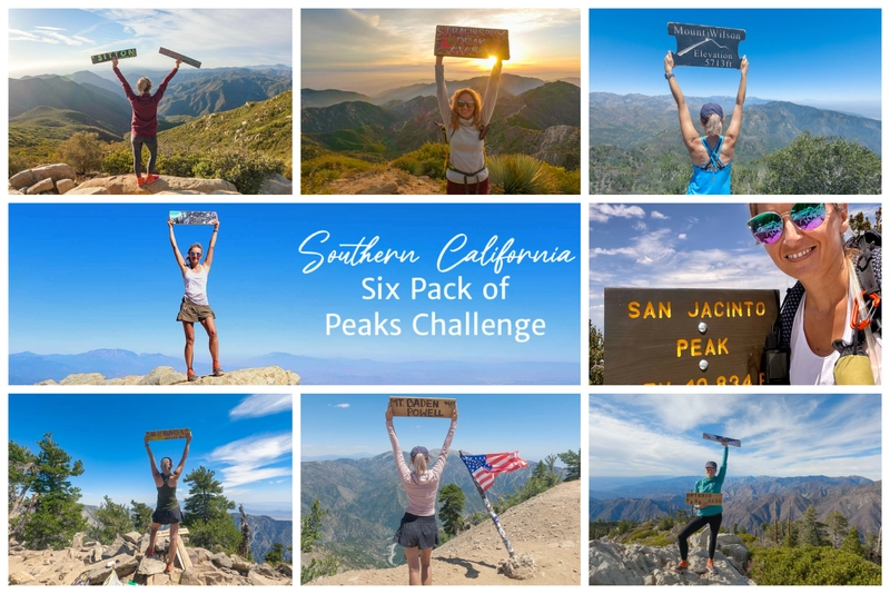
The Epic SoCal Six Pack of Peaks Hiking Challenge
I took on the SoCal Six Pack of Peaks Hiking Challenge, also known as the Southern California Six Pack of…
Ontario Peak Hike Guide: Trail Tips & Six Pack Challenge
Ontario Peak is a standout summit in the San Gabriel Mountains, offering panoramic views, alpine vibes, and a solid challenge…
Cucamonga Peak Hike via Icehouse Canyon Trail Guide
Cucamonga Peak stands out as one of the most iconic hikes in Southern California. Rising to 8,862 feet, it’s a…
Hiking San Bernardino Peak via the Angelus Oaks Trail
San Bernardino Peak is one of the original hikes in the SoCal Six Pack of Peaks challenge, and the Angelus…
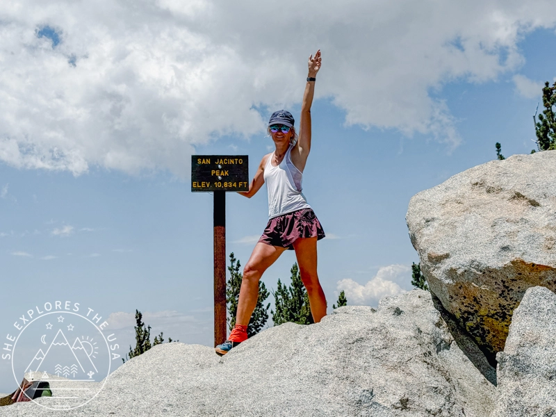
San Jacinto Peak Hike Via Marion Mountain Trail
San Jacinto via Marion Mountain Trail is one of the original SoCal Six Pack of Peaks challenge hikes, and I…
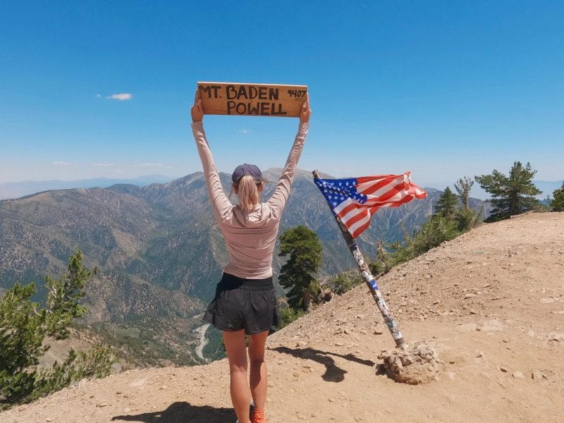
Mount Baden Powell Hike via Vincent Gap Trailhead
I took advantage of the July 4th holiday to drive up to LA and conquer Mt Baden Powell for my…

Hike Strawberry Peak in LA: Trail Tips & Epic Sunset
In my journey to conquer the peaks of the SoCal six-pack of peaks challenge, I aimed for the Strawberry Peak…
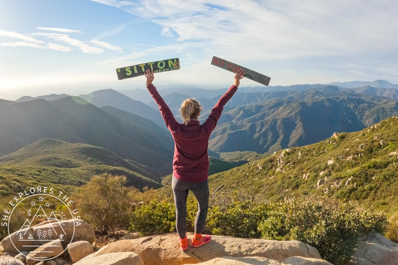
Sitton Peak Trail Guide: SoCal Six Pack’s Easiest Peak
Sitton Peak, nestled in the San Mateo Canyon Wilderness near Lake Elsinore, CA, is a hidden gem and an excellent…
Post originally published on June 5, 2024, and last updated on March 12, 2026.