Mount Baden Powell Hike via Vincent Gap Trailhead
DISCLOSURE: This post may contain affiliate links. If you purchase after clicking one of my links, I may earn a small commission at no extra cost to you. As an Amazon Associate, I earn from qualifying purchases. For more information, see my disclaimer.
Mount Baden Powell is one of Southern California’s most iconic summit hikes and a highlight of the SoCal Six Pack of Peaks Challenge. Starting from the Vincent Gap trailhead, this 8-mile round-trip journey climbs through beautiful forested switchbacks to reach a breathtaking 9,407-foot summit. In this guide, I’ll share everything you need to know about hiking Mount Baden-Powell, including gear tips, parking at Vincent Gap, trail conditions, and what to expect at the top.
50% Off AllTrails Plus
Planning hikes, downloading maps, getting a little more off-grid without losing your way… this is the upgrade that actually gets used.
About Mount Baden Powell
Mount Baden Powell is a prominent peak in the San Gabriel Mountains, located within the Angeles National Forest in Los Angeles County, California.
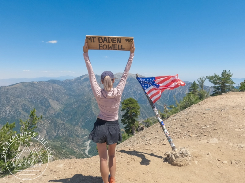
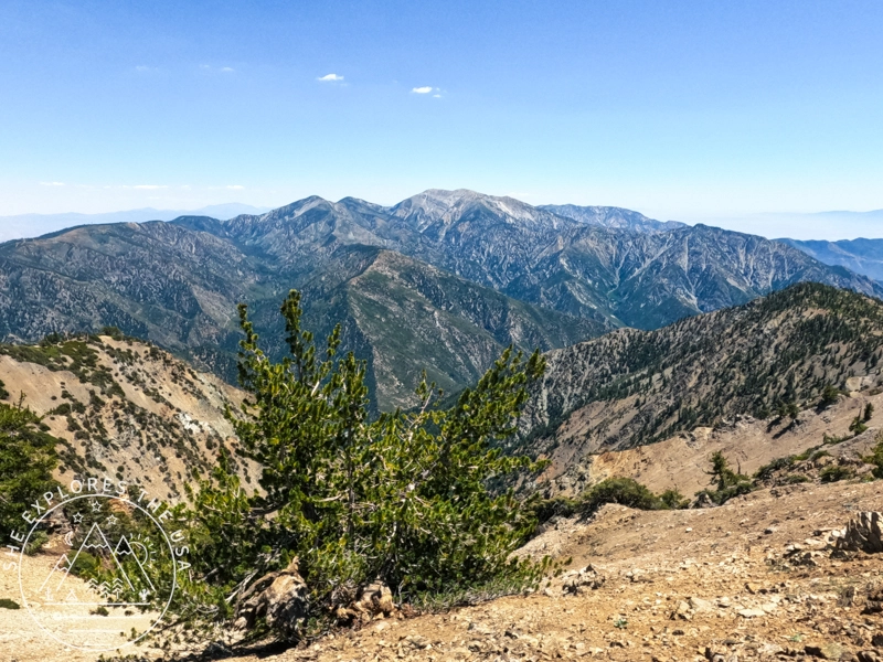
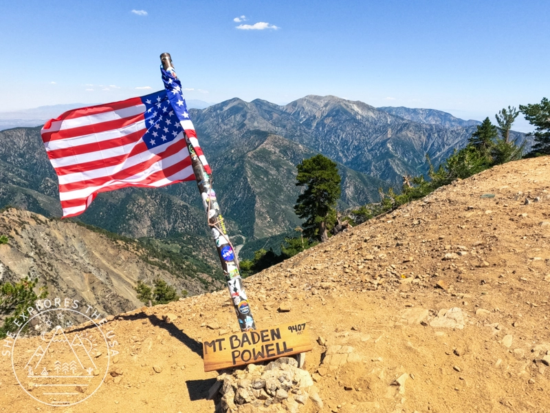
Named in honor of Lord Robert Baden-Powell, the founder of the Boy Scouts, the peak stands at an elevation of 9,407 feet (2,867 meters), as indicated by a wooden sign at its summit. The ascent is commonly made via the Pacific Crest Trail, starting from the Vincent Gap trailhead, where hikers navigate a series of rigorous switchbacks. Those who reach the top are rewarded with breathtaking views of the Mojave Desert, the Los Angeles Basin, and surrounding mountain ranges.
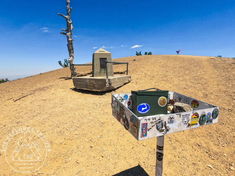
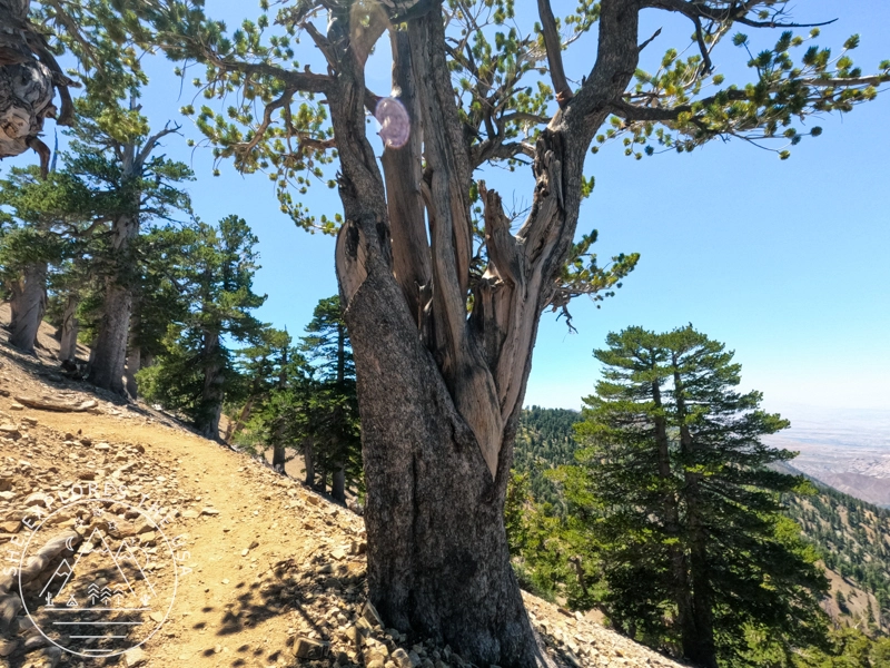
The summit reveals ancient limber pine trees and also features a memorial plaque dedicated to Baden-Powell. There’s also an American flag and a wooden sign for the obligatory summit photos!
Additionally, Mount Baden-Powell is a notable part of the SoCal Six-Pack of Peaks Challenge, making it a popular destination for adventurers aiming to complete this series of iconic Southern California hikes.
Gear Recommendation for your Mt Baden Powell hike


Hiking Mt Baden Powell from the Vincent Gap trailhead
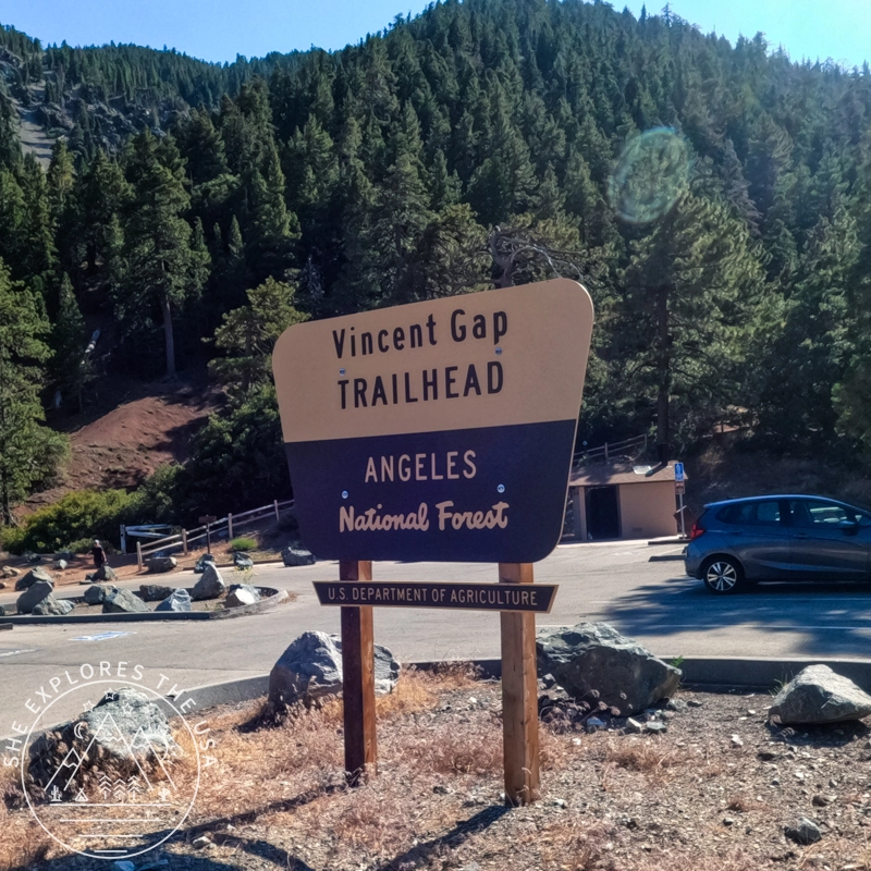
Reaching the trailhead
The Mt. Baden Powell trailhead starts at Vincent Gap, just a few miles beyond Wrightwood. The drive up on CA-2 is quite scenic, and I was taken aback when I saw the imposing height of Mt Baden Powell looming ahead. The steepness of the mountain was quite intimidating.
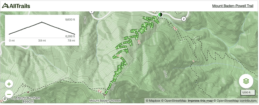
Mt Baden Powell from Vincent Gap Trail Map
Click the map to view the full route on AllTrails.
🥾 Plan Smarter Hikes with AllTrails
AllTrails is my go-to for trip planning, from checking trail reviews to downloading maps, navigating from my phone, and sending routes straight to my Garmin 67i. Offline maps, alerts, and AI route planning make upgrading to Plus & Peak worth it!
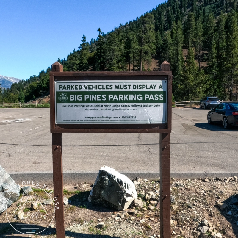
Parking at Vincent Gap Trailhead
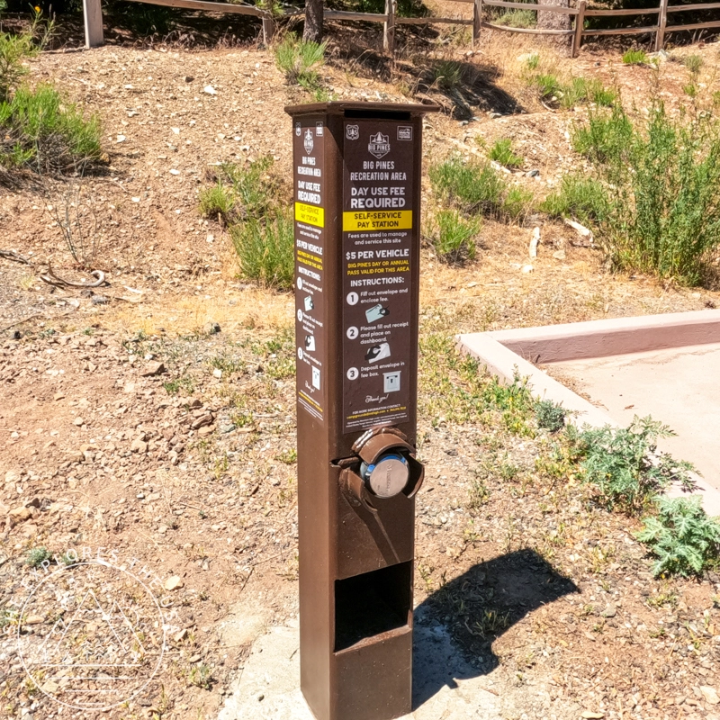
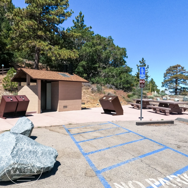
There is a large parking lot at the Vincent Gap trailhead, and parked vehicles must display a Big Pines pass. The pass can be purchased from the pay station near the restrooms inside the parking lot. You simply provide your name, license plate, and $5.00 in the envelope and deposit it into the slot. You then place the filled-out receipt on your dashboard. You can also buy a pass in Wrightwood.
I spoke to a hiker who frequently visits this trailhead, and he mentioned that since the parking lot requires a Big Pines pass, the toilets are cleaner and always stocked with lots of toilet paper! So I guess that’s where the $5 fee goes!
The parking lot also offers picnic tables and bear-proof trash containers.
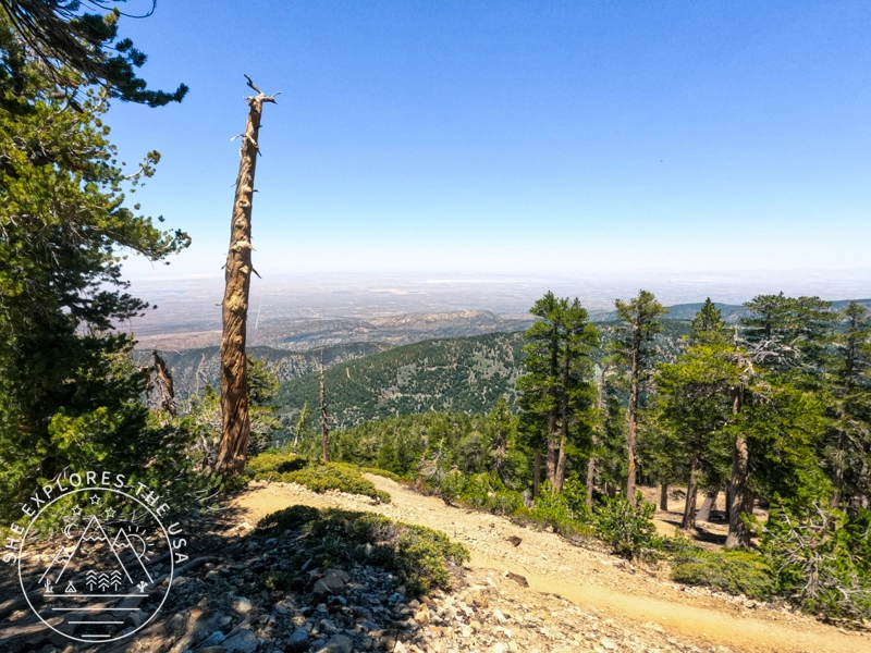
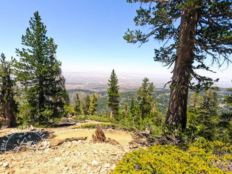
Scenic hike to the summit
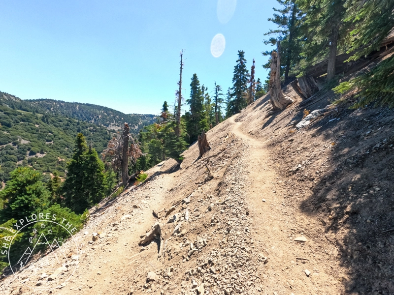
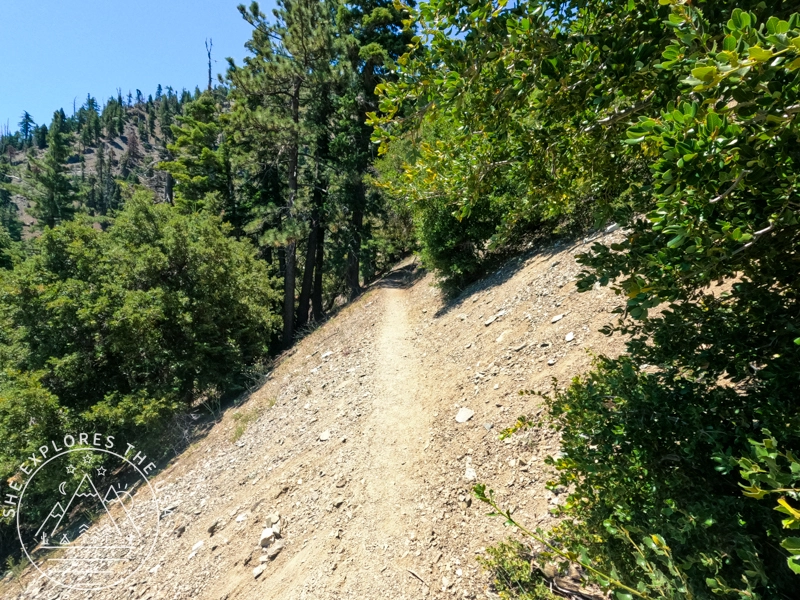
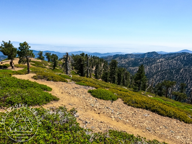
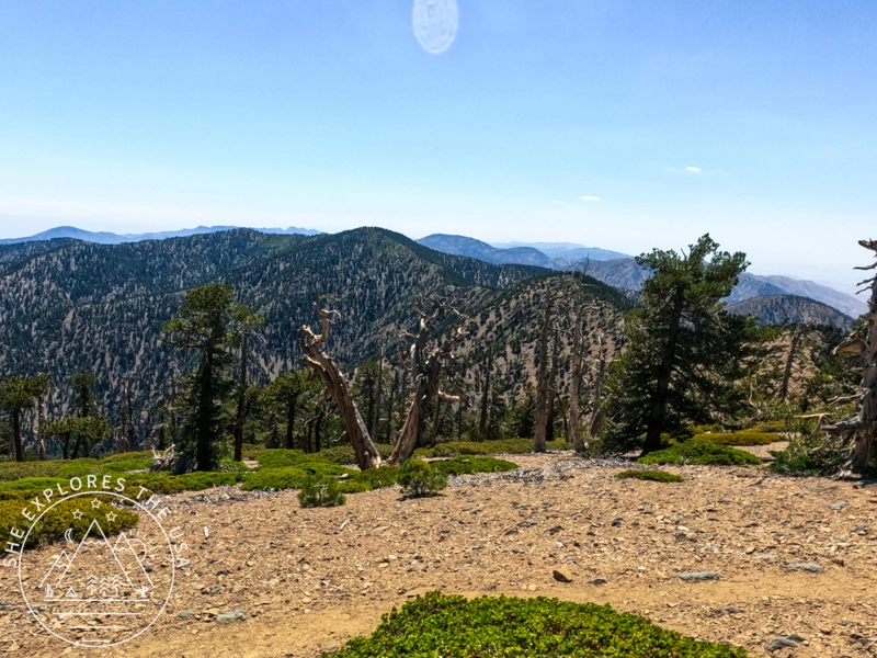
The hike primarily consists of switchbacks, 40 of them, according to AllTrails. The trail leads you through a stunning variety of vegetation, including oaks, Jeffrey pines, sugar pines, incense cedars, lodgepole pines, and white firs. Near the summit, you’ll encounter the gnarled limber pines. Hiking in early July, I spotted only a few red wildflowers along the path.
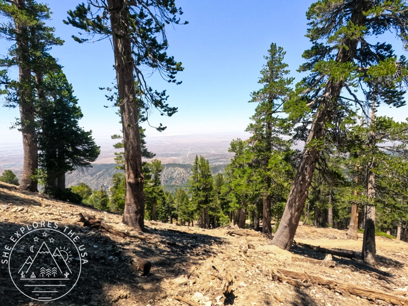
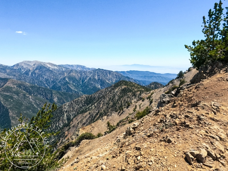
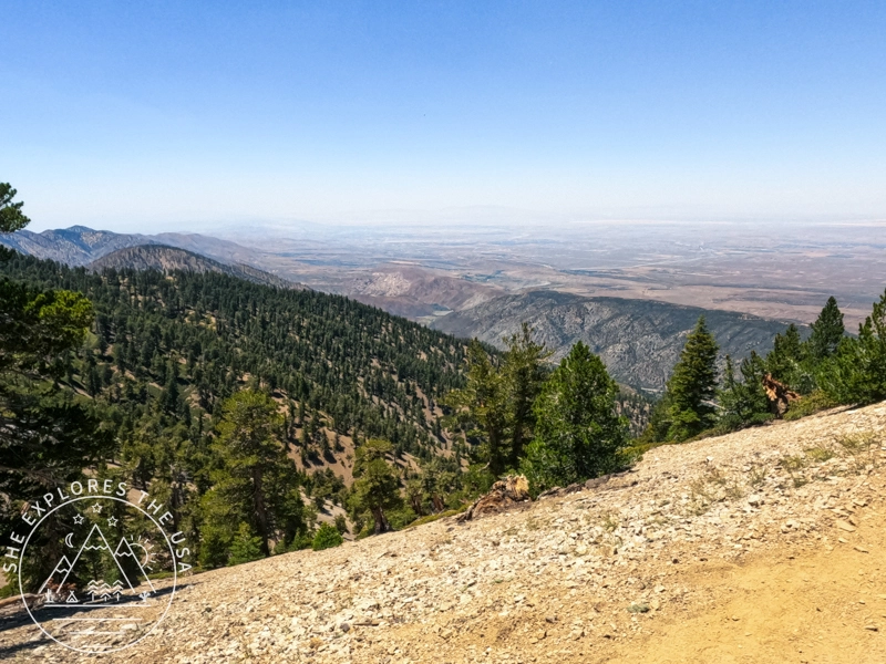
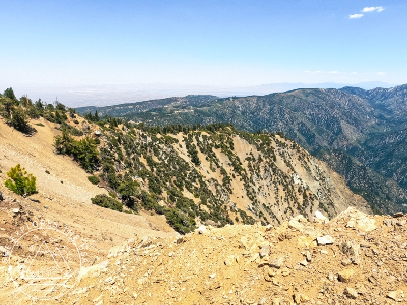
As you ascend, the views become increasingly spectacular. The trek is well worth the effort, with breathtaking vistas from the summit overlooking the Mojave Desert on one side and Baldy on the other. Be sure to take some time to enjoy the scenery once you reach the top.
Terrain and Conditions
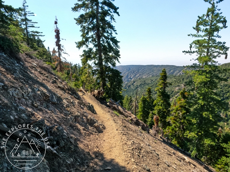
The terrain is steep, but the numerous switchbacks make the ascent more manageable. However, it’s easy to understand why PCT thru-hikers might be concerned about this section when it’s snow-covered. I would be petrified to tackle this trail in snowy conditions.
I began my hike at 11 am, and it was already warm due to an excessive heat warning that day. I enjoy warm weather, and the trail offers plenty of shaded spots as you wind through the switchbacks. I wore shorts and a tank top, but the bugs were a nuisance, so I switched to my sun hoodie after getting stung by a bee.
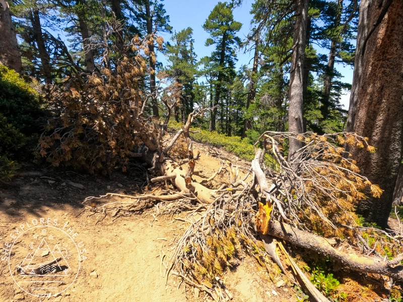
This trail is part of the PCT CA Section D and is in excellent condition, typical of alpine terrain, with loose rocks, packed dirt, and scattered tree roots. I encountered only one downed tree across the trail, which was easy to navigate.
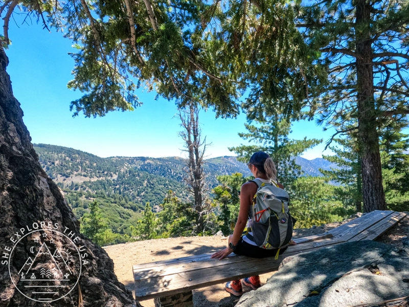
PCT thru-hikers always say the trail provides, and it’s true of this section too. A mile up from the trailhead, a bench offers scenic views for a quick rest, and it even comes with a natural tripod to take your own photo!
I met several other hikers on their way down, along with many trail runners.
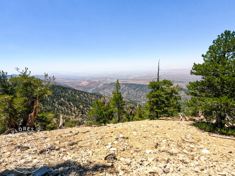
Mt Baden Powell Summit Experience
The summit provides spectacular 360-degree views: to the south, you can see Mt. Baldy and many other peaks, while to the north, you can glance at the Mojave Desert and, on a clear day, even the southern Sierra Nevada range.
Unfortunately, I was unable to use my Peak Finder app to identify all the peaks because I recently purchased a new phone and I didn’t have cell service at the summit to download the Peak Finder data.
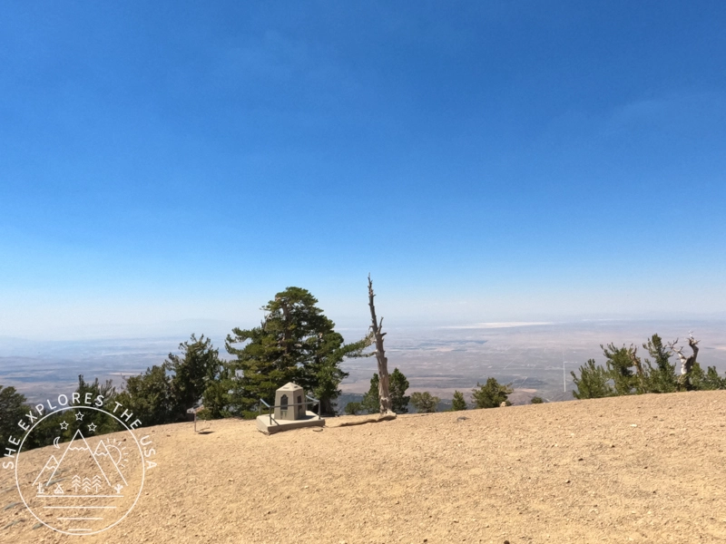
There is also a monument to Lord Baden-Powell, the founder of the Boy Scouts of America, which has been at the summit since 1957!
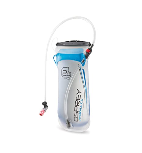
The summit is very exposed, but there are small shaded areas where you can rest and enjoy a meal. There are no water sources, so be sure to carry enough water for your entire hike. I carried 3L with me and didn’t run out.
Post-Hike Recommendation
On your way back, consider stopping by the Grizzly Bear Cafe in Wrightwood for lunch and a cool drink!
Relive my Mt Baden Powell Hike
I kept taking breaks on the way up, so it took me 3 hours to hike up to the summit, and less than an hour to come back down! Check out my Mt Baden Powell hike on Relive! It’s a fantastic platform for adventure lovers to capture and share outdoor experiences like never before. With Relive, you can create custom videos that vividly depict your journeys, turning memories into captivating stories for sharing. Share the beauty of your adventures and inspire others to explore nature through Relive’s immersive storytelling.
Mount Baden Powell Hike FAQs
Is Vincent Gap Trailhead open?
Highway 2 access to Vincent Gap is now open again, as the repairs from the Bridge fire are completed! Mount Baden Powell is accessible via Vincent Gap, but it’s always a good idea to check the Angeles National Forest website for the latest updates on trail conditions and closures before your hike.
How hard is the hike to Mount Baden Powell?
The hike is rated moderate to strenuous due to its elevation gain of about 2,800 feet over 4 miles. However, the switchbacks make it more manageable, even for intermediate hikers.
What is the elevation of Mount Baden Powell?
Mount Baden Powell stands at 9,407 feet (2,867 meters). The elevation gain from Vincent Gap to the summit is approximately 2,800 feet.
Where is the Vincent Gap Trailhead located?
Vincent Gap Trailhead is located along Highway 2 in the Angeles National Forest, just past the town of Wrightwood, California. It’s a popular access point for the Pacific Crest Trail and Mount Baden Powell summit hikes.
Do I need a Big Pines Pass or an Adventure Pass?
As of now, enforcement of the Big Pines Pass began when the trailhead reopened; a $5 self-pay station is available at the Vincent Gap lot.
Final Thoughts on the Mt Baden Powell Hike
I thoroughly enjoyed my Independence Day adventure to Mt. Baden Powell. The drive up from San Diego was surprisingly smooth, thanks to the holiday, and the scenic views along the way made the journey delightful. The ascent, with its numerous switchbacks, was made even more rewarding by the breathtaking views and the rich diversity of vegetation. The thrill of summiting and the panoramic views were unmatched, making this hike a memorable highlight of my holiday. Have you experienced any unforgettable hikes on special occasions? I’d love to hear about your adventures!
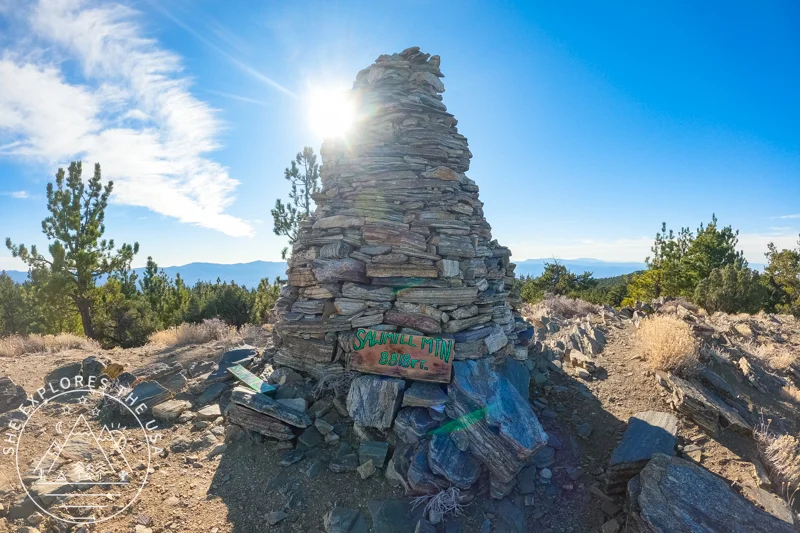
Sawmill Mountain Hike via Mt Pinos (Six Pack of Peaks)
My first hike of the new year was to Mount Pinos and Sawmill Mountain, a trail I had planned to…
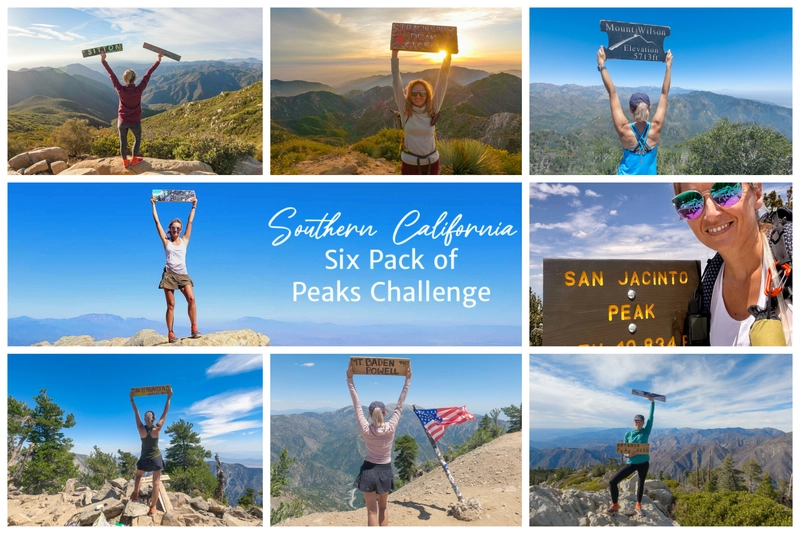
The Epic SoCal Six Pack of Peaks Hiking Challenge
I took on the SoCal Six Pack of Peaks Hiking Challenge, also known as the Southern California Six Pack of…
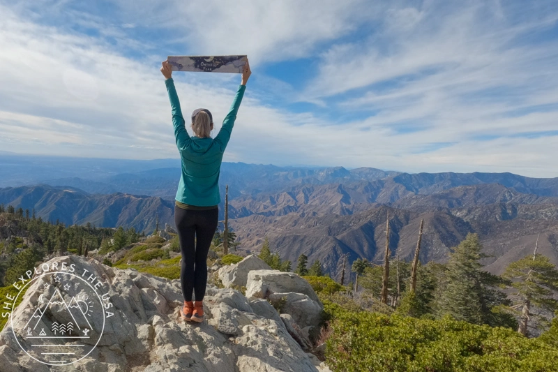
Ontario Peak Hike Guide: Trail Tips & Six Pack Challenge
Ontario Peak is a standout summit in the San Gabriel Mountains, offering panoramic views, alpine vibes, and a solid challenge…

Cucamonga Peak Hike via Icehouse Canyon Trail Guide
Cucamonga Peak stands out as one of the most iconic hikes in Southern California. Rising to 8,862 feet, it’s a…
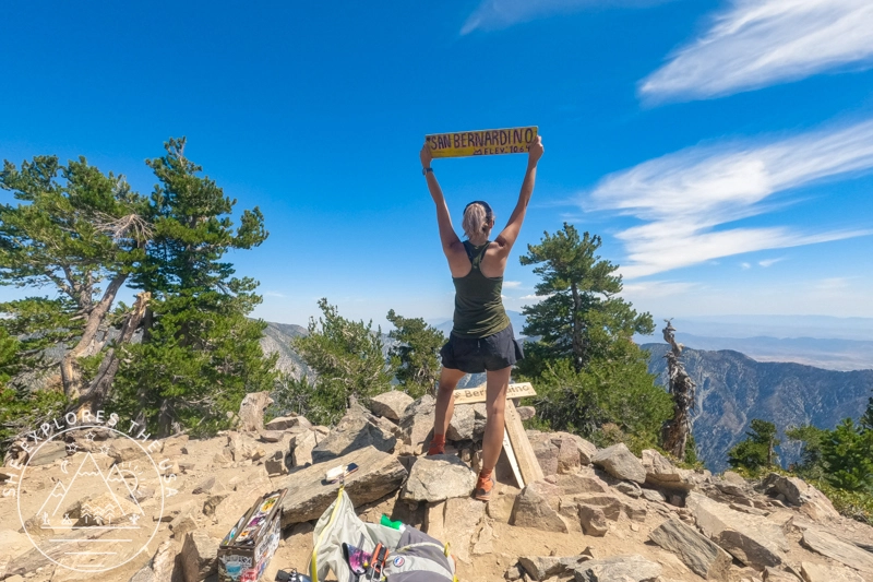
Hiking San Bernardino Peak via the Angelus Oaks Trail
San Bernardino Peak is one of the original hikes in the SoCal Six Pack of Peaks challenge, and the Angelus…
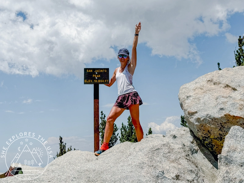
San Jacinto Peak Hike Via Marion Mountain Trail
San Jacinto via Marion Mountain Trail is one of the original SoCal Six Pack of Peaks challenge hikes, and I…
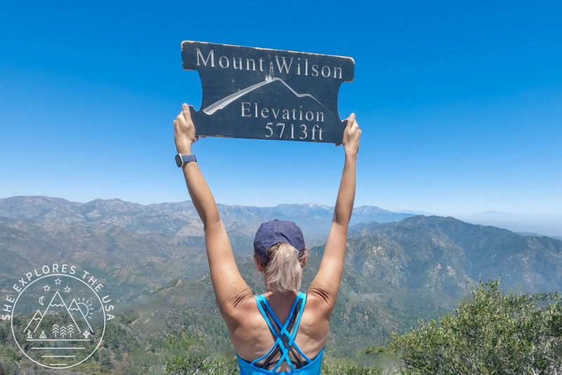
Mount Wilson Hike: Observatory, Trails & Views
Mount Wilson has a reputation, and it’s well earned. As part of the SoCal Six Pack of Peaks Challenge, this…

Hike Strawberry Peak in LA: Trail Tips & Epic Sunset
In my journey to conquer the peaks of the SoCal six-pack of peaks challenge, I aimed for the Strawberry Peak…
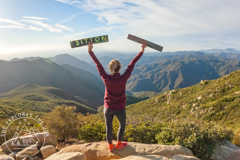
Sitton Peak Trail Guide: SoCal Six Pack’s Easiest Peak
Sitton Peak, nestled in the San Mateo Canyon Wilderness near Lake Elsinore, CA, is a hidden gem and an excellent…
Post originally published on July 6, 2024, and last updated on April 4, 2026.