The Best Solo Backpacking Trip I Didn’t Even Plan
DISCLOSURE: This post may contain affiliate links. If you purchase after clicking one of my links, I may earn a small commission at no extra cost to you. As an Amazon Associate, I earn from qualifying purchases. For more information, see my disclaimer.
In early July, I was granted time off work at the very last minute, and all I could think about was a solo backpacking trip in the Eastern Sierra. I wasn’t aiming for epic, just some peace and mountain air. I jumped on recreation.gov and grabbed the first available permit I could find: Cottonwood Lakes. It had “lakes” in the name, which sounded promising, so I mapped out a mellow route on AllTrails and figured I’d improvise the rest. My goal was simple: test my gear, move slowly, and wake up to a different view each morning. However, the trip I hadn’t even planned turned out to be one of the best.
- Plan A: Solo Backpacking From Cottonwood Lakes Trail
- Plan B: A Blazing Detour to Alabama Hills
- My Original Plan C Took an Unexpected Turn… Solo Backpacking to Big Pine Lakes
- What I Packed for My First Solo Backpacking Trip in the Sierra
- FAQ: Solo Backpacking in the Eastern Sierra
- Final Thoughts on My First Solo Backpacking Trip in the Sierra
Plan A: Solo Backpacking From Cottonwood Lakes Trail
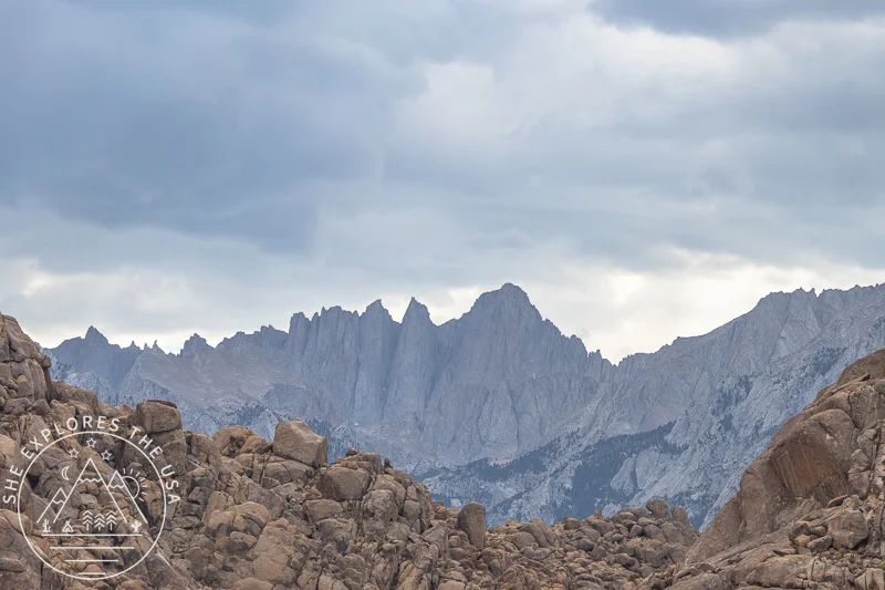
I snagged a permit starting at the Cottonwood Lakes trailhead in Inyo National Forest, planning to hike up the New Army Pass, connect with the PCT, and loop back via Cottonwood Pass, roughly a 20-mile route.
That distance probably sounds short to seasoned backpackers. But this was my first time in the Sierras, and I live at sea level. I hadn’t been to high elevation since the French Alps about ten years ago, so I had no idea how my body would handle the gain or the thinner air. Just in case, I came up with a three-tiered plan: A, B, and C.
I wasn’t out to “crush miles.” I just wanted a calm, self-paced adventure where I could test my gear in real conditions, move slowly, and see what it felt like to sleep outside in the Sierra wilderness.
Best Outdoor Gear For Epic Backpacking Adventures
I’ve been camping and backpacking for several years now, and people often ask me about my favorite adventure gear, and…
Unexpected Medical Issue
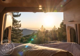
My migraine started way before I even got close to the mountains, somewhere on Interstate 15, probably still in Riverside. So by the time I arrived at the Cottonwood Lakes trailhead, which sits at over 10,000 feet, it had already been hours of dealing with it. The elevation may have added to it later, but the migraine had firmly settled in long before then.
I was hoping to snag a walk-up site at the trailhead campground so I could rest and try to sleep it off, but there were no open spots. I wasn’t feeling up for much, but I also didn’t want to just sit in my car, miserable. So I made a soft call: I’d hike in just a mile or two, find a flat spot to rest, and see if that helped.
Settling In Amidst the Pain
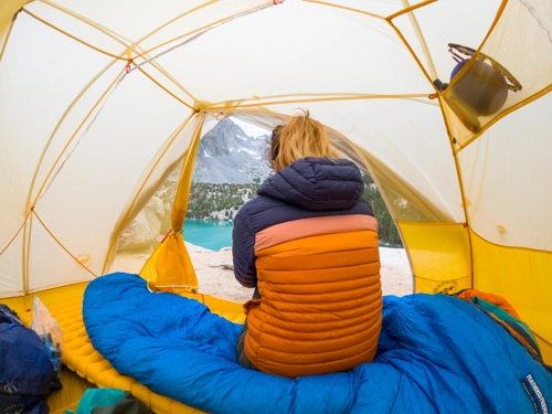
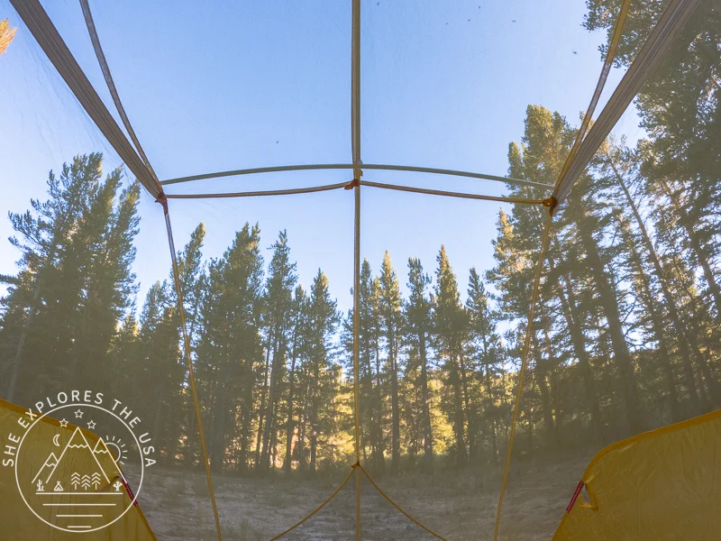
I set up in a peaceful meadow about two miles from the trailhead, left the rainfly off so I could watch the sky, and crawled into my tent to lie down. I felt awful, nauseous, heavy, and sensitive to light and sound, and wasn’t sure if it was just the migraine still raging or if altitude was starting to layer on top. It could’ve been both. Either way, I didn’t have much in me, and I get the same symptoms at sea level with my migraines, so I’ll never know.
Dinner and the Unwelcome Surprise
After a few hours horizontal, I felt slightly better and made myself dinner: cold instant mashed potatoes with turkey gravy because I couldn’t even be bothered to heat water. Not exactly a campfire feast, but it was food.
At some point that night, I ended up vomiting. I was already awake and not feeling great, so it wasn’t entirely unexpected. I had to run out of my tent and go about 200 feet away, following Leave No Trace guidelines. Being in bear country, I was extra careful to do it properly, which definitely added some stress to an already rough night.
The Toughest Decision
That night dragged on. I barely slept, and when morning came, I had to face a hard choice. Push on? Or get back to lower elevation and regroup? It was tough not to feel like I was bailing. But I also didn’t want to risk getting worse and losing the ability to hike myself out. So I decided to hike back to my car and drive down to Lone Pine!
7 Leave No Trace Principles: How to Teach Kids
Mastering the seven Leave No Trace principles is essential for any outdoor enthusiast. Developed by the […]…
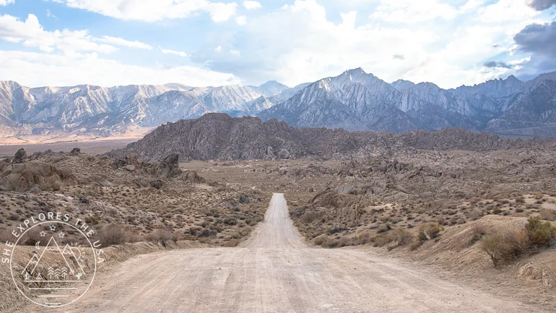
Plan B: A Blazing Detour to Alabama Hills
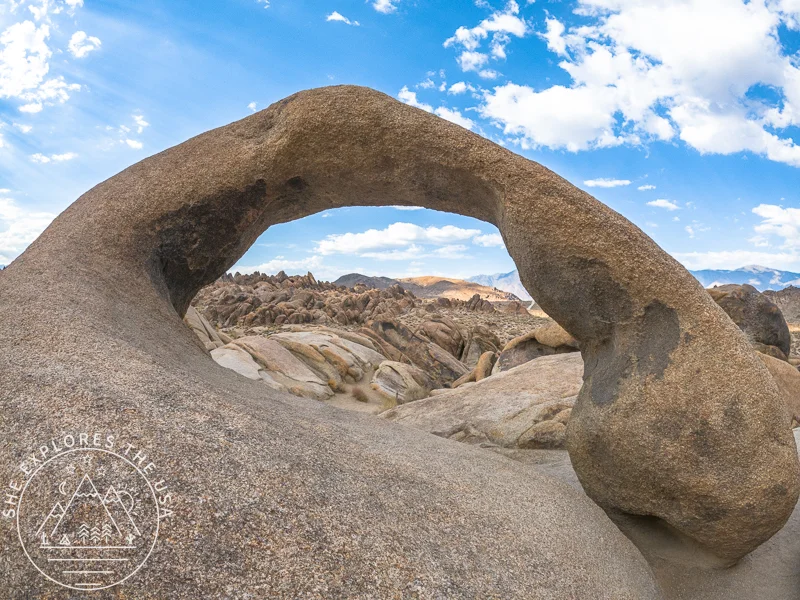
After grabbing a smoothie in Lone Pine that gave me a bit of strength back, I headed over to Alabama Hills during the day to explore and scout locations for the night photography I hoped to do later. The rounded rock formations and dramatic landscape were even more stunning in person, and I was excited about the possibilities.
But it was scorching, 116°F (46°C), and even though I usually tolerate heat pretty well, that day my body just wasn’t having it. So I decided to book a hotel room to cool off and rest in air conditioning. It felt like a luxury after the rough day I’d had and exactly what I needed to recharge.
I had planned to head back out for sunset and night sky photography, but by the time evening rolled around, exhaustion had completely taken over. I ended up staying in and resting instead.
Sometimes the best plan is knowing when to pause, and that night was definitely one of those times.
My Original Plan C Took an Unexpected Turn… Solo Backpacking to Big Pine Lakes
The next morning, I woke up feeling like a whole new person. Rested. Recharged. Ready.
I opened recreation.gov, more out of curiosity than hope… and boom. A Big Pine Lakes overnight permit was available.
I’d been trying to get one all winter with no luck, and now, here it was. Practically handed to me. I booked it immediately and hit the road, laughing at how perfect the timing was.
Thank you, Universe. Truly. You planned this one better than I did.
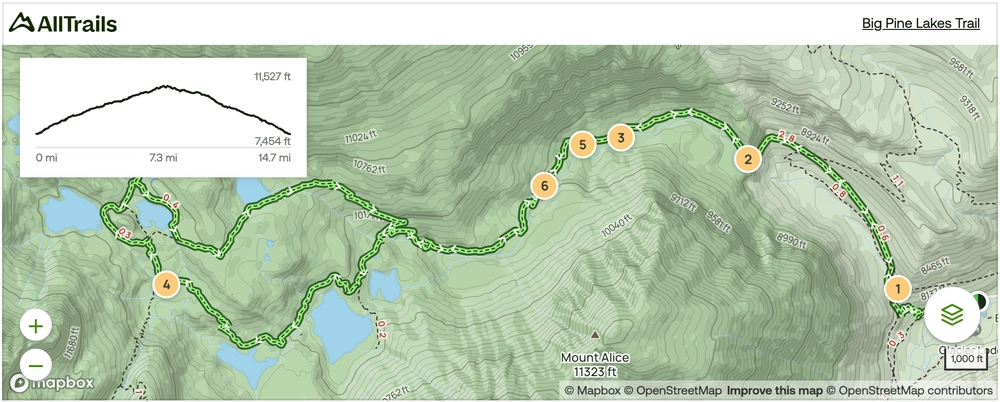
Big Pine Lakes Trail Map
🥾 Plan Smarter Hikes with AllTrails
AllTrails is my go-to for trip planning, from checking trail reviews to downloading maps, navigating from my phone, and sending routes straight to my Garmin 67i. Offline maps, alerts, and AI route planning make upgrading to Plus & Peak worth it!
About the Big Pine Lakes Hike
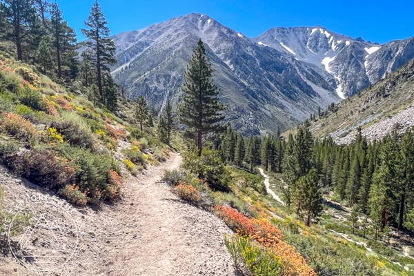
The trail starts at around 8,000 feet in elevation. Although I woke up early at 6 a.m., I didn’t hit the trail until 10 a.m. because I had about an hour’s drive from Lone Pine to the Big Pine Lakes trailhead. Plus, I needed some time to catch up on food intake and make sure I was properly fueled for the hike ahead.
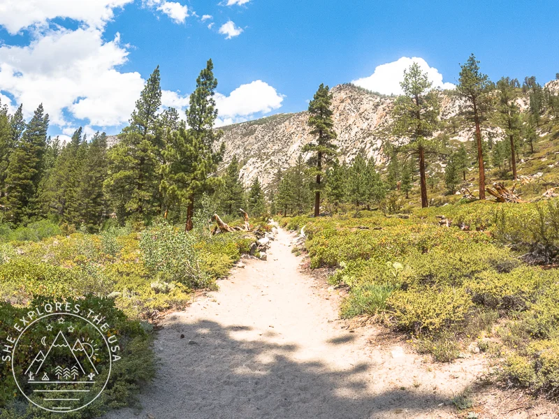
Due to the late start, the sun was already blazing. The trail is exposed with no shade, and I was taking breaks every five minutes, doubting whether I’d even make it. But I kept going. And eventually, I reached the waterfall, where shade finally kicked in and the trail turned greener and softer.
Tip: If you need to refill water, that’s the point to start looking. Beyond the waterfall, there are several easy access spots along the trail.
Not long after my lunch break, the sky shifted and light rain began to fall. Thunder rumbled somewhere in the distance, but the rain was actually refreshing. I love it when the weather shifts like that mid-hike; it makes the moment feel alive.
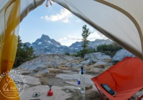
By the time I reached Second Lake around 2 p.m., I was buzzing.
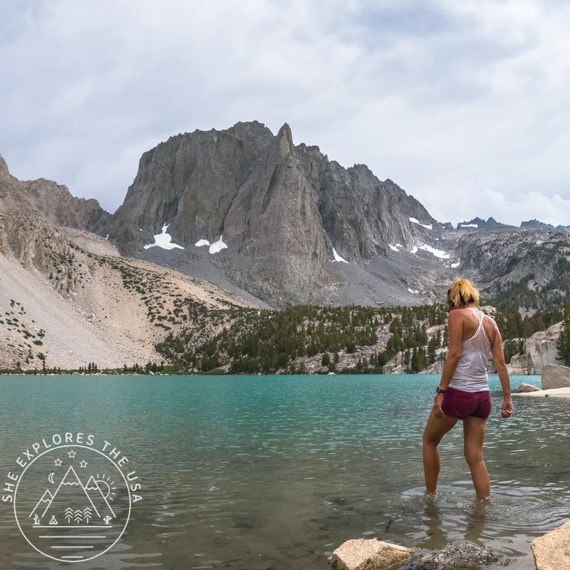
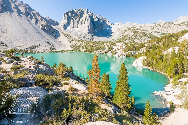
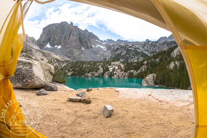
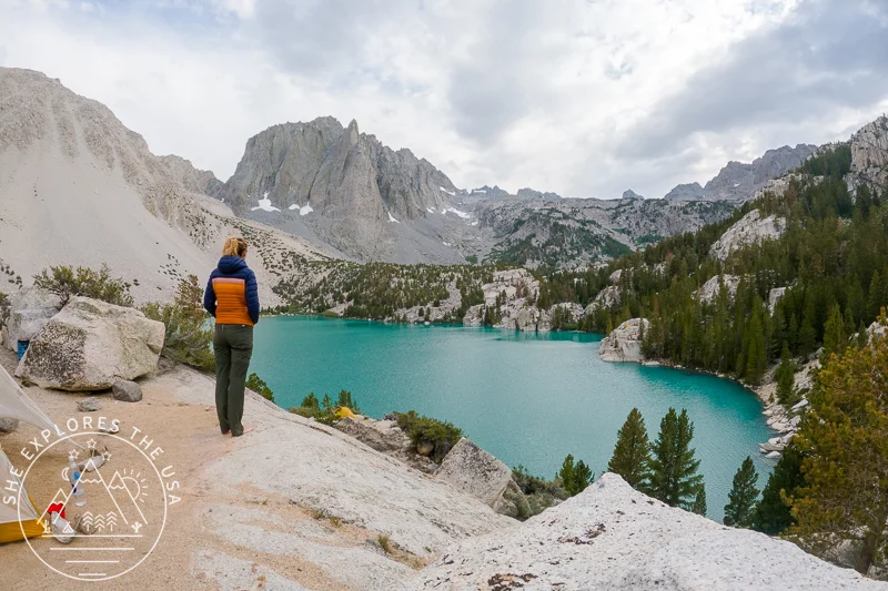
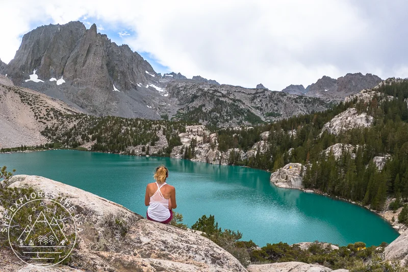
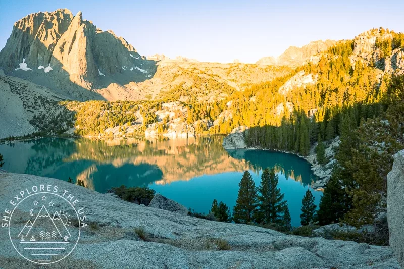
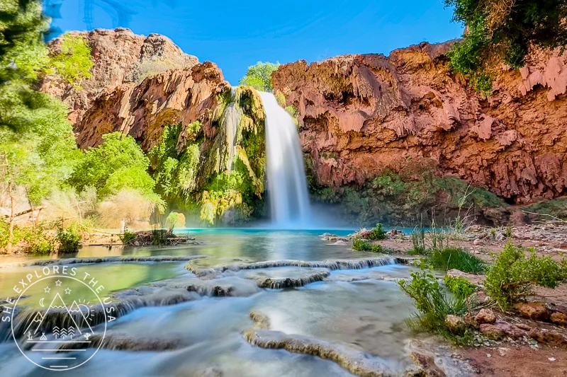
The Magic of the Big Pine Lakes
I’d seen photos of Big Pine Lakes for years, but nothing prepares you for the real thing. The color is almost fake-looking, glacier-fed turquoise so rich it looks edited.
The trail is scenic the whole way, but those first two lakes? They’re something else.
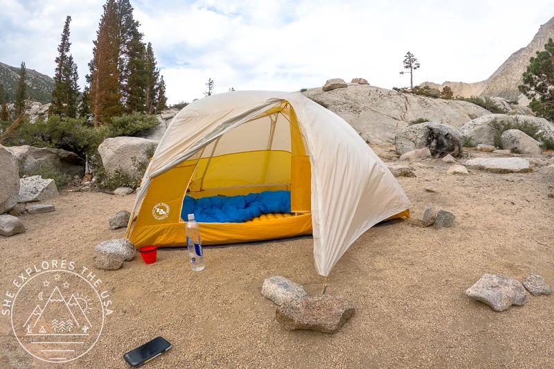
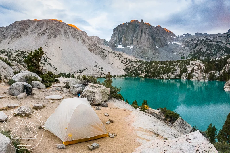
I scouted a few campsites, but most were already taken. Someone tipped me off to another spot that was still available, and I got lucky; it had a stunning view straight across the lake.
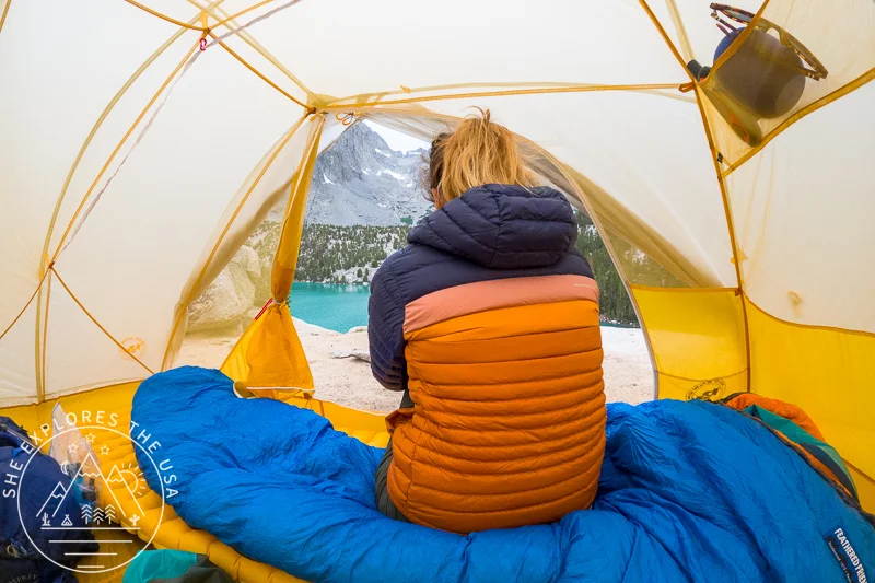
As I finished setting up my tent, the wind picked up and the rain returned. But I didn’t care. I was finally exactly where I needed to be.
That afternoon, I just sat and stared at the lake. Awe. Peace. Total disbelief that I was really there after everything.
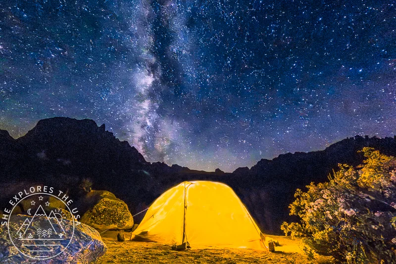
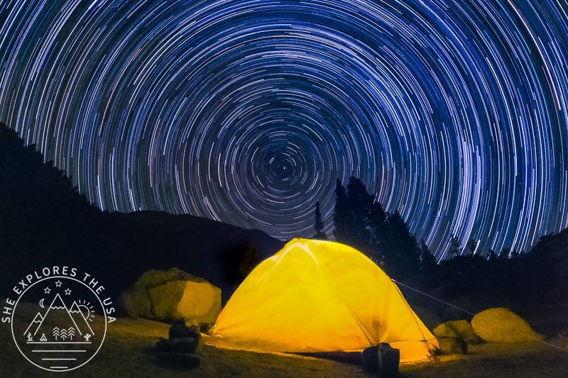
And just when I thought the trip couldn’t get more magical, the clouds parted after sunset and revealed a clear night sky. I watched the Milky Way rise and took my first-ever star trail photo using my GoPro Hero 9. Everything on this trip, photos and videos, was captured on that one camera. It’s ridiculously lightweight and surprisingly powerful. Read this blog post for the best camera equipment for backpacking.
The next day, I slowly packed up and made my way back down to drive the long way home.
My Favorite Photo And Video Gear for the Trail
I’ve always been the “Trigger Happy” one on group tours, the person who can’t resist snapping hundreds of shots a…
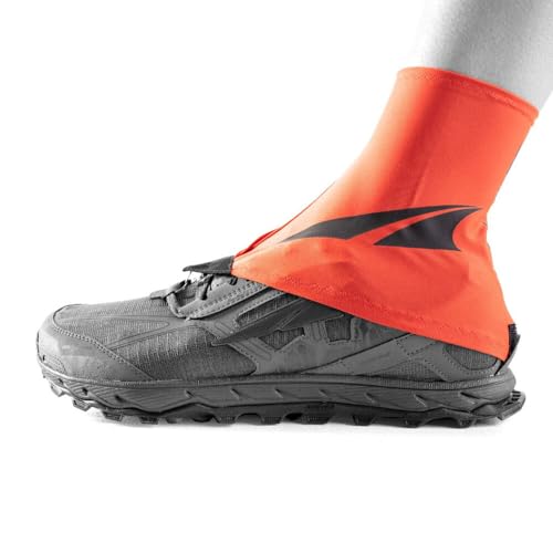
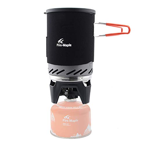
What I Packed for My First Solo Backpacking Trip in the Sierra
I’d backpacked solo before, usually in the desert, but this was my first time taking on the Sierra. Here’s the gear I brought with me.
Discover the full collection of my favorite outdoor finds in my curated gear shop.
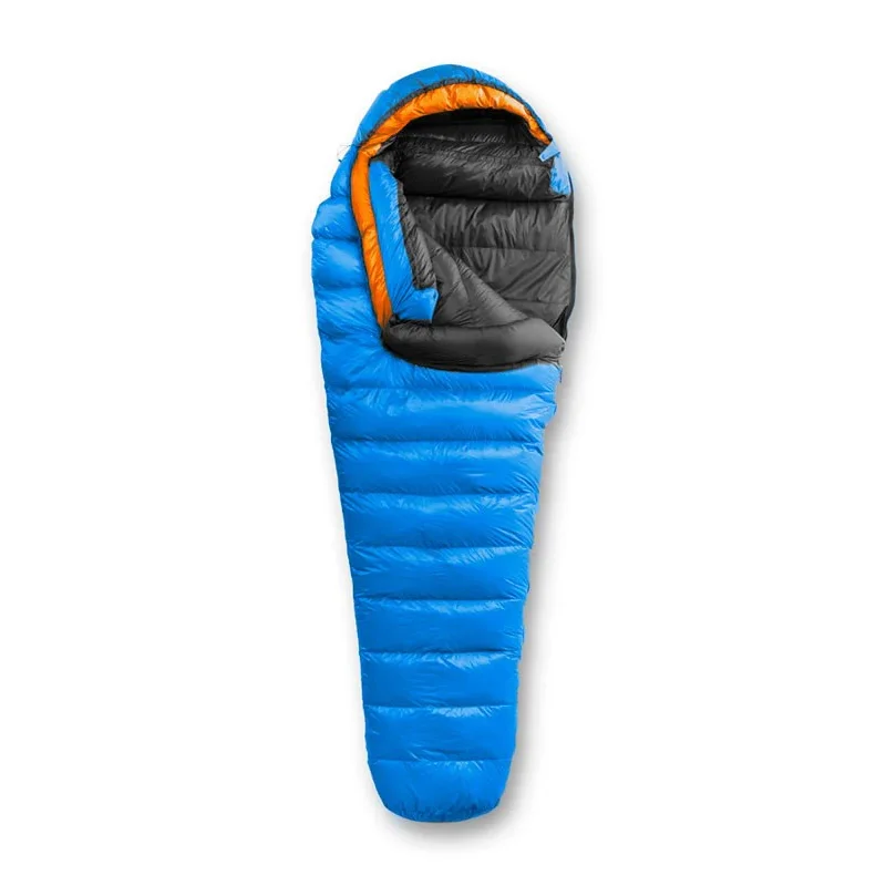
Shelter and Sleeping


Clothing & Accessories


Navigation and Safety


Hydration


Miscellaneous


Backcountry Poopy Kit

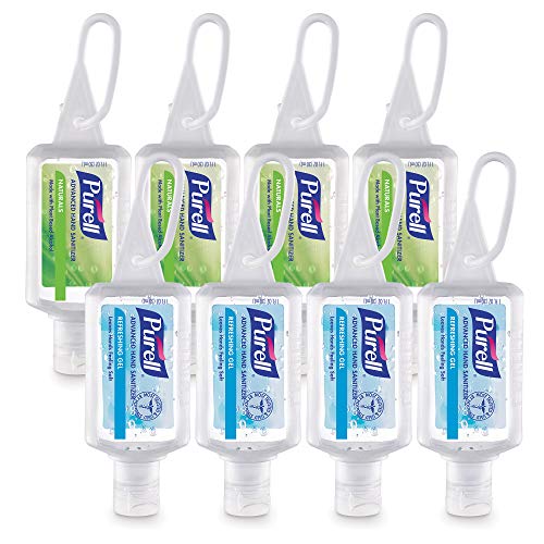

Personal Hygiene Items


Camp Kitchen


FAQ: Solo Backpacking in the Eastern Sierra
Is Big Pine Lakes a good solo backpacking destination?
Absolutely. Big Pine Lakes is one of the most scenic overnight hikes in the Eastern Sierra, with well-marked trails, accessible water sources, and unforgettable glacier-fed lake views. It’s a great trip for solo hikers with a bit of experience and decent fitness.
Do I need a permit for Big Pine Lakes or Cottonwood Lakes?
Yes, both trailheads require overnight wilderness permits through recreation.gov. These permits can book out early for popular dates, but sometimes you can snag last-minute cancellations or same-day permits (as I did!).
What elevation is Big Pine Lakes?
The Big Pine Lakes trail starts at about 7,800 feet and climbs to over 10,000 feet by the upper lakes. If you’re coming from sea level, consider acclimating beforehand or building in plenty of rest time, especially if you’re solo.
Can I backpack solo if I’m new to the Sierra?
You can, but take it slow. The altitude, weather shifts, and long miles can be tough your first time. I recommend testing your gear, knowing Leave No Trace principles, and building flexibility into your plans, just like I did with multiple other plans.
What’s the best time of year to hike Big Pine Lakes?
Late June through September is ideal. Snow usually lingers through early summer, and permits get harder to grab in peak season, so plan early, or be open to spontaneous magic like I was.
Final Thoughts on My First Solo Backpacking Trip in the Sierra
This trip didn’t go the way I planned, and honestly, I’m glad it didn’t.
From the unexpected migraine at the Cottonwood Lakes trailhead to detouring through scorching Alabama Hills, and finally landing that last-minute permit for Big Pine Lakes… the Universe definitely took the lead on this one. And it knew what it was doing.
Even with the rough start, I got to test my gear, feel how my body responded to elevation, and learn how I show up for myself when things go sideways. And I still got the magic, those glacier-fed lakes, the soft light on jagged peaks, and a night sky that felt like a reward for sticking with it.
I’ve been back to the Sierra since, and I plan to keep going back. There are still more lakes on that trail I want to explore, and now I know I can handle it, even if the journey gets a little messy.
Until next time, happy trails.
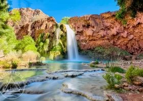
Havasupai Packing List 2026: The Complete Guide
Havasupai packing list! Here’s everything I brought on my backpacking trip to Havasupai, which had been a […]…
Post originally published on September 25, 2021, and last updated on May 31, 2026.