Oak Grove Trail to High Point: Hike & Lookout Guide
DISCLOSURE: This post may contain affiliate links. If you purchase after clicking one of my links, I may earn a small commission at no extra cost to you. As an Amazon Associate, I earn from qualifying purchases. For more information, see my disclaimer.
The Oak Grove Trail to High Point is a scenic and challenging 13.4-mile out-and-back hike tucked into the backcountry of San Diego County. Starting near Aguanga, California, this route climbs steadily to the summit of High Point, home to a historic lookout tower with sweeping views of the surrounding mountains. Whether you’re hiking it as part of the Six Pack of Peaks Challenge or just chasing a solid adventure with serious payoff, this trail delivers a mix of dry Southern California landscapes, pine forest, and moments that’ll stay with you long after your boots come off. In this guide, I’ll share my experience on the trail, tips for navigating the Oak Grove Trailhead, and what made the High Point Lookout such a memorable reward at the top.

High Point Hike Trail Details and Challenge Overview
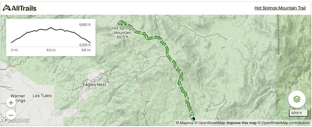
Nestled in San Diego County, the Oak Grove Trail to High Point hike unfolds over 13.4 miles, presenting hikers with a challenging yet rewarding route as part of the esteemed Six Pack Of Peaks Challenge. The trail’s varied terrain promises not only steep ascents but also stretches of gentler landscapes, offering a true taste of Southern California’s backcountry.
Quick Stats for Oak Grove Trail to High Point
- Distance: 13.4 miles round trip
- Elevation Gain: Approximately 3,000 feet
- Average Time: 7 to 8 hours
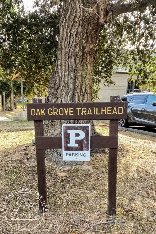
- Trailhead Location: Oak Grove Trailhead, near Aguanga, CA
- Trail Type: Out-and-back
- Difficulty: Moderate to challenging
- Dog Friendly: Yes, dogs must be on leash
- Permits: Cleveland National Forest Adventure Pass required for parking
- Best Time to Hike: Fall through spring for cooler temps
- Key Highlights: High Point Lookout Tower, diverse terrain, panoramic views
High Point via Oak Grove Trail Map
🥾 Plan Smarter Hikes with AllTrails
AllTrails is my go-to for trip planning, from checking trail reviews to downloading maps, navigating from my phone, and sending routes straight to my Garmin 67i. Offline maps, alerts, and AI route planning make upgrading to Plus & Peak worth it!
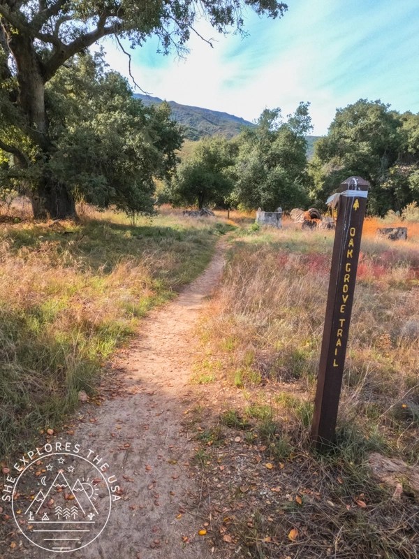
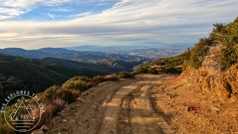
The first two miles are the steepest, offering an initial stamina test. Once past this section, the trail transitions to a service road, making the journey to the top more manageable. However, the ease of the descent is offset by the last two miles, presenting a challenging downhill stretch, especially when your legs are most fatigued.
Situated near Aguanga, California, this trail demands an average of 7 hours and 29 minutes to complete, according to AllTrails. Dogs are welcome but must be on a leash.
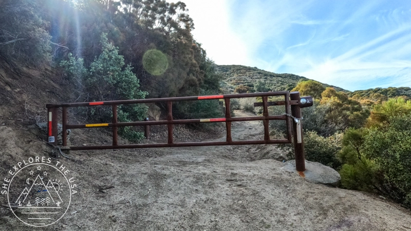
For those ready to tackle High Point, the journey begins at the Oak Grove trailhead, opposite the Oak Grove campground. Be sure to display your Cleveland National Forest Adventure Pass in your vehicle when using the Forest for recreational purposes.
Gear Recommendation for the High Point Hike
For a hike of this magnitude, ensure you’re well-prepared. In conjunction with the famous ten essential items, explore the following gear recommendations:
- Southern California Adventure Pass
- Sturdy hiking boots or trail runners with good traction
- Trekking poles for stability, particularly during the downhill descent
- Backpack to carry your essentials
- Layered clothing for temperature changes, including a warm and wind-resistant puffy jacket for the chilly conditions at the summit
- Ample water to stay hydrated, especially in the sunny areas
- Snacks to refuel during the journey
- Sun protection, including sunscreen, a hat, and sunglasses
- Bug net to protect against insects, especially during warmer seasons when bugs are more prevalent

Discover the full collection of my favorite outdoor finds in my curated gear shop.


The Ascent: Views and Vistas
The initial two miles of the trail set the tone with a rigorous ascent, testing both stamina and determination. The views get better and better with every step you take. As the route progresses, it transitions into a service road, revealing stunning views of San Jacinto. This section of the trail becomes gentler, allowing hikers to fully appreciate the scenic beauty that San Diego County has to offer.

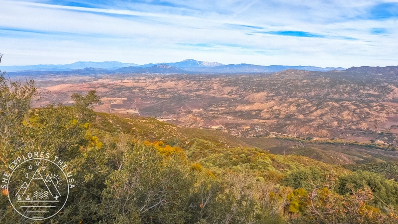
Navigating the service road toward High Point, the trail’s character transforms, guiding you through a more gentle terrain. This stretch allows you to immerse yourself fully in the scenic beauty that envelops you. The amazing views of San Jacinto are always there, making each step feel like a move toward something special.
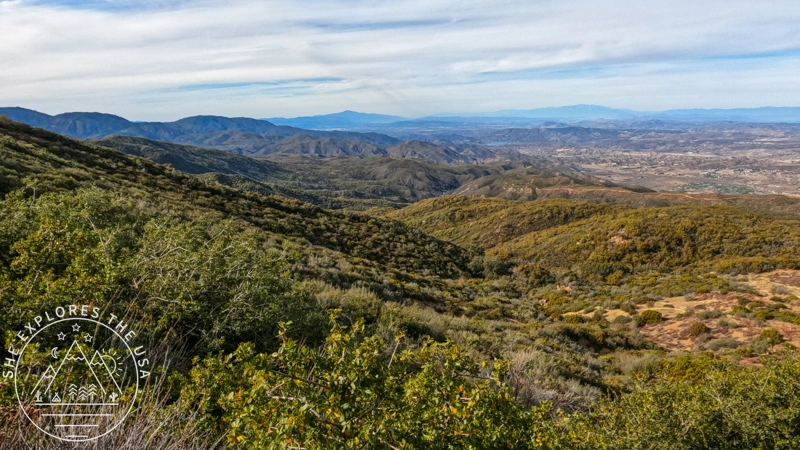
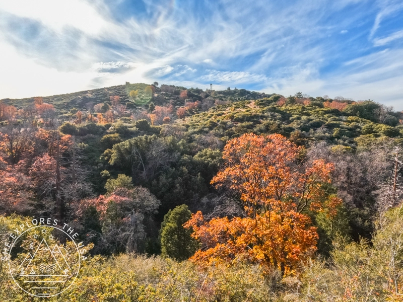
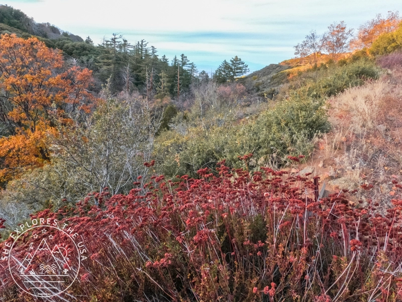
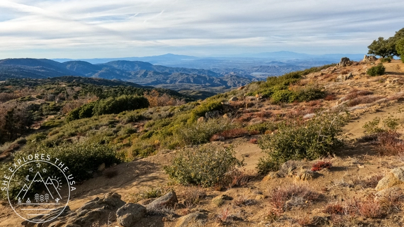
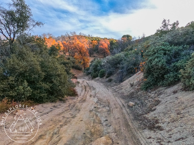
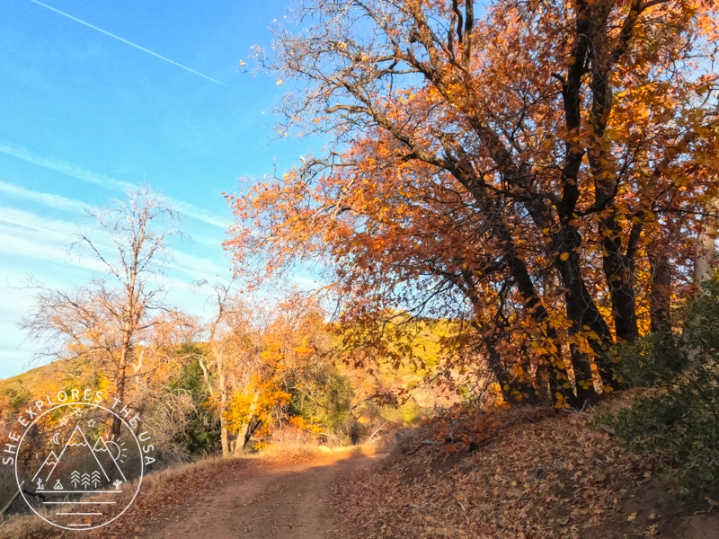
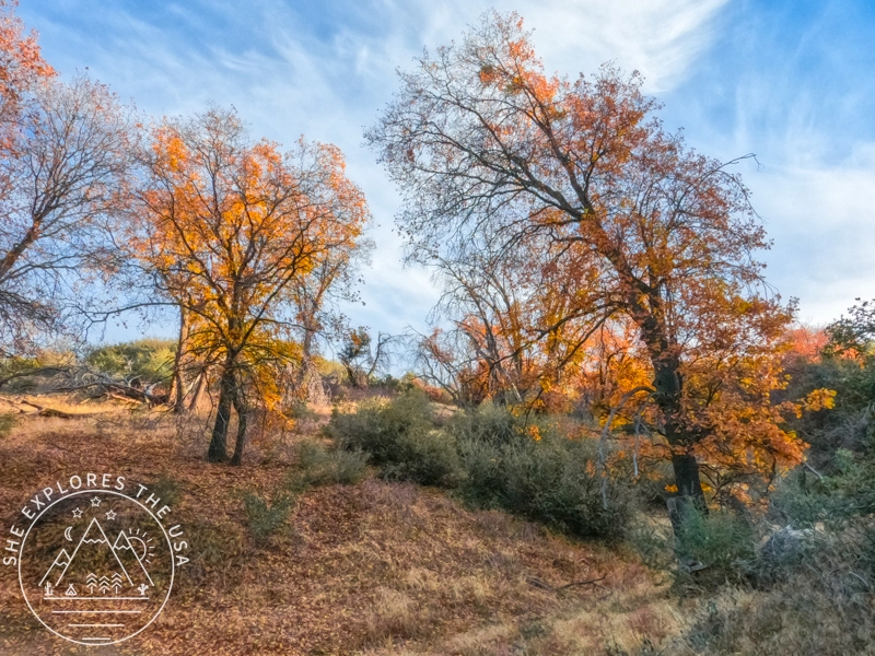
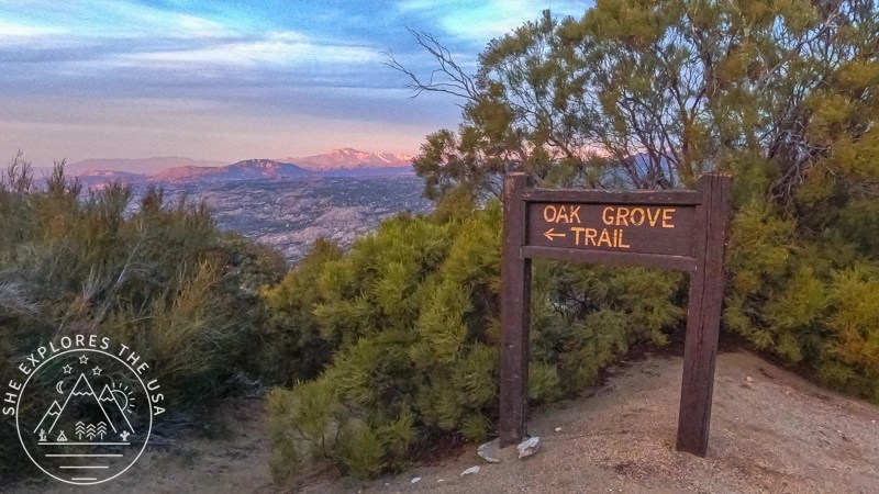
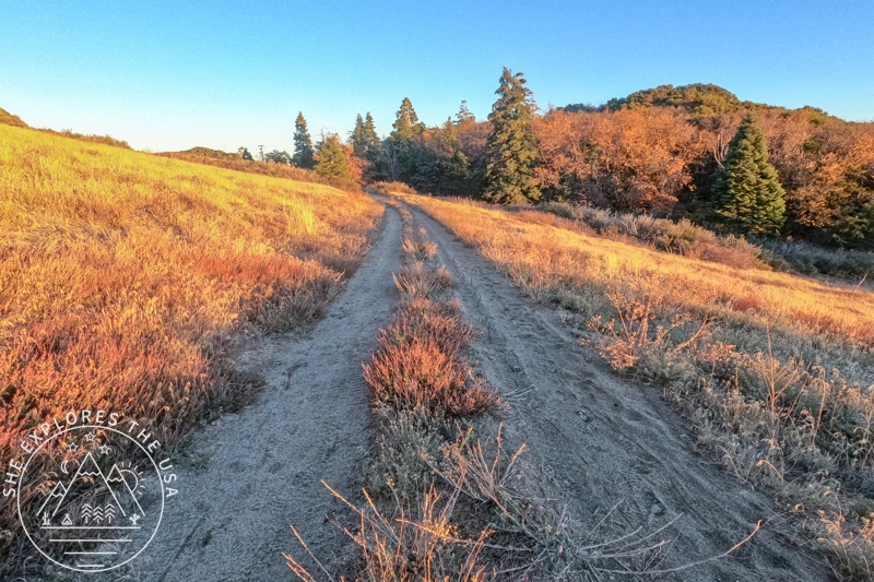
Despite views of San Jacinto in the distance, the first 5 miles are very much a typical SoCal almost desert landscape. But as you reach the last two miles of the hike, suddenly you are met with pine trees and fall foliage (I hiked this in late November!).

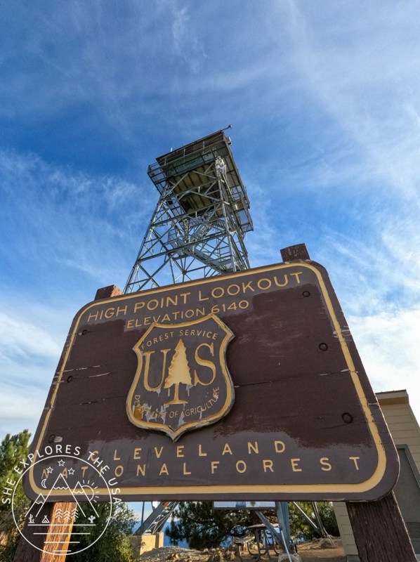
Summit Glory and Lookout Tower Welcome
Reaching the summit marked not only a physical achievement but also an unexpected welcome from the lookout tower volunteer as he shouted “You made it!”, making me jump out of my skin! Even though I saw the ranger’s truck, I certainly was not expecting him to interact with me or hikers in general. This created a memorable moment against the stunning backdrop of Palomar Mountain.
There is a picnic table at the summit, so I enjoyed a quick lunch after putting on my puffy, had a quick photoshoot with the summit wooden signs, and off I went on my merry way back down.


The Descent: Twilight Magic and Navigating Challenges
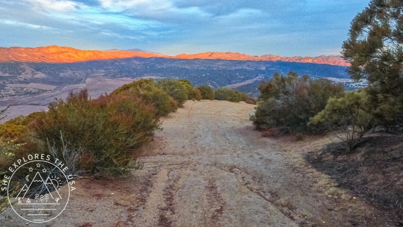
As I descended back towards the trailhead, the universe had another spectacle in store. A stunning sunset unfolded, turning the trail into a canvas of twilight magic. The sky turned into gorgeous orange and pink hues, and the almost full moon rose in front of me, though barely showing through clouds.


Towards the end of the descent, the trail also throws a surprise at weary legs. The service road may seem forgiving, but the last two miles introduce a steep downhill stretch. Slippery rocks and rolling stones add an unexpected challenge, testing hikers even on the journey back.
Hiking Stats
I started my hike at 11.15 am and made it back to my car at 5.24 pm. It took me just over three hours to climb up, and two hours to come back down. I spent around 45 mins at the top for lunch and photos.


Relive my High Point Hike
As usual, here’s my Relive Video of this hike. I love how it gives a deeper perspective of the terrain. I use the free version, so the video quality is not the best, but it’s pretty good for being free. Best of all, I don’t need to track with Relive, it connects to the Garmin app.
High Point Hike FAQ
Where is the High Point Trail located?
The High Point Trail starts at the Oak Grove Trailhead near Aguanga in San Diego County, California.
How long is the High Point hike?
The round-trip hike is about 13.4 miles with challenging elevation gain.
Is the High Point Lookout Tower accessible?
Yes, the trail leads directly to the historic lookout tower with panoramic views.
Final Thoughts on my High Point Hike
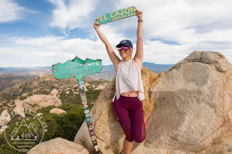
This wasn’t just another box to check. The Oak Grove Trail to High Point felt like a full-on journey, part endurance, part beauty, part magic. It was my sixth hike for the San Diego Six Pack of Peaks Challenge, and even though I swapped in Mount Woodson instead of El Cajon (for now), I still count this as a solid win.
Watching the sunset fade into moonrise at the end of the trail reminded me why I keep showing up for hikes like this. There’s magic out there if you’re willing to earn it. Every mile of this 13.4-mile trek reminded me why I hike: not just to summit, but to feel alive in the wild.
If you’re curious about the challenge, you can sign up for the San Diego Six Pack of Peaks here and see what these mountains have in store for you.


Post originally published on November 29, 2023, and last updated on April 4, 2026.