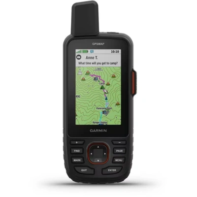
Garmin GPSMAP 67i Review & Which InReach Suits You?
DISCLOSURE: This post may contain affiliate links. If you purchase after clicking one of my links, I may earn a small commission at no extra cost to you. As an Amazon Associate, I earn from qualifying purchases. For more information, see my disclaimer.
If you’re looking for a reliable GPS for hiking or backpacking, the Garmin GPSMAP 67i is a top choice. It’s rugged, accurate, and works when there’s no cell service. After my old Explorer+ was stolen, I needed something just as dependable. The 67i has inReach satellite messaging, detailed maps, and long battery life. It keeps you connected in remote places and helps you stay safe. In this review, I’ll go over the top features, what makes it stand out, and how it compares to the Garmin 66i, Mini 2, Mini 3, and Messenger Plus.

- Garmin 67i Review
- Garmin GPSMAP 67i Top Features and Benefits
- Essential Apps to Pair with Your Garmin GPSMAP 67i
- InReach Subscription Plans Options
- Garmin GPSMAP 67i Pros and Cons
- How I Stay Informed About Wildfires While Off-Grid
- Comparing InReach Satellite Devices
- FAQ About Garmin GPSMAP 67i
- Final Thoughts on Garmin GPSMAP 67i
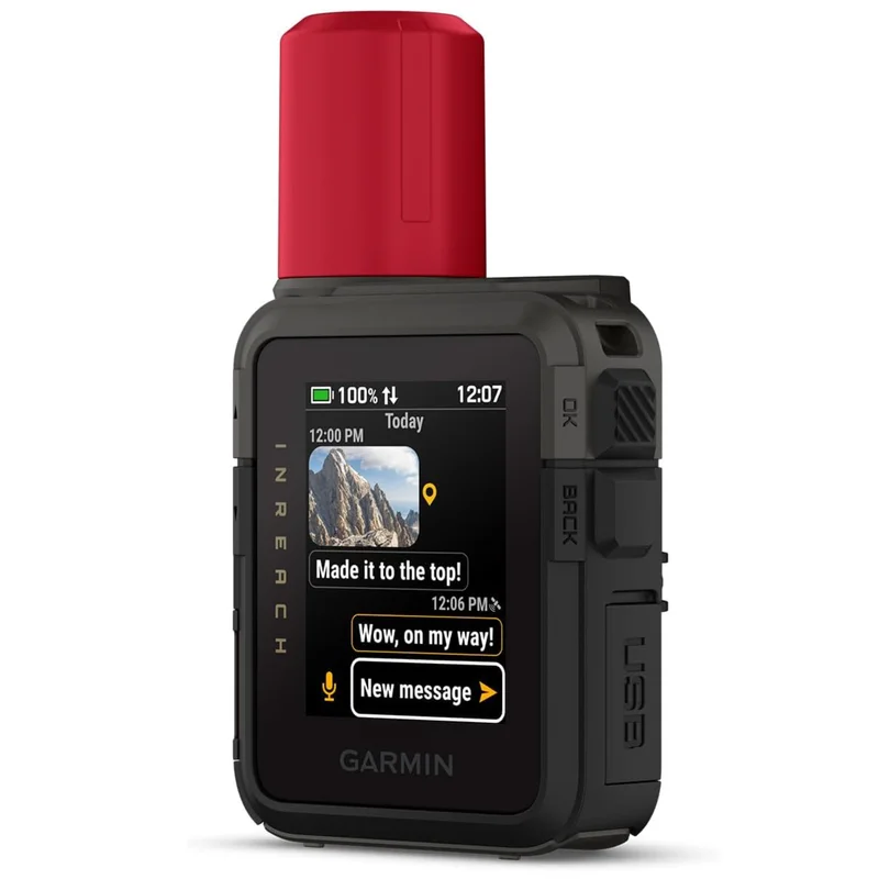
Garmin 67i Review
I loved my Garmin InReach Explorer+, so I was devastated when it got stolen. But the 67i quickly turned that disappointment into excitement. It immediately felt like a major upgrade.
The messaging features, like texting and check-ins, are just as reliable as before. But the 67i’s navigation takes things to a whole new level. The interface is easier to use, and the screen feels more like a smartphone. That makes navigating both simpler and more enjoyable.
It still has some of the clunky feel of the Explorer+, but the improvements are clear, and they make a real difference.
Technical Specs of the Garmin GPSMAP 67i
- Lens Material: Chemically strengthened glass
- Dimensions: 2.5” x 6.4” x 1.4” (6.2 x 16.3 x 3.5 cm)
- Weight: 8.1 oz (230 g) with batteries
- Water Rating: IPX7
- Display Type: Transflective color TFT
- Display Size: 1.5″W x 2.5″H (3.8 x 6.3 cm); 3″ diag (7.6 cm)
- Battery Life: Up to 165 hours with inReach enabled with 10-minute tracking and up to 840 hours in Expedition mode.
- Memory: 16 GB internal, expandable with a 32 GB microSD card.
- Maps & Navigation: Preloaded with TopoActive maps, routable; supports up to 15,000 map segments and 10,000 waypoints.
- Connectivity: Wi-Fi, Bluetooth, ANT+
Garmin GPSMAP 67i
- inReach Satellite Messaging & SOS
- Advanced Navigation
- Extended Battery Life
Garmin GPSMAP 67i Top Features and Benefits
Features & Benefits Table
Here are my top Garmin 67i features and how they help outdoor lovers.
| Feature | Benefit |
|---|---|
| Multi-band GNSS | Increased GPS accuracy, even under heavy tree cover |
| inReach Satellite Messaging | Send/receive texts even without cell service |
| Pre-set Check-ins | Unlimited location sharing with loved ones |
| Weather Forecasts | Know what’s coming, even in the backcountry |
| Long Battery Life (up to 840 hrs in Expedition Mode) | Spend more days off-grid with less charging |
| Built-in LED Flashlight | Useful in emergencies or nighttime camp setups |
| MIL-STD-810 Rugged Rating | Durable and water-resistant for harsh conditions |
| Sun & Moon App | Great for timing hikes, photography, and campsites |
| Predictive Text Typing | Quicker messages on the go |
67i Battery Performance
The Garmin GPSMAP 67i has impressive battery life. With inReach enabled and 10-minute tracking turned on, it can last up to 165 hours. In regular GPS mode, it stretches to 180 hours.
For even longer trips, Expedition Mode shines:
- 425 hours with inReach on
- Up to 840 hours without inReach
In this mode, the screen turns off and the device enters low-power mode. It collects fewer GPS track points, which helps save battery.
In my experience, battery life has never been an issue. The 67i always has plenty of charge left when I get home. One tip that helps: I turn it off at night on multi-day hikes. That small habit saves power without affecting safety or performance.
Importance of inReach Satellite Technology for Remote Adventures
inReach Satellite Technology is a must-have for any serious hiker or backpacker. It works even when there’s no cell service, so you’re never really off the grid.
Key features include:
- Two-way messaging
- Location sharing
- SOS emergency response, available 24/7
Whether you’re deep in the backcountry or just out of range, inReach gives you peace of mind. You can stay in touch with loved ones or get help in an emergency. It’s one of the most valuable tools I carry in remote areas.
Please Be Mindful: Calling for Help Is a Responsibility
Having the ability to call for help with the 67i is a huge comfort, but it’s important to remember it’s not a guarantee that rescue will come. Sending an alert doesn’t mean someone will immediately, or even ever, be able to reach you. It’s always best to use good judgment when you’re out in the backcountry. Search and rescue teams are real people with families, and they’re taking risks to help when they can. So, it’s a good idea not to rely solely on technology to get you out of situations you’d normally avoid.
Real-World Reliability: How I Use the 67i
The Garmin 67i has proven to be a dependable companion in tough environments. Here’s how it helps me stay safe and informed:
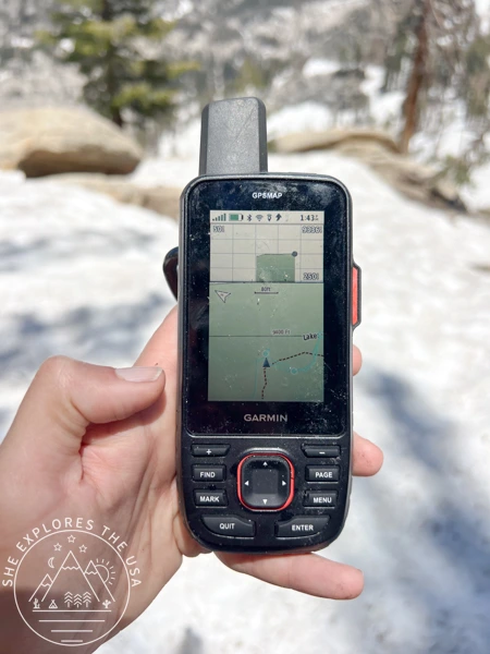
Navigating Snow-Covered Trails
I’ve used the 67i to find my way when trails were buried under snow. It kept me on course when the path was completely invisible. (Read about one of those adventures here!)
Driving Through Remote Deserts
Out in the desert, where there’s no cell service for miles, I feel much more secure knowing I can still communicate if something goes wrong.
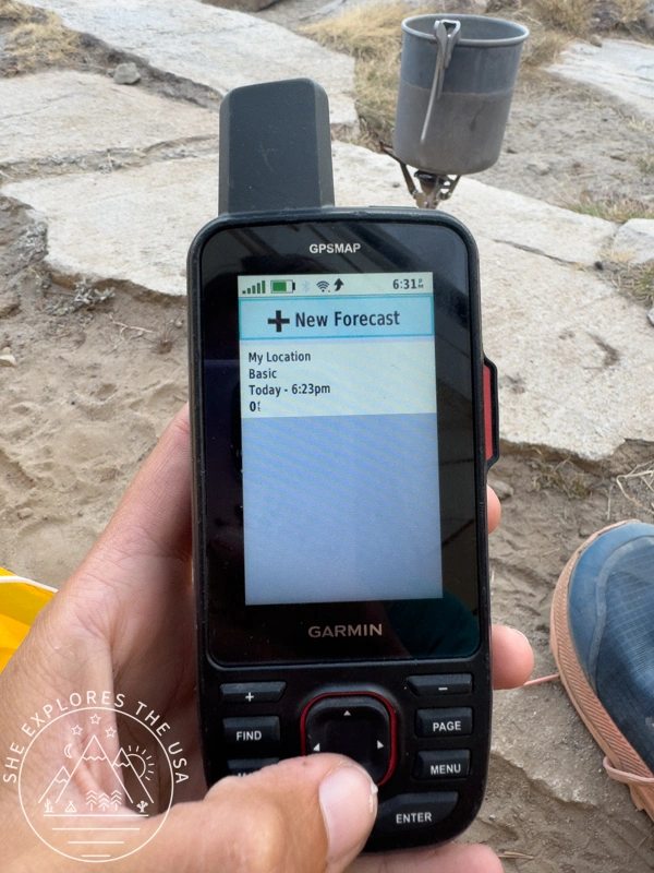
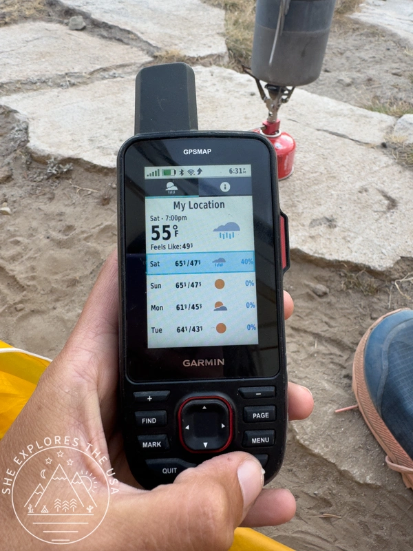
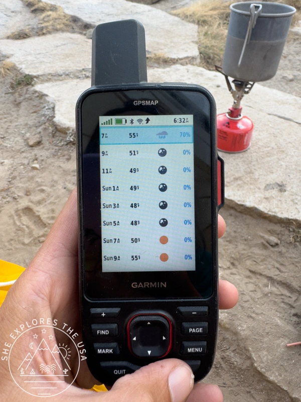
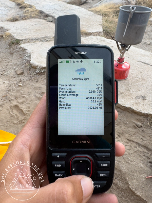
Requesting Weather Forecasts
The built-in weather feature is a huge plus. I can request updated forecasts right from the device. It helps me plan around storms, or even just wait out strong winds when I know they’ll die down later.
Unlimited Pre-Recorded Check-Ins
One of my favorite features, also available on the old Explorer+, is the ability to send unlimited pre-recorded check-in messages. Your inReach subscription includes three customizable templates, so it’s easy to keep family and friends updated, even when you’re deep off the grid.
These check-ins don’t use message credits and send with just one click. It’s a simple but powerful way to let loved ones know you’re okay.
Note: As of September 27, 2022, check-in messages have replaced preset messages. If your inReach account was created before that date, you may still have access to the older preset feature. New accounts will default to check-in messages.
Independent Communication with Predictive Text
One thing I really appreciate about the 67i is that it doesn’t need a phone to send messages. You can text straight from the device, which makes it a reliable backup when your phone is dead or has no signal.
While the keyboard feels a bit old-school (like a 2000s flip phone), predictive text makes a big difference. It speeds up typing and makes it much less frustrating, especially when you’re tired or wearing gloves.
That said, it’s important to be patient. Messages sometimes take a few minutes to send or receive. It depends on satellite location and signal strength, so don’t panic if there’s a delay. The messages usually go through, just not always instantly.
Garmin GPSMAP 67i
- inReach Satellite Messaging & SOS
- Advanced Navigation
- Extended Battery Life
InReach-to-InReach Messaging: Seamless Communication Anywhere
Garmin inReach devices let you send messages to other inReach users, even in the most remote places without cell service. It works like a digital walkie-talkie but uses satellites to send texts worldwide.
When you send a message, it’s charged like a regular text. If your plan includes texting, that cost is covered.
Unique inReach Address
Each user gets a unique inReach address (for example, example@inreach.garmin.com). This acts like an email but works only within Garmin’s satellite network for inReach-to-inReach messaging.
Sending and Receiving Messages
- Sending: Open the messaging feature, choose ‘New Message,’ enter the recipient’s inReach address, write your message, and send.
- Receiving: The other person’s device will notify them of a new message. They can read and reply right from their device, just like texting.
Real-Time Satellite Messaging
Messages are sent almost instantly, depending on satellite visibility. This makes conversation-like communication possible, even far off the grid.
Easy Setup and Use
Share your inReach address with your hiking or adventure group before your trip. Once connected, you can message each other anywhere, perfect for remote hiking, camping, or expeditions.
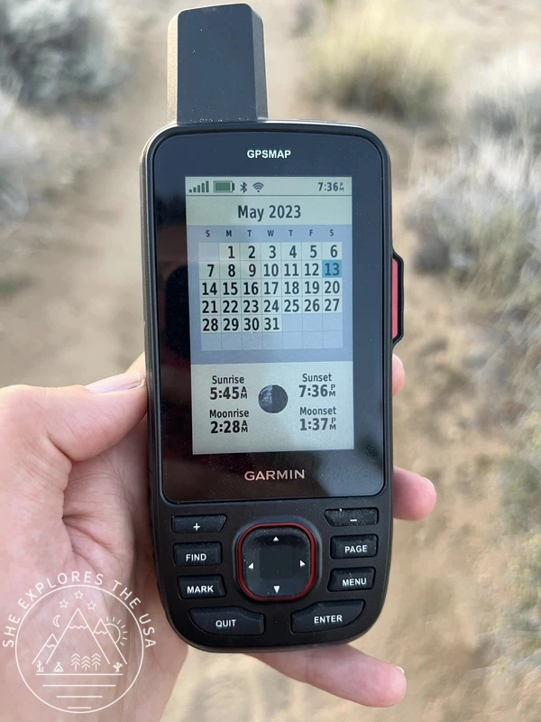
67i Sun and Moon App
The Garmin 67i includes a handy built-in Sun and Moon app. It shows you sunrise, sunset, moonrise, and moonset times based on your current GPS location. This feature is great for planning your day on the trail, whether you want to catch the sunrise, know when it’s getting dark, or track moon phases for night hikes. Having this info right on your GPS means one less app or device to carry.
Built-in Flashlight App on 67i
One great upgrade over the Explorer+ is the built-in LED flashlight app on the 67i. It has three useful modes:
- A steady beam for general use
- Strobe mode with adjustable intervals for signaling
- An SOS mode for emergencies
This adds extra utility, making the device more versatile on your adventures.
Garmin 67i Durability and Design
I was impressed by the rugged design of the 67i right away. It meets military durability standards (MIL-STD-810) and works well in tough outdoor conditions. It can handle extreme temperatures, shocks, and vibrations.
The 67i has an IPX7 waterproof rating. That means you can submerge it up to 1 meter deep for 30 minutes without damage. This gives you peace of mind in wet or rainy weather. The rubber grip keeps it steady in your hand, even when wet or wearing gloves.
It weighs only 7.05 ounces, so it is light and easy to carry on your backpack strap.
However, I noticed it scratches and scuffs more easily than I thought. My older Explorer+ felt tougher and more durable.
Favorite Amazon Finds for the GPSMAP 67i
Here are some top-rated accessories for the 67i, my go-to picks from Amazon:


![Mr.Shield Screen Protector compatible with Garmin GPSMAP 67 679 67i 66i 66s 66st 66sr [Tempered Glass] [3-PACK] [Japan Glass with 9H Hardness]](https://m.media-amazon.com/images/I/51Jnu7PPACL._SL160_.jpg)
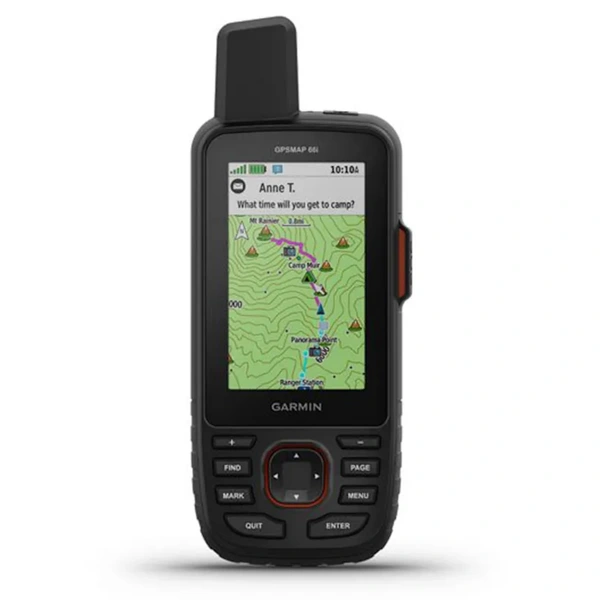
67i Display & Navigation
The 67i features a large 3-inch LCD screen that’s easy to read, even in bright sunlight. I find it especially clear when wearing sunglasses, making it convenient to check messages and navigation details on the move.
Navigation is a major strength of this device. It comes preloaded with detailed topographic maps and lets you upload more for different terrains. The high-resolution display and turn-by-turn navigation have been lifesavers, especially on snow-covered trails where it’s hard to see the path.
Its precise positioning gives me confidence to find my way, even in tough conditions. I’ll share more about how I use the 67i for navigation in the next section.
Garmin GPSMAP 67i
- inReach Satellite Messaging & SOS
- Advanced Navigation
- Extended Battery Life
Essential Apps to Pair with Your Garmin GPSMAP 67i
Connection with AllTrails
These two features to connect Garmin and AllTrails are only available with the paid-for AllTrails Plus, but if you don’t have that yet, I highly recommend you sign up now!
Syncing Garmin 67i Activities with AllTrails
You can connect your Garmin 67i to AllTrails, allowing your completed activities to sync automatically if you choose. This means you don’t need to track your activity separately on both devices. One activity recording is enough for sharing your adventure and leaving a review on AllTrails. Plus, syncing helps save battery life by reducing duplicate tracking!
Downloading AllTrails Routes to Garmin 67i for Navigation
More importantly, you can send AllTrails navigation routes to your 67i and navigate directly from the device, no phone needed during your hike. Here’s how:
- From AllTrails (Desktop Version):
- Scroll down to the “Hit the Trail” section.
- Click the “Download the Route” option and select “Send to Garmin.”
- This sends the route to your Garmin Connect account.
- Syncing with Garmin Connect:
- Sync your 67i with Garmin Connect (either via Bluetooth or by connecting it to your computer).
- After syncing, the route will be available on your 67i as a “course.”
- Starting Navigation on the 67i:
- On your 67i, click the Find button.
- Select Courses and choose the course you want to navigate.
- Click Go to start navigating the route.
That’s it! Your course is now active, and you’re ready to hit the trail. This method makes it easy to follow detailed routes directly from your 67i, making it the best hiking companion.
🥾 Plan Smarter Hikes with AllTrails
AllTrails is my go-to for trip planning, from checking trail reviews to downloading maps, navigating from my phone, and sending routes straight to my Garmin 67i. Offline maps, alerts, and AI route planning make upgrading to Plus & Peak worth it!
MapShare: Real-Time Location Sharing
One of the great connectivity features of the GPSMAP 67i is MapShare. It lets you send family, friends, or followers a link to your real-time progress on a map. You can share your planned route and waypoints, so others can track your journey as it happens. There are multiple privacy settings, letting you keep your trip public or private.
This came in handy on a recent backpacking trip in the Sierra. My family, who lives halfway around the world, could follow my location in real time and feel reassured even when I wasn’t able to check in regularly. The inReach location tracking kept us connected and gave them peace of mind.
They can also press a “locate” button to request my current position. For this to work, my device needs to be on with a clear view of the sky. Although it might take up to 20 minutes for my device to respond, the locate request will keep trying for up to five days. This feature provides an important safety net for me and my loved ones.
Compatible Smartphone Apps
While the 67i is fully functional without a cell phone, pairing it with a compatible smartphone unlocks additional features. Two Garmin apps, in particular, enhance the experience:
Garmin Messenger App
Pair this Messenger app with your 67i (via Bluetooth) to send messages without needing a cellular network. It’s especially helpful when you’re off the grid and need to communicate, ensuring fast, easy messaging wherever you are.
Garmin Explore App
The Garmin Explore app is perfect for off-the-grid adventurers. It helps you plan, navigate, and review your outdoor trips, making it a must-have for hikers and explorers. You can even use the app on your desktop to create routes and maps, then sync everything with your GPSMAP 67i. This way, you can head off-grid with confidence and peace of mind.
After each trip, I sync my 67i back to the Explore app, no cords needed, as it uses WiFi and Bluetooth. This sync transfers my activities to the iPhone app. From there, I open the activity in the Relive app to create the videos I share on YouTube after my hikes.
Don’t Forget to Log Into the Messenger App Before Your Trip
One important lesson I learned is to make sure you’re still logged into the Messenger App before losing cell service on your trip. If you log in ahead of time, you can send texts from your phone just like normal, which makes typing easier. If you forget to log in, don’t worry, you can still send texts and request help directly from the 67i device itself. I had to do this when I needed wildfire assistance during my last trip. Sometimes, even if you logged in during your last trip, app updates can log you out without warning. That’s what happened to me recently. So it’s best to double-check you’re logged in before heading into the wilderness.
Garmin GPSMAP 67i
- inReach Satellite Messaging & SOS
- Advanced Navigation
- Extended Battery Life
InReach Subscription Plans Options
To use the Garmin GPSMAP 67i (and other inReach devices mentioned here), you need an active satellite subscription. This connects your device to the Iridium network, enabling key features like tracking, messaging, weather updates, and SOS.
Garmin offers flexible plans for all types of users, from casual hikers to serious adventurers.
My Experience:
I used the Monthly Safety Plan at $14.95 for years, and it works well for my shorter trips. But Garmin updated their plans with the launch of Messenger Plus. These changes make things simpler: most plans now include more messages and weather forecasts, and Garmin removed the annual and early termination fees.
As a result, I upgraded to the inReach Essential Plan, which gives me 50 text messages. That’s enough for my weekend and 5-day trips, as it also includes unlimited check-ins. If and when I thru-hike the PCT, I’ll switch to the inReach Premium plan to get unlimited text messages.
Here’s what you need to know:
- No more annual program fees, a welcome change.
- A new low-cost “inReach Enabled” plan keeps your device active with SOS and lets you pay only for messaging and tracking when you use it.
- Most plans now include more text messages, perfect if you want to stay connected without unlimited messaging.
- Garmin replaced the old Suspend option with the inReach Enabled plan. If you paused your subscription before, this plan is now your go-to. Bonus: Freedom Plan users get two months of inReach Enabled free during the switch.
If you use an inReach device, check how these updates affect your plan. I’m still deciding if I’ll switch or stay on my current plan, but the new setup feels more flexible.
Search And Rescue (SAR) Insurance Plans
If you’re thinking about purchasing the 67i or any other inReach device, adding a Search and Rescue (SAR) insurance plan is worth considering. SAR insurance helps cover the costs of qualified search and rescue operations if you ever face an emergency. With an active subscription and a supported device, such as an inReach, you can trigger an SOS and connect with the Garmin Response Center for assistance. Depending on the plan you choose, SAR insurance can reimburse you for eligible rescue expenses, providing peace of mind on your adventures.
Garmin GPSMAP 67i Pros and Cons
I’ve used the Garmin 67i for two years, and it’s packed with pros with no major cons so far.
Pros
- Cell phone not required
- Accurate Positioning
- Reliable InReach Satellite Communication
- InReach-to-InReach Messaging
- Long Battery Life
- MapShare, Messenger & Explore apps
- Ability to load AllTrails maps for navigation
- Flashlight App
- USB-C charging (same as many other devices!)
Cons
- It is less rugged than anticipated; it seems to scratch and scuff more easily compared to my Explorer+
- Overkill for casual users
- Dated text interface
- Still a bit clunky (like Explorer+)
How I Stay Informed About Wildfires While Off-Grid
One experience that highlighted a potential opportunity in the 67i’s functionality occurred during a trip in the Sierra at 10,000 feet this past Labor Day weekend (August 2024). I woke up to the smell of smoke and the sound of helicopters flying overhead, all signs pointing to a nearby wildfire. However, figuring out exactly where the fire was or how to assess the situation was pretty difficult.
I had to text people back home, asking them to research the wildfire’s location and send me updates, but they couldn’t find anything! I wish there were a feature, or app, that would allow users to receive on-demand satellite alerts about wildfires or other emergencies, similar to how we can receive satellite weather updates. Watch Duty is only accessible with cell service as far as I know. Having that kind of safety feature for situations like this would be reassuring, as it’s about staying connected and informed about the dangers nearby.
🔥🚨 NEW! Real-Time Wildfire Alerts via Satellite Text
Since last summer, I’ve found an easy way to get wildfire updates even when you’re off the grid.
Just text your GPS coordinates to (765) 55-FIRES (+1 765-553-4737) using your inReach or any satellite communicator. Or, turn on “Message Location” on your inReach and send any message to that number.
You’ll get fast updates on fires within 50 miles and the Air Quality Index (AQI) from the closest station.
This service comes from TrailInfo.org, a great resource for hikers and outdoor lovers. It’s a game-changer for backcountry safety!


Comparing InReach Satellite Devices
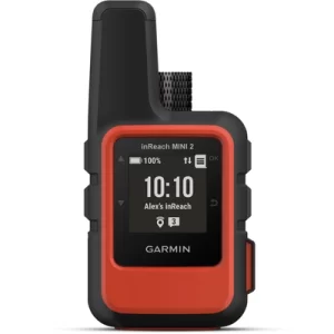
67i vs. Garmin inReach Mini 2: Which Is Best for You?
Compared to my Explorer+, the 67i is a clear step up in terms of functionality and modernity. While the Explorer+ was still available to purchase in April 2023 when I was on the market for a new device, the real choice for me was between GPSMAP 67i and inReach Mini 2, which was released in 2022.
Why I Chose the Garmin GPSMAP 67i over the Mini series
I wouldn’t have upgraded to the GPSMAP 67i if I still had my Explorer+, but I’m pleased with my choice given the circumstances. While the 67i retains some of the Explorer+’s clunkiness, I chose it over the Mini to avoid relying too much on my phone’s battery, and I’m glad I did.
Price Comparison: 67i vs Mini 2
The 67i comes with a premium price, reflecting its advanced features like inReach satellite technology, GPS mapping, and rugged design. It is more expensive than basic handheld GPS units. But for serious outdoor lovers, the reliable communication in remote areas and its durability make it worth the investment.
Now that Garmin has released the Mini 3, you can grab the Mini 2 for much cheaper, even outside of typical sale season. This makes it a great option if you can time your purchase right. For those who need dependable satellite communication and mapping, the price offers peace of mind and reliability.
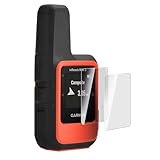
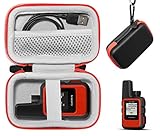
My Favorite Amazon Finds for the inReach Mini 2
Here are some of my favorite Amazon finds! These must-have accessories, like a carrying case and screen protector, will make your Mini 2 experience even better.

Comparative table of the Garmin GPSMAP 67i and Mini 2 devices
| Feature | GPSMAP 67i | inReach Mini 2 |
|---|---|---|
| Size & Weight | Larger (2.5″ x 6.4″ x 1.4″), 8.1 oz (230 g) | Ultra-compact (2.04″ x 3.90″ x 1.03″), 3.5 oz (100 g) |
| Display | 3” color display, high resolution (240 x 400 px) | Small monochrome display (0.9″ x 0.9″, 176 x 176 px) |
| Battery Life | 425 hrs in Expedition Mode, 180 hrs in GPS Mode | 30 days at 30-min tracking, 14 days at 10-min tracking |
| Maps & Navigation | Preloaded topo maps, 16 GB storage, detailed maps | Maps via Garmin Explore app (requires phone) |
| SOS & Messaging | Interactive SOS, 2-way messaging, group messaging | Interactive SOS, 2-way messaging, group messaging |
| Durability | MIL-STD-810 (rugged, shockproof, waterproof) | IPX7 (waterproof, rugged) |
| Additional Features | Advanced navigation tools (altimeter, compass), weather, more | Simple, compact design, easy communication features |
| Ideal Use Case | Multi-day hiking, backcountry navigation, off-grid adventures | Shorter hikes, light backpacking, basic communication |
| Best For | Serious adventurers, long trips, detailed mapping | Lightweight trips, essential messaging, compactness |
Decision Summary: Garmin GPSMAP 67i vs Mini 2
Choose the Garmin GPSMAP 67i if you want advanced mapping, a larger screen, and full navigation tools that work without your phone. It lets you send texts and use all features independently. This makes it perfect for longer trips, detailed maps, and reliable satellite communication in remote areas.
If you prefer something smaller and simpler, and mainly need SOS and messaging, the Garmin inReach Mini 2 might suit you better. However, the Mini 2 depends on your phone for texting and doesn’t offer the 67i’s advanced navigation features.
Garmin inReach Mini 2

Now more affordable than ever!
- Satellite Technology
- Lightweight
- Cell phone dependent
Garmin inReach Mini 3 vs Mini 3 Plus vs GPSMAP 67i: Which One Should You Choose?
In early December 2025, Garmin released the Inreach Mini 3 and Garmin Inreach Mini 3 Plus models.
*** update coming soon! ***
GPSMAP 66i vs. Garmin GPSMAP 67i: Key Differences
If you’re looking for a satellite communicator with advanced mapping, extended battery life, and smart connectivity, including multi-band frequency support, the Garmin GPSMAP 67i is the top choice. Its ability to switch seamlessly between Wi-Fi, cellular, and satellite connections, combined with its enhanced features, makes it perfect for remote adventures and worth the higher price.
On the other hand, if you’re on a budget and don’t need the latest features or as much battery life, the Garmin GPSMAP 66i delivers solid performance at a lower cost. It offers reliable satellite messaging and navigation, making it a great option for simpler needs.
Below is a comparison table highlighting the key differences between the two models:
| Feature | 67i | 66i |
|---|---|---|
| Battery Life | Up to 840 hrs (Expedition Mode) | Up to 200 hrs (Power Save Mode) |
| USB Port | USB-C | Micro-USB |
| GPS Systems Supported | BeiDou, IRNSS, GPS, Galileo, QZSS | GPS, Galileo, BeiDou |
| Price | Higher (New model) | Lower (Previous model) |
Garmin GPSMAP 66i
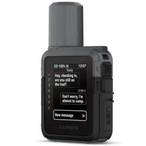
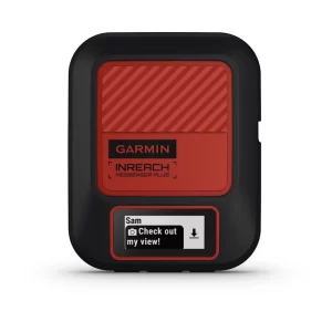
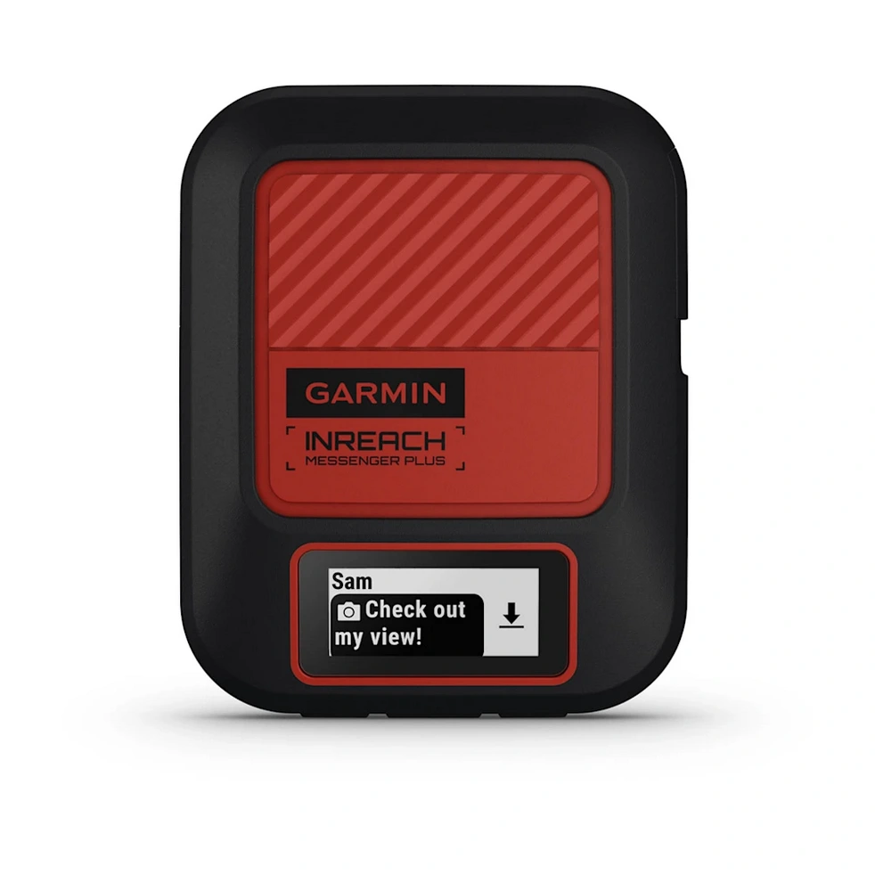
About The Latest InReach Offering: Garmin inReach Messenger Plus
Released on September 18, 2024, the Garmin inReach Messenger Plus sets a new standard for backcountry communication with unmatched safety and connectivity features. Designed for outdoor adventurers, this next-gen SOS satellite communicator now includes photo and voice messaging, making it easier than ever to stay in touch and share moments, no matter how far off the grid you roam.
What Makes the inReach Messenger Plus Stand Out?
- On-Device Display
View and confirm your messages directly on the device, even if your phone runs out of battery. - Phone Charging
Use Messenger Plus as a backup battery to charge your phone in emergencies. - Automatic Satellite Acquisition
Built-in GPS ensures fast, accurate location tracking without needing to aim the device at the sky. - Smart Network Switching
Seamlessly switch between Wi-Fi, cellular, and satellite networks depending on what’s available, no manual toggling required.
inReach Messenger Plus’ Best Amazon Picks
Upgrade your Messenger Plus with these favorite handpicked accessories from Amazon, including a carrying case and a silicone case!


Choosing Between the 67i and Messenger Plus
When choosing between the Garmin GPSMAP 67i and the inReach Messenger Plus, it’s essential to consider your priorities, whether it’s advanced navigation, rugged durability, or next-level satellite communication.
The GPSMAP 67i is a powerful handheld GPS device designed for serious adventurers. It features detailed topographic maps, turn-by-turn navigation, and advanced trip-planning tools, making it the ideal choice for long hikes, backcountry camping, or remote expeditions. While it also includes two-way satellite messaging and SOS capabilities, its biggest strength lies in comprehensive navigation, perfect for those who need reliable mapping as well as communication.
On the other hand, Messenger Plus is built for satellite messaging first. It supports text, photo, and voice messaging, along with group chats, all without needing cell service. It’s compact, lightweight, and focused on helping you stay in touch off the grid. While it includes basic navigation features like TracBack routing, it lacks the detailed mapping and route customization of the 67i. The Messenger Plus is ideal for travelers and hikers who prioritize communication and connectivity over complex navigation tools.
Garmin inReach Messenger Plus
NEW
- Photo & Voice Messaging
- Inreach Technology
- Phone Charging
FAQ About Garmin GPSMAP 67i
What is the difference between the Garmin 67 and the 67i?
The Garmin GPSMAP 67 and 67i are both rugged handheld GPS devices that offer identical navigation capabilities. The main difference? The 67i includes inReach satellite communication technology, enabling two-way messaging, SOS emergency response, and real-time location sharing via the Iridium satellite network.
📡 [i = inReach = Satellite Communication]
How accurate is the Garmin GPSMAP 67i?
In my experience, the 67i is extremely accurate, even on snow-covered trails and in remote backcountry areas. That’s thanks to its multi-band GNSS support, which allows it to access signals from multiple satellite systems (GPS, Galileo, and QZSS). By using more than one frequency, the device can better handle signal interference, reflections, and obstructions, delivering reliable location tracking even in rugged terrain. I’ve consistently felt confident navigating with it, even when visibility is poor.
When was the Garmin GPSMAP 67i released?
The Garmin GPSMAP 67i was released in March 2023.
Does Garmin GPSMAP 67i need a subscription?
Yes, but only for the satellite features. The Garmin 67i requires a satellite subscription to activate inReach capabilities like messaging, weather updates, location sharing, and SOS alerts.
However, GPS navigation, route planning, and map use still work without a subscription.
Where are satellite communicators illegal?
According to Garmin and my own research, satellite communicators like the 67i are restricted or banned in some countries. It’s your responsibility to check local laws before using one abroad.
As of now, use is restricted or prohibited in:
- China
- Cuba
- India
- North Korea
- Myanmar (Burma)
- Chad
- Nigeria
- Russia
- Sudan
Always check for updates before traveling, as regulations can change.
Can I get real-time wildfire alerts with my Garmin GPSMAP 67i or satellite communicator?
Yes! You can text your GPS coordinates from your inReach or other satellite communicator to (765) 55-FIRES (+1 765-553-4737) to receive instant updates on active wildfires within 50 miles and the local Air Quality Index. Just send your location or enable ‘Message Location’ and send any message to get real-time fire info.
Garmin GPSMAP 67i
- inReach Satellite Messaging & SOS
- Advanced Navigation
- Extended Battery Life
Final Thoughts on Garmin GPSMAP 67i
What I love most about the Garmin GPSMAP 67i is that it’s a true all-in-one device; I don’t have to rely on my phone for communication or navigation. It delivers reliable satellite messaging, accurate GPS tracking, and turn-by-turn directions, even in the most remote locations where cell service disappears.
In this Garmin GPSMAP 67i review, I’ve shared how it stacks up against similar devices like the GPSMAP 66i, inReach Mini 2, and Messenger Plus. While the Messenger Plus leads in messaging features like voice and photo sharing, the 67i excels in advanced mapping, detailed navigation, and rugged durability, making it the best option for serious hikers, backpackers, and off-grid explorers.
Overall, the Garmin GPSMAP 67i is a powerful, dependable tool that brings peace of mind on any outdoor adventure. Pairing it with the Garmin Explore and Garmin Messenger apps unlocks even more functionality, allowing you to plan, track, and share your journey with ease.
Whether you’re heading into the backcountry or planning your next thru-hike, the 67i is well worth the investment. Happy adventuring!
Ready to grab the Garmin 67i for your own adventures?
I use mine on every backcountry trip, and it’s been a total game-changer for safety and navigation. You can find it in my shop here.
Garmin GPSMAP 67i
My go-to backcountry safety device: the Garmin GPSMAP 67i keeps me connected anywhere via satellite messaging, location sharing, and SOS…
Post originally published on November 19, 2024, and last updated on February 18, 2026.