Sequoia’s Heather Lake Hike: The Best Snow Adventure
DISCLOSURE: This post may contain affiliate links. If you purchase after clicking one of my links, I may earn a small commission at no extra cost to you. As an Amazon Associate, I earn from qualifying purchases. For more information, see my disclaimer.
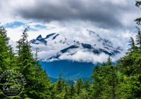
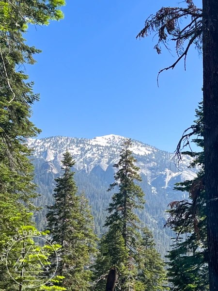
Hiking to Heather Lake in Sequoia National Park was the main reason I returned to the park in early July. I originally hoped to reach Pear Lake, but my research showed that snow still covered the trail after mile marker 2.5. So, I wasn’t surprised when the path became impassable beyond Heather Lake. I had never experienced hiking in snow during the summer before, and the idea of a snowy adventure in July was too tempting to resist. My inner adventurer had to see it for herself.
Heather Lake Hike, Sequoia National Park
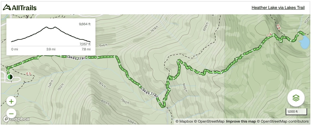
Heather Lake via the Lakes Trail is a 7.8-mile out-and-back hike in Sequoia National Park. Starting at the Wolverton Trailhead, it then leads you through the stunning Sierra wilderness while climbing 2,427 feet in elevation. Typically, most hikers complete it in just under five hours.
The trail is open year-round. However, winter conditions can make it impassable. In fact, that year, heavy snowfall during the winter season left half the trail still covered in snow by July. That said, this is usually a snow-free summer hike.
Most importantly, dogs are not allowed on this trail. So, be sure to leave your furry friends at home.
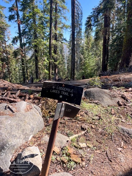
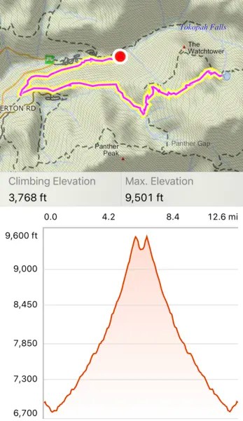
Heather Lake via the Lakes Trail Map
🥾 Plan Smarter Hikes with AllTrails
AllTrails is my go-to for trip planning, from checking trail reviews to downloading maps, navigating from my phone, and sending routes straight to my Garmin 67i. Offline maps, alerts, and AI route planning make upgrading to Plus & Peak worth it!
Sequoia National Park: First-Timer’s Guide to an Epic Trip
If you’re planning your first trip to Sequoia National Park, get ready for an unforgettable adventure. This guide will walk…
Gear Recommendation
Check out my curated outdoor gear shop for more of the products I actually use on the trail.


Travel Insurance
Before any trip, I always recommend sorting out your travel insurance. World Nomads offers both single-trip and annual worldwide coverage, and you can get a free quote in just a few minutes to see what it would cost for your trip.
👉 Get Your Free QuoteHow I Hiked to Heather Lake, Sequoia National Park
Getting to the Lakes Trail trailhead
I stayed at the Lodgepole Campground, which connects to many parts of the park via hiking trails. So, I decided to walk from my campsite (in the upper loop) and then hike the Lakes Trail. This route made my hike nearly 13 miles long with over 3,500 feet of elevation gain!
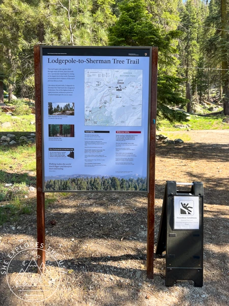
If you’d like to do the same route, start at the Lodgepole Campground shuttle parking area, also known as the Topokah Falls parking lot. From there, take the Lodgepole to Sherman Tree hiking trail. It’s a steady uphill climb the entire way, but the walk is easy and scenic.
When you reach the waterfall, look for a trail heading up to the left. The turn comes just before the falls, and the sign is falling over, so it’s easy to miss.
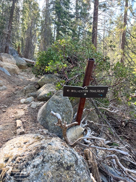
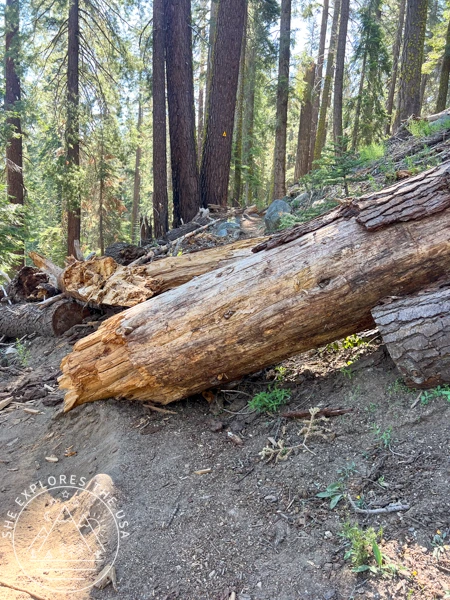
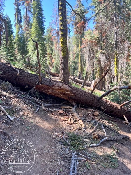
After that, continue for about a mile to reach the official Lakes Trail trailhead. Again, expect a steady uphill path with plenty of downed trees to climb over, duck under, or navigate around. It’s hard work, but totally worth it!
The Lakes Trail, Sequoia National Park
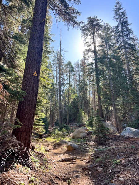
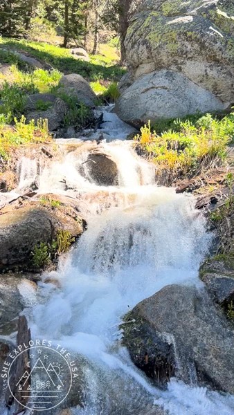
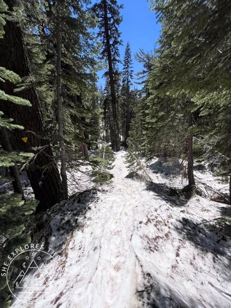
Once I reached the Lakes Trail, the first two miles were fairly easy. The path included two river crossings, some snow patches, and several downed trees. At one point, the trail followed a creek, but none of these obstacles were major.
Soon, I arrived at a fork. One way leads to the Watchtower Trail, which is meant to be very scenic and moderately challenging. The other route goes through the Hump Trail, which is steep and not very scenic. Unfortunately, the Watchtower Trail was cordoned off with a sign explaining it was closed due to severe winter conditions. So, I took the Hump Trail instead.


Hump Trail, Sequoia National Park
The Hump Trail started with mostly snow-free switchbacks. At first, the path was clear, but as I climbed higher, snow began covering more of the trail and the surrounding landscape. By about three miles from the trailhead, the snow blanketed everything in sight. That’s when I put on my Microspikes (available on Amazon | Backcountry | Campsaver | REI).
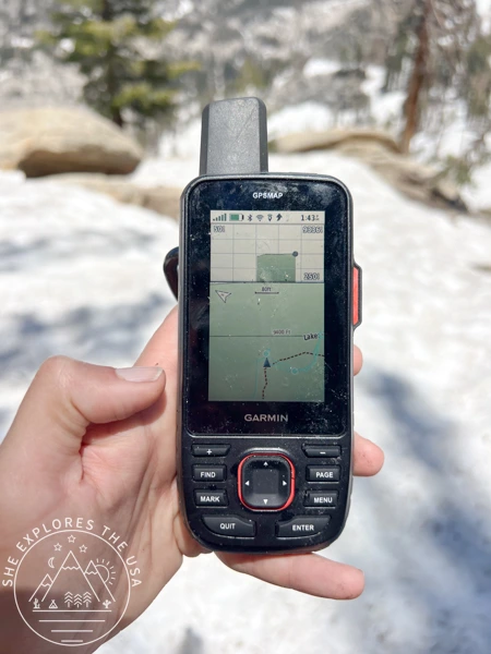
Shortly after, I encountered a snow bridge that looked like it might collapse. Fortunately, I carefully crossed it and continued uphill. Because the snow covered the trail so heavily, I had to rely on my Garmin 67i for navigation. You can find the 67i at Amazon | Backcountry | Campsaver | REI.

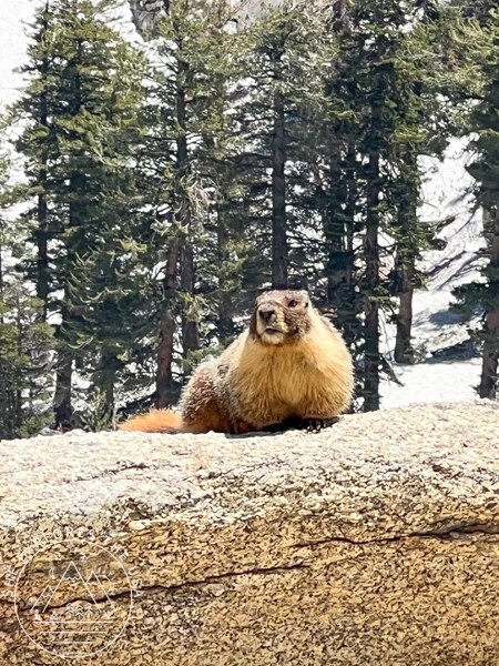
I finally reached the highest point of the hike, where a cute marmot greeted me. From there, the view of the Topokah Falls valley took my breath away. It also gave me a good idea of what the scenic Watchtower Trail would be like.

Reaching Heather Lake in Sequoia National Park
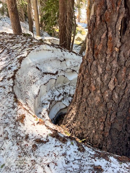
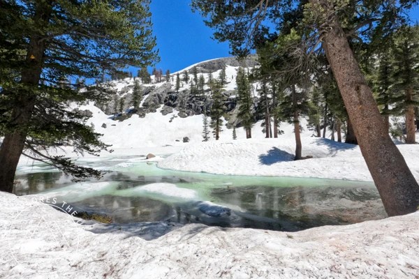
The trail to Heather Lake in Sequoia National Park was completely covered by several feet of snow. I couldn’t even see the way down to the lake. Although I hiked alone, a couple arrived at the highest point around the same time. I’m glad they were there, it made me feel safer for the final stretch on the Lakes Trail. (Shout out to Doris and Arturo if you’re reading this!)
By taking it slowly, we found a path down the sketchy, slushy landscape. The descent was very steep, so we used hiking poles to test the snow’s stability before stepping forward. It was a slow process, but safety always comes first!
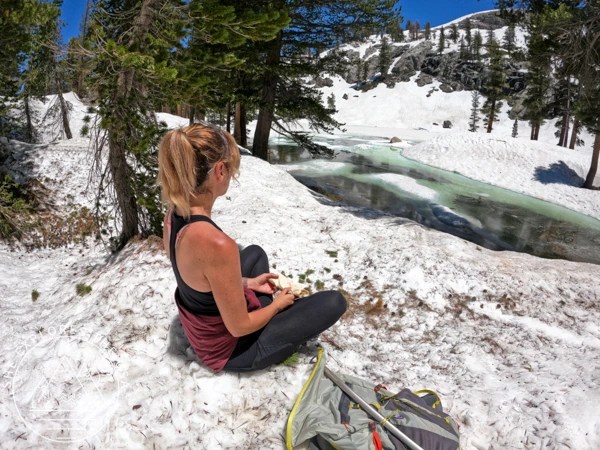
After 3 hours and 27 minutes from the Wolverton Trailhead, I reached Heather Lake. The lake was still partly frozen, which made it an idyllic spot for lunch.


Other Lakes near Heather Lake
From Heather Lake, the trail continues to Emerald Lake and Pear Lake. You can also catch a distant view of Aster Lake while hiking toward Emerald Lake. On a typical snow year, the trail stays snow-free to Pear Lake, where many hikers backpack overnight.
However, as of July, over seven feet of snow covered the trail beyond Heather Lake, making it impossible to see the path without GPS. The next day, I visited the Lodgepole Visitor Center and spoke with a wilderness ranger. He shared that Heather Lake had accumulated up to 20 feet of snow over the winter!
Making my way back
After a short lunch break by the lake, I made my way back up to the highest point. By then, the snow had become increasingly slushy. I was surprised at how quickly our footsteps had disappeared, which made retracing our steps without GPS difficult. Once again, my Garmin GPSMAP 67i (Amazon | Backcountry | Campsaver | REI) was extremely useful. It showed me the route I took down, allowing me to easily retrace my path uphill.
Once I reached the highest point, it was mostly downhill back to my campground. However, the snow became slushier, the river crossings deeper than in the morning, and the snow bridge on the brink of collapse looked even more fragile. The Hump Trail is pretty steep, and with the slushy snow, I ended up sledding down several slopes on my butt. This added even more fun to the adventure.
After a total of 13 miles and 5 hours of moving time, I returned safely to my campsite. This was one of the toughest hikes I’ve done due to the heavy, slushy snow conditions. Although I’m a little disappointed I couldn’t reach Pear Lake, this adventure was unforgettable. I wouldn’t hesitate to do it again, even in the same wintry conditions. Reaching Heather Lake despite the snow felt very satisfying, and I felt more accomplished than I expected.


FAQ About Hiking to Heather Lake
Is Heather Lake trail open year-round?
Yes, the trail to Heather Lake is open all year. However, heavy snowfall can make it impassable, especially in late spring or early summer.
How long is the hike to Heather Lake?
The standard out-and-back route from Wolverton Trailhead is 7.8 miles with 2,427 feet of elevation gain. In general, it takes just under five hours to complete.
Can dogs go on the Lakes Trail to Heather Lake?
Unfortunately, dogs are not allowed on the Lakes Trail in Sequoia National Park. So, it’s best to leave your furry friends at home.
Where does the trail to Heather Lake start?
The hike starts at the Wolverton Trailhead. However, I began from Lodgepole Campground, which made it a nearly 13-mile round trip with over 3,500 feet of elevation gain.
Final Thoughts on Hiking to Heather Lake in Sequoia National Park
Preparation is key for any hike. On my way down, I saw fewer than five people. Most hadn’t expected snow and lacked proper gear. Because they started late, the snow was very slushy. As a result, many probably had to turn back before reaching the lake.
Be sure to carry the ten essentials. Before your hike, visit the Lodgepole Visitor Center to check current trail conditions. In snowy weather, microspikes (available on Amazon | Backcountry | Campsaver | REI) and hiking poles can help a lot. Also, a GPS navigation device with SOS features, like the Garmin GPSMAP 67i (Amazon | Backcountry | Campsaver | REI), could save your life.
If you want more hiking ideas, check out these related blog posts!
Happy trails, and stay safe out there!
Post originally published on July 9, 2023, and last updated on April 4, 2026.