Hot Springs Mountain Trail: San Diego’s Highest Peak
DISCLOSURE: This post may contain affiliate links. If you purchase after clicking one of my links, I may earn a small commission at no extra cost to you. As an Amazon Associate, I earn from qualifying purchases. For more information, see my disclaimer.
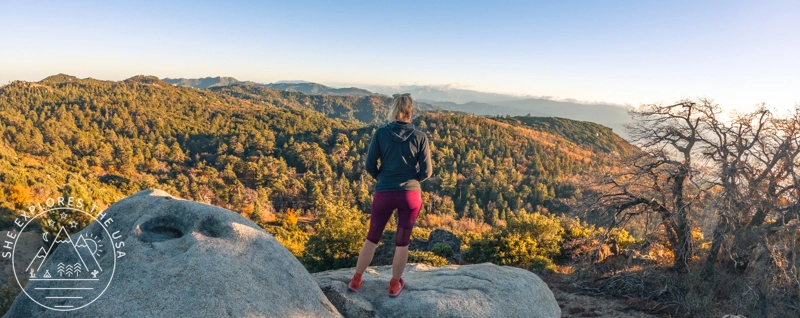
The Hot Springs Mountain Trail is the highest hike in San Diego County, climbing to the summit of Hot Springs Mountain at 6,535 feet. Located on the Los Coyotes Indian Reservation near Warner Springs, California, this 10-mile round-trip hike rewards you with panoramic views, lush forests, and a peek into local history. In this post, I’ll walk you through everything you need to know, from trailhead confusion to gear recommendations, plus what it felt like to summit the highest peak in San Diego.
50% Off AllTrails Plus
Planning hikes, downloading maps, getting a little more off-grid without losing your way… this is the upgrade that actually gets used.
Hot Springs Mountain Trail Overview
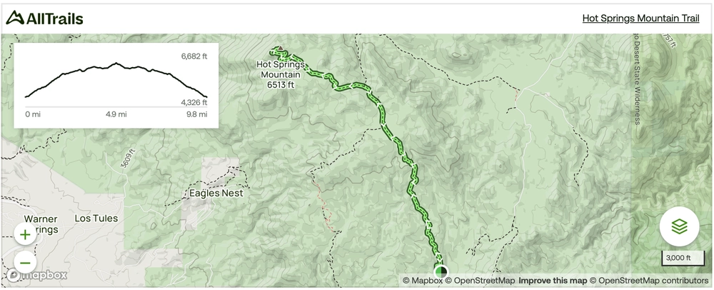
The Hot Springs Mountain Trail is a popular 10-mile route open year-round, attracting outdoor enthusiasts from all around. The trail’s challenging nature means it takes an average of 5 hours and 19 minutes to complete, according to AllTrails.
The journey promises stunning views and encounters with diverse flora and fauna, making it a must-visit destination for hikers seeking a memorable adventure. Dogs are welcome, provided they are leashed, adding to the appeal for pet owners looking for a scenic trek with their four-legged companions.
This trail is part of the San Diego Six Packs Of Peaks Challenge, and it is the fifth hike I am taking as part of this challenge.
Hot Springs Mountain Trail Map
🥾 Plan Smarter Hikes with AllTrails
AllTrails is my go-to for trip planning, from checking trail reviews to downloading maps, navigating from my phone, and sending routes straight to my Garmin 67i. Offline maps, alerts, and AI route planning make upgrading to Plus & Peak worth it!
Permits and Courtesy
Before embarking on the Hot Springs Mountain Trail, it’s essential to note that a hiking permit is required from the Los Coyotes Reservation. This permit can be purchased in advance online here and currently costs $10.00 (plus a $1.00 booking fee!) As the trail is located on the Los Coyotes Indian Reservation, hikers are reminded to be respectful of the land and its inhabitants. Also, bring your ID with you for the gate attendant to match your reservation!
Trail Specifics
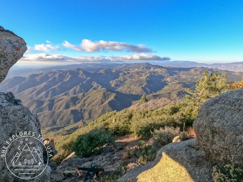
The trail climbs to San Diego County’s highest summit, topping out at 6,535 feet. Be ready for sunny, exposed sections, so bring enough water and sun protection. The challenging terrain is offset by breathtaking scenery, turning each step into a journey through nature’s wonders.
Weather
Check the weather forecast before you go; it gets considerably cooler at the summit. During my visit, the forecast predicted low 60s at the trailhead, accurate initially. However, it got colder as I climbed and gained elevation. Despite wearing knee-length leggings, a tank, and a warm hoodie, I wished for long leggings and a puffy jacket. It was so cold at the top that I could see my breath! I shivered through lunch and eagerly got moving again.
Bugs
I read on AllTrails that the bugs were bad at that trail, and bringing a bug net was a must! So I made sure I bought one before I took on this hike, and of course, I encountered zero bugs!

The San Diego Six Pack of Peaks Hiking Challenge

In 2023, I took on the San Diego Six Pack of Peaks Challenge. I signed up in late July, giving…
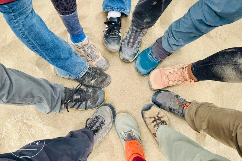
Gear Recommendation to Hike the Hot Springs Mountain Trail
In addition to the ten essentials, check out these gear recommendations below. You can also find all my go-to hiking gear in my curated outdoor gear shop.


How to Choose the Best Hiking Shoes (& Top Picks)
Choosing the right hiking shoes is key to comfort, performance, and safety. The right footwear prevents discomfort on rugged […]…

Garmin GPSMAP 67i Review & Which InReach Suits You?
Review of the Garmin GPSMAP 67i and comparison to the GPSMAP 66i, Mini 2 and InReach Messenger plus[…]…
My Hot Springs Mountain Hike Report
Starting Late, Racing Sunset
One Sunday afternoon, I rolled up to the Los Coyotes Reservation to hike Hot Springs Mountain, the highest peak in San Diego County. The plan was simple: start at 12:30, reach the summit, and get back before my day-use permit expired at 6 pm.
But the gate attendant casually mentioned I actually needed to be out by 5:30, not 6. So now I had under 5 hours to hike nearly 10 miles with 2,400 feet of gain. No pressure.
Off to a Rocky Start
I was ready, or so I thought. As I reached for the trail map, I realized AllTrails had mysteriously offloaded during the drive. I also hadn’t synced my Garmin with the route, and of course, there was zero cell service at the trailhead. I stood there staring at my phone, which was now useless, with no memory of the exact trailhead or the landmarks from the AllTrails reviews I had read weeks earlier.
Where Is the Hot Springs Mountain Trailhead?
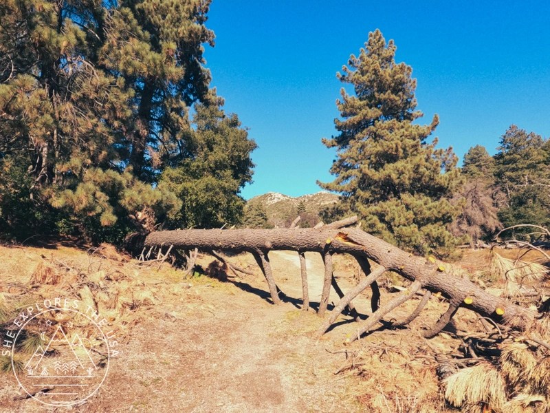
I parked and spotted a portaloo to the right, so I went that way. Next to it, I saw a sign marking two trails: Tukwet and Pal. I vaguely remembered reading something about a steep start to the trail, so I picked Tukwet and hoped for the best. The trail dove straight into a quiet forest, alternating between steep ups and downs. It felt like a backcountry rollercoaster.
About 1.75 miles in, the trail connected to a wide service road. Finally, I saw a sign that actually said “Hot Springs Mountain Trail.” It pointed down toward the campground, so I went the opposite direction, uphill, and hoped that was the right call. Spoiler: it was.


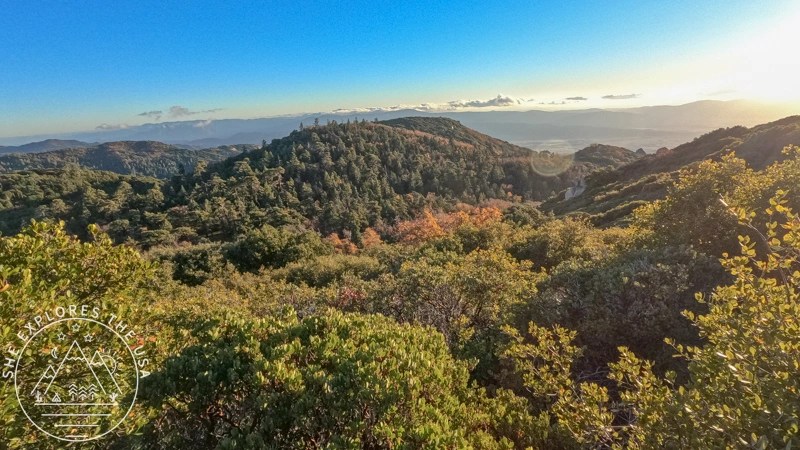
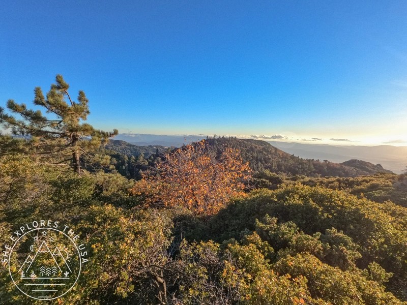
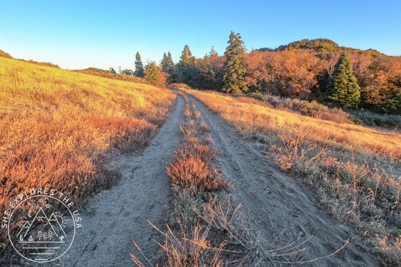
Forests, Fall Colors, and a Historic Tower
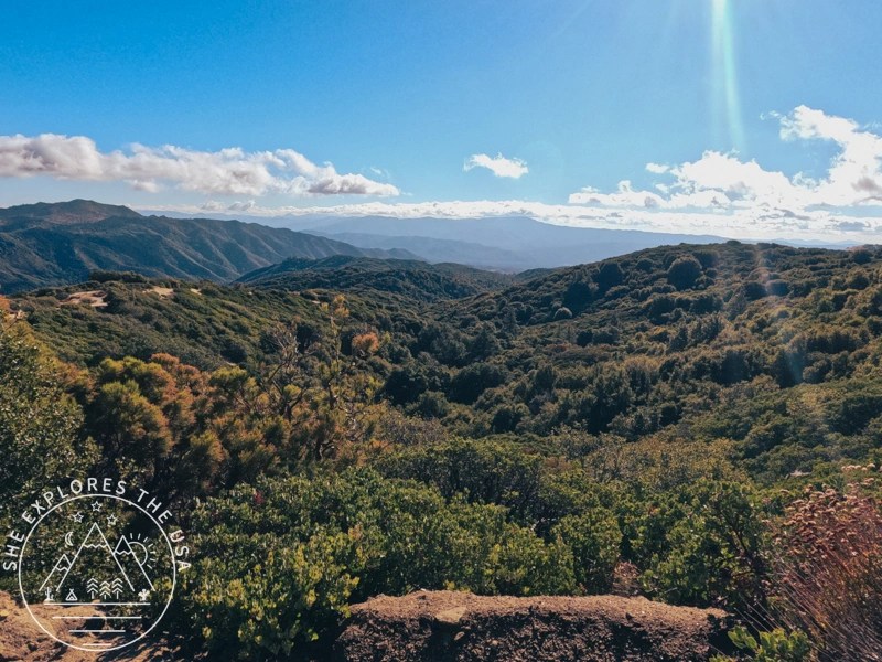
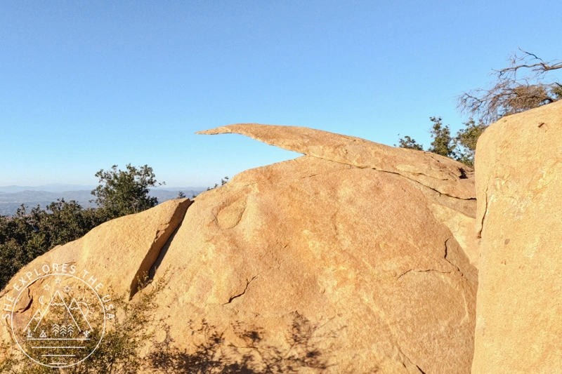
After the steep climb, the trail flattened out and wandered through a beautiful, tree-lined stretch. Most trees were still green, but a few had hints of fall colors. A little farther up, I finally reached the summit of Hot Springs Mountain. I climbed up the old lookout tower and took in the sweeping views.


At the top, there’s a poster explaining the history of the fire lookout. It’s actually the oldest one in the entire Cleveland National Forest. The first tower was built in 1912, and the poster includes photos showing how it evolved over the past century.


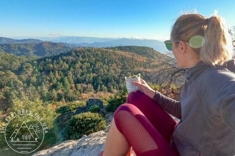
Lunch with a View… Just Not That View
I unpacked my lunch and sat down to eat with a view of the forest valley far below. The only problem? I couldn’t find the Hot Springs Mountain summit sign that everyone seems to get a photo with. I think I was on the wrong side of the summit and should’ve gone behind a large rock to the left instead of heading to the right, so I never saw the ladder to reach the true summit. Oh well. The view was still incredible and the wrap hit the spot.


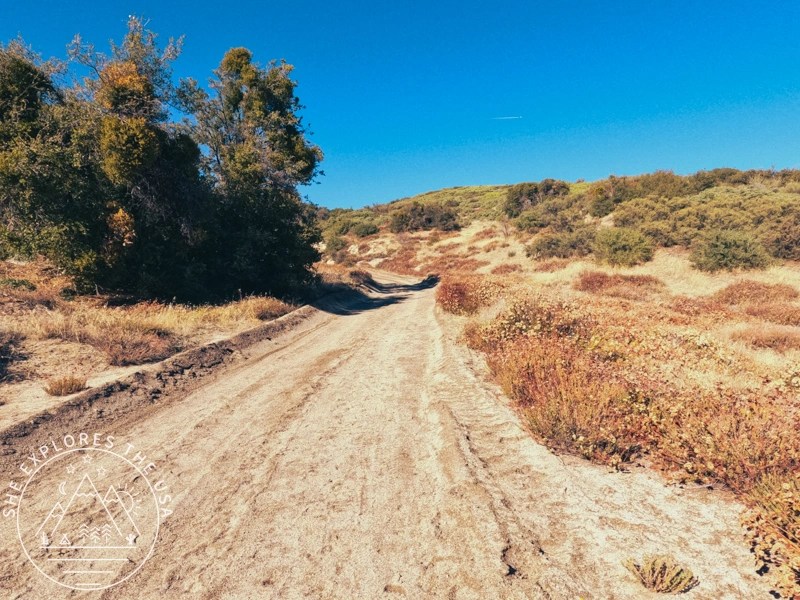
The Descent: Back via the Service Road
For the return, I skipped the Tukwet trail and stayed on the wide service road to save some time. It wasn’t as scenic, but it shaved off about a mile. The late afternoon light was golden, and the clouds in the valley were starting to glow. I could feel the temperature dropping, but the sunset was so worth it.


Mission Accomplished
I got back to the parking lot at 5:31 pm, mission complete, barely. My Garmin recorded 11.18 miles and 2,790 feet of total gain in just under five hours.
Later, I realized the official Hot Springs Mountain trailhead is on the gated road to the left of the parking area. I had gone right, toward the portaloo and Tukwet trail, which made the hike longer but more interesting. So if you’re aiming for the standard route, take the road on the left behind the gate. If you’re up for a little extra mileage and forest vibes, the way I went works too.


Relive My Hot Springs Mountain Hike
If you’ve seen my posts before, you’ll know I typically use Relive to make a movie of my hikes. I love how it gives a better perspective of the terrain.
I use the free version, so the video quality is not the best, but it’s pretty good for being free. Best of all, I don’t need to track with Relive, it connects to the Garmin app.
Hot Springs Mountain Trail FAQs
How long is the Hot Springs Mountain Trail?
The trail is around 9.8 miles round trip if you take the standard route from the gated road. Give yourself at least 4-6 hours to complete it, especially if you plan to enjoy the views at the top.
What’s the elevation of Hot Springs Mountain?
The summit sits at 6,535 feet, making it the highest point in San Diego County. It’s cooler and windier up top, bring layers!
Where is the Hot Springs Mountain trailhead?
The official trailhead starts behind a gated road to the left of the parking area at the Los Coyotes Reservation. I missed it at first and accidentally took the Tukwet Trail, which connects to the correct route eventually, but adds distance. If you want to stay on the main trail, stick to the gated road on the left.
Do you need a permit to hike Hot Springs Mountain?
Yes. You’ll need a permit from the Los Coyotes Indian Reservation, which you can buy online for $10 (plus $1 fee). Make sure to bring your ID, there’s a gate attendant who’ll check your name against the list.
Is Hot Springs Mountain dog-friendly?
Yes, dogs are allowed as long as they’re leashed. Just be mindful of the weather; there are exposed sections and limited water sources, so pack accordingly for your pup.
Is there cell service on the trail?
Not really. I’m on T-Mobile and lost service before even reaching the trailhead. If you’re using a hiking app, download the offline map in advance or sync it to a GPS device.
What’s the best time to hike Hot Springs Mountain?
Spring and fall are ideal. The trail can get hot and dry in summer, and the trail can be covered in snow in winter. Start early to avoid rushing, especially since you’ll need to be out by sunset if you’re hiking with a day-use permit.
Is Hot Springs Mountain part of the Six-Pack of Peaks Challenge?
Yes! It’s one of the peaks in the San Diego Six-Pack of Peaks Challenge! Want to join the fun? Sign up for the San Diego Six Pack of Peaks challenge here!
Final Thoughts on Hot Springs Mountain Trail
Hot Springs Mountain is one of those hikes that really sticks with you. It’s got a little bit of everything: steep climbs, quiet forests, wide-open views, and that satisfying feeling of standing on the highest point in San Diego County. It’s not the easiest trail, but that’s part of what makes it so rewarding. If you’re looking for a hike that challenges you a bit and gives you space to breathe, this one’s worth it.
And with that… just one more hike to go in the San Diego Six-Pack of Peaks Challenge!
The San Diego Six Pack of Peaks Hiking Challenge
In 2023, I took on the San Diego Six Pack of Peaks Challenge. I signed up in late July, giving…
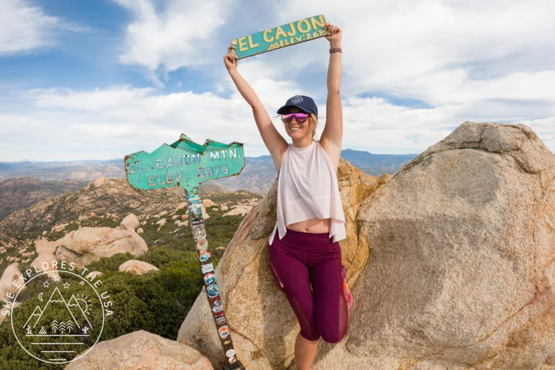
El Cajon Mountain Trail: Hardest Hike in San Diego
El Cajon Mountain was my mission last Sunday, taking on this last hike as part of the San Diego Six…
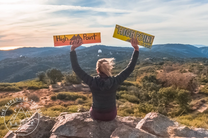
Oak Grove Trail to High Point: Hike & Lookout Guide
Embarking on the Oak Grove Trail to High Point hike is a journey through breathtaking landscapes, challenging […]…
Hot Springs Mountain Trail: San Diego’s Highest Peak
Tucked in the scenic landscapes of Warner Springs, California, the Hot Springs Mountain Trail provides a challenging […]…
Hiking Potato Chip Rock via Mount Woodson in San Diego
Situated in Poway, just northeast of San Diego, California, Potato Chip Rock is a favorite among local hikers and visiting…
Cuyamaca Peak Hike: My New Favorite in San Diego
For my third hike in the San Diego Six Pack of Peaks challenge, I chose to climb Cuyamaca Peak on…
Post originally published on November 21, 2023, and last updated on April 4, 2026.