Hiking Potato Chip Rock via Mount Woodson in San Diego
DISCLOSURE: This post may contain affiliate links. If you purchase after clicking one of my links, I may earn a small commission at no extra cost to you. As an Amazon Associate, I earn from qualifying purchases. For more information, see my disclaimer.
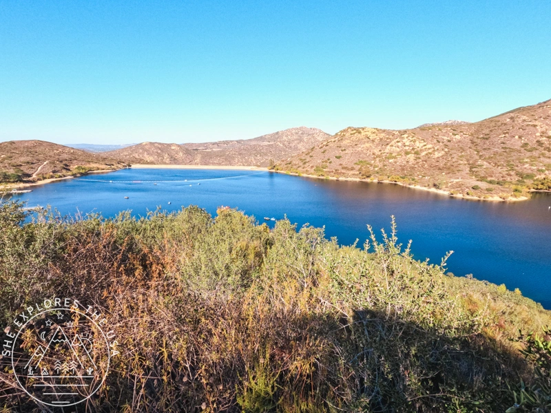
Situated in Poway, just northeast of San Diego, California, Potato Chip Rock is a favorite among local hikers and visiting trail lovers alike. The Mount Woodson Trail, which leads to the famous “chip,” is also part of the San Diego Six-Pack of Peaks Challenge as an alternate summit. I decided to revisit this hike recently, not for the viral photo, but to see how it feels years after my first attempt, when the crowds were so overwhelming I swore I’d never go back. Spoiler: I’m glad I gave it another shot. Here are some key details about the Potato Chip Rock hike.
50% Off AllTrails Plus
Planning hikes, downloading maps, getting a little more off-grid without losing your way… this is the upgrade that actually gets used.
Potato Chip Rock: Location, Parking, and Amenities
The Potato Chip Rock hike is situated on the Mount Woodson Trail in Poway, northeast of San Diego. As far as I know, the trailhead that counts for the San Diego Six Packs of Peaks Challenge is accessible from Lake Poway Recreation Area.
There is a parking lot at Lake Poway Recreation Area, and a $10.00 fee may be required on Saturdays and Sundays if you don’t live in Poway. The fee is payable by credit card. Heads-up: the Lake Poway parking lot gates close at 4:45 pm sharp. So, make sure you get your car out before that time if you choose to park in the Lake Poway Recreation Area.
The trailhead area also has amenities like restrooms, water fountains, and even picnic tables near the trailhead. Once you start hiking, there are a couple of areas with portaloos around the lake, before the climb starts.
Potato Chip Rock Hike At-A-Glance
- 📍 Location: Mount Woodson Trail via Lake Poway, Poway, California
- 🥾 Distance: 7.5 miles round trip
- ⏱️ Time Required: ~3–4 hours
- 📈 Elevation Gain: 2,200 feet
- 🧭 Trail Type: Out and back
- ⚠️ Difficulty: Moderate
- 🚽 Facilities: Restrooms and water near the trailhead
- 🕒 Best Time to Go: Early morning if you want cooler temps and fewer crowds, or late afternoon for a softer light and a chance at fewer people in your shot (just mind the gate closing time if you park at Lake Poway).
- 📷 Famous For: Insta-worthy rock formation resembling a potato chip
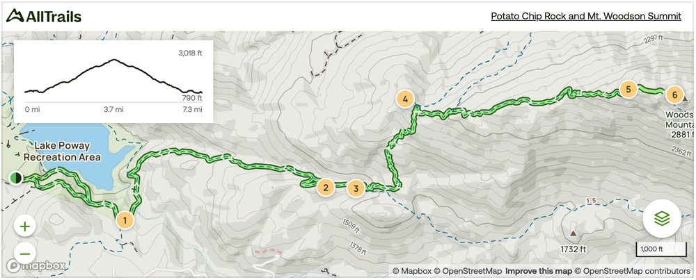
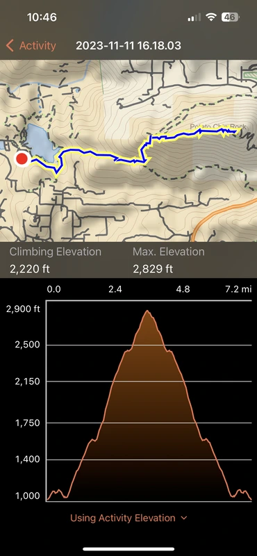
Potato Chip Rock Trail Map
🥾 Plan Smarter Hikes with AllTrails
AllTrails is my go-to for trip planning, from checking trail reviews to downloading maps, navigating from my phone, and sending routes straight to my Garmin 67i. Offline maps, alerts, and AI route planning make upgrading to Plus & Peak worth it!
Gear Recommendation
In addition to the ten essentials, check out these gear recommendations below. You can also find all my go-to hiking gear in my curated outdoor gear shop!


The Potato Chip Rock (Mount Woodson) Hiking Trail
Hiking Stats
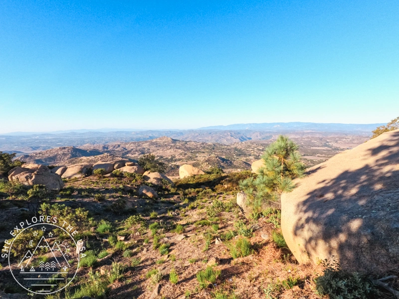
The hike to Potato Chip Rock is moderately challenging, with a slightly steep incline and rocky terrain after the junction with Warren Trail. I hiked to the top of Mount Woodson, which is only a few minutes higher up than the Insta-famous rock.
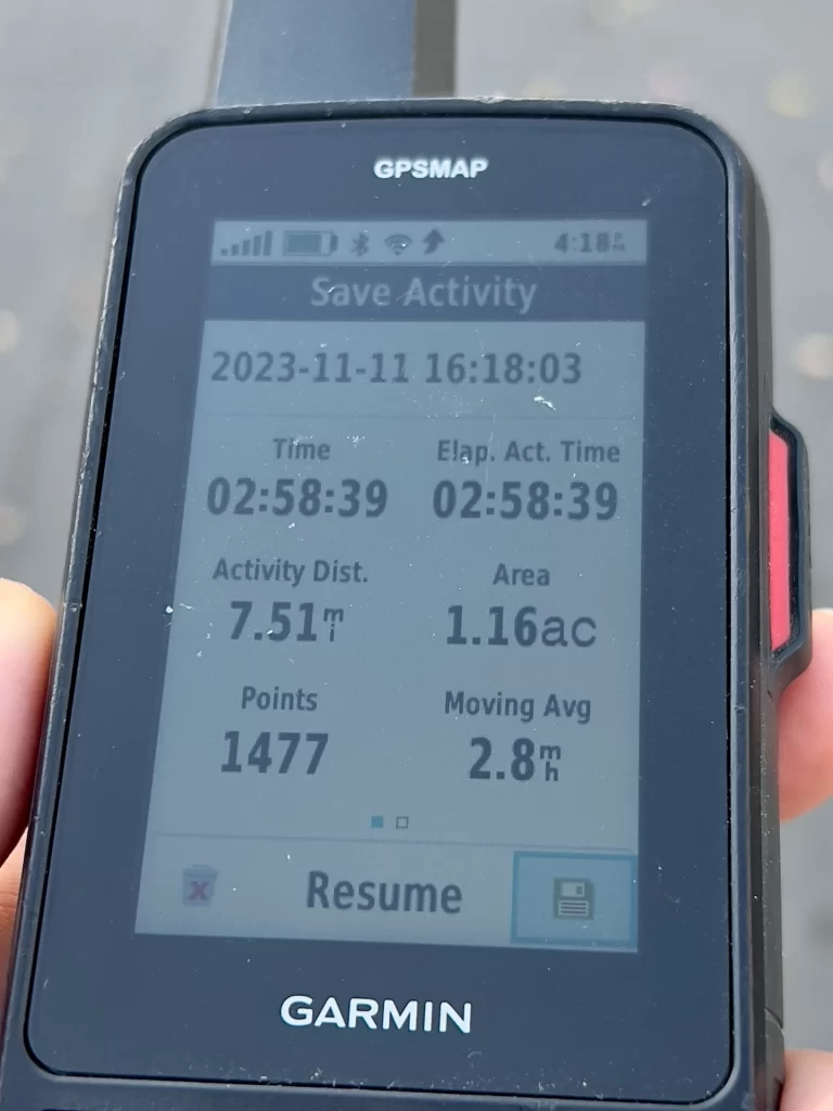
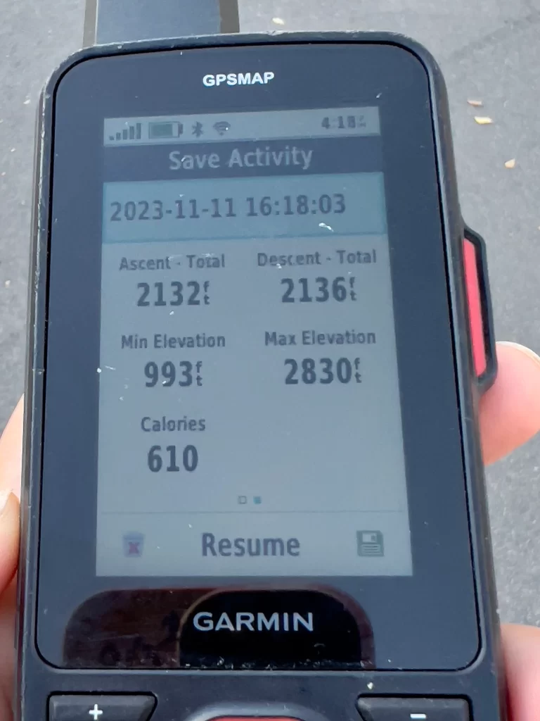
The round trip is approximately 7.5 miles (12 kilometers), with a 2,220 ft climbing elevation. It took me 2 hours and 58 minutes to complete it, without pausing the clock at the top or for photo breaks. I started on a Saturday at 1.19 pm and finished at 4.18 pm.
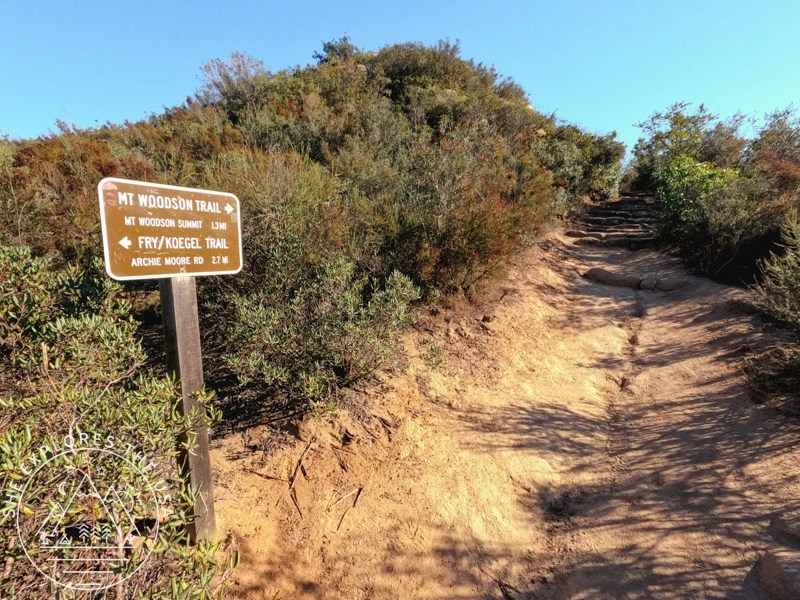
The trailhead is easily accessible, and there are clear markers to guide hikers along the path. You don’t need to pay attention to a map if you pay attention to the signs.
The Hike
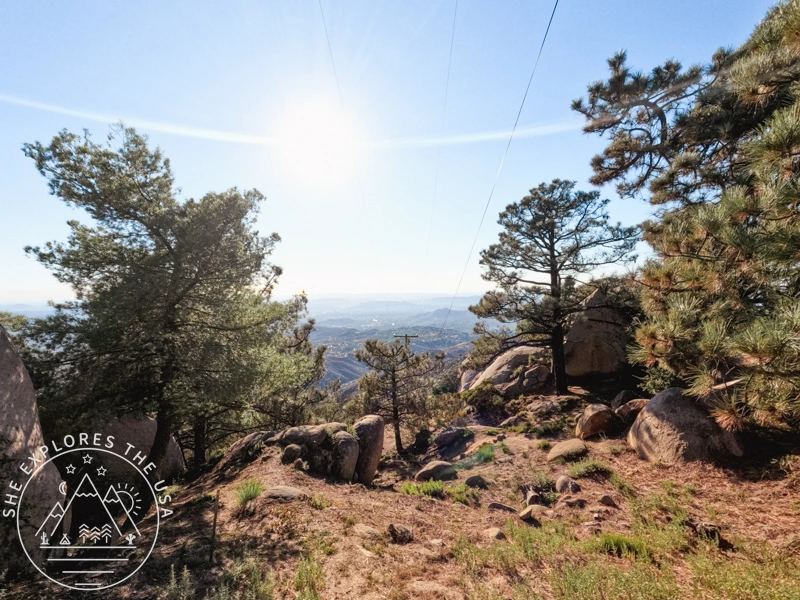
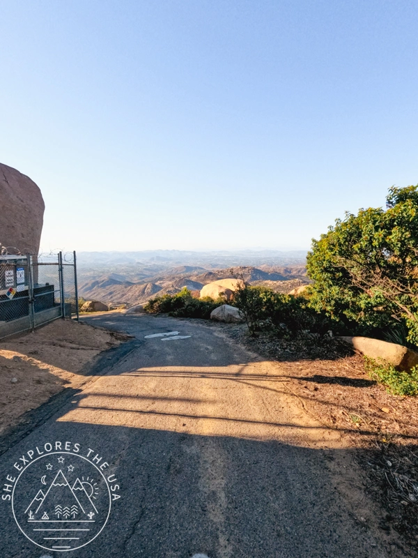
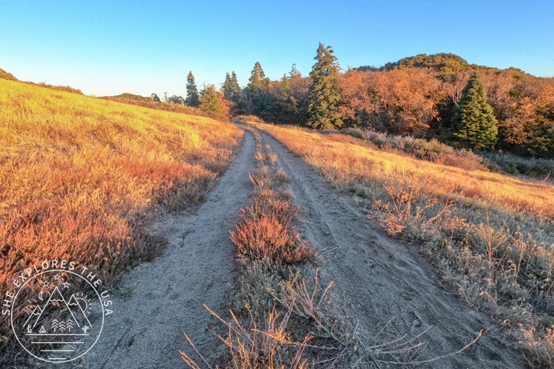
It’s 3.7 miles one way to the top. The trail starts easy with a downhill around Lake Poway to reach the hills.
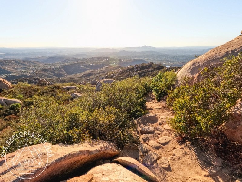
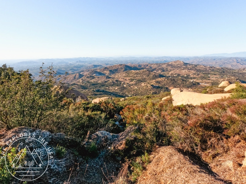
At 0.7 miles, it then becomes a moderate incline until about halfway to the top. After the junction with Warren Trail, the trail becomes more rocky. Don’t forget to turn around, the views just keep getting better as you climb!

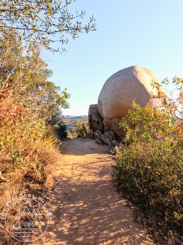


Once you’re past that rocky stretch, the rest of the way to Potato Chip Rock is pretty mellow.


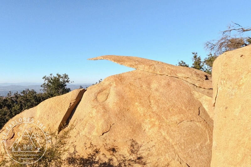
Potato Chip Rock is a thin, slanted rock formation that extends over the edge of the mountain. It has become a popular spot for photos, with hikers posing on the thin “chip-like” structure. Hikers can stand, sit, or even jump atop this unique formation perched on the mountain’s edge if you have enough patience to wait for your turn!
There were perhaps only 5 people in line to take a photo, which is quiet compared to peak times. However, I was worried about the 4.45 pm parking lot gate closure to get my car out so I skipped the photo opp.
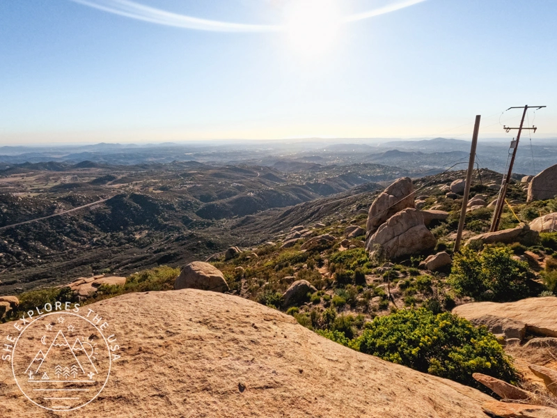
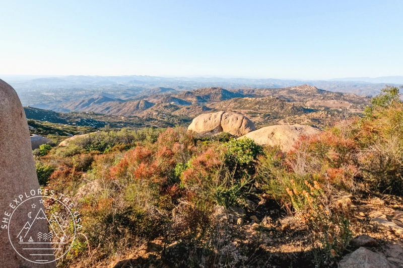
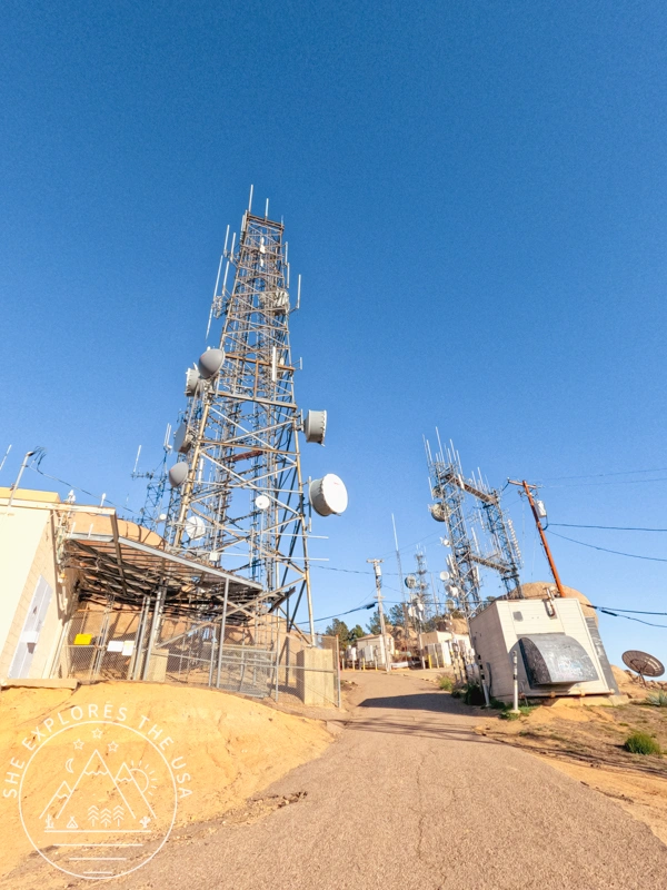
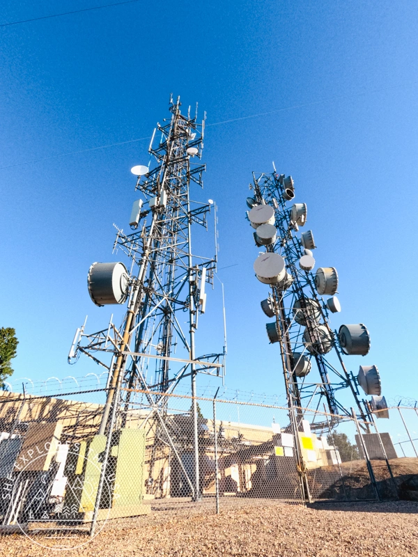
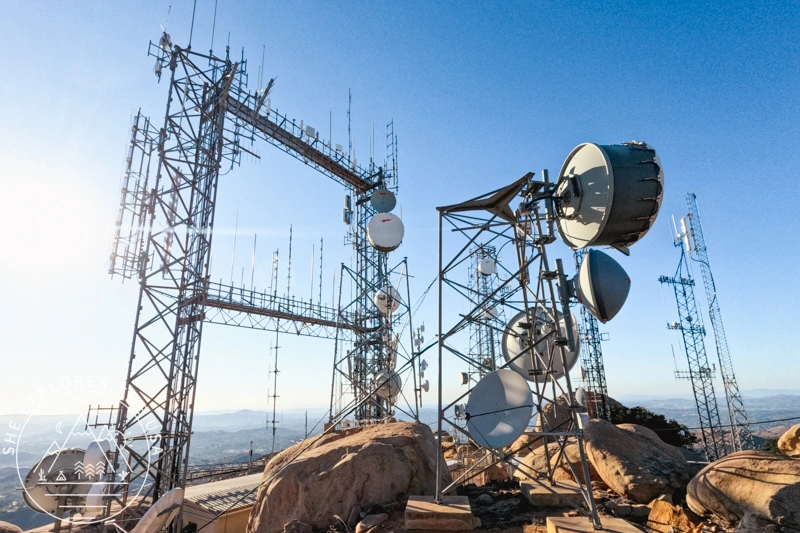
The last portion from Potato Chip Rock to Mount Woodson summit is a steep paved road. Don’t miss going to the top! You’ll be rewarded with great views in all directions!
Crowds
I first completed this hike in April 2018. It was a Sunday morning, and it was so unbelievably crowded that I hated it and never went back until November 2023. This time around, though, on a Saturday afternoon, it was much quieter and a lot more enjoyable. The only annoyance was a couple of people playing their music on a loudspeaker… why!!!!
Weather Considerations
Given the exposed nature of the trail, it’s essential to bring sun protection, especially on warmer days. Adequate water and sturdy hiking shoes are also recommended. There are some shaded areas to catch a breath, but it’s mostly very exposed to the elements.
Relive Video
I love using Relive to visually see my hikes amongst mountains and other terrains. I am sure you will, too. And best of all, you don’t need to use your phone’s app to get this tracking. I connected Relive to my Garmin Connect app, and it automatically retrieves my hikes. Then I used the Relive app on my phone to put together this video.
You can create the video in multiple formats. It’s a great little app. The free version’s video quality is not the best, so if you plan on using it a lot, it may be worth purchasing the paid version. Then you can add video clips and use more than 10 photos to your Relive adventure.
FAQ: Potato Chip Rock Trail
How long is the Potato Chip Rock hike?
The hike is about 7.5 miles round trip and usually takes around 3 to 4 hours, depending on your pace and breaks.
Where is the Potato Chip Rock trailhead?
The main trailhead starts at Lake Poway Recreation Area. There’s a $10 fee for non-Poway residents on weekends.
What’s the elevation gain of the hike?
You’ll climb about 2,200 feet to reach the summit.
Is the hike to Potato Chip Rock hard?
It’s a moderately difficult hike with steep sections and rocky terrain after the Warren Trail junction.
Is Potato Chip Rock safe?
While the rock looks precarious, it’s solid. That said, always be cautious when climbing for photos and avoid when it’s slippery or windy.
Is there a shorter trail to Potato Chip Rock?
There’s a shorter route to Woodson Mountain and Potato Chip Rock via from Highway 67 (about 4 miles round trip), but it’s much steeper and less scenic.
Final Thoughts
And just like that, I crossed off another peak in the San Diego Six-Pack of Peaks Challenge. Still have a few more to go, stay tuned for updates! If you’re thinking about doing this challenge yourself, check out the details here. It’s a fun way to explore some of SoCal’s best trails. Sign up for the San Diego Six Pack of Peaks challenge here!
Happy trails!

The San Diego Six Pack of Peaks Hiking Challenge
In 2023, I took on the San Diego Six Pack of Peaks Challenge. I signed up in late July, giving…
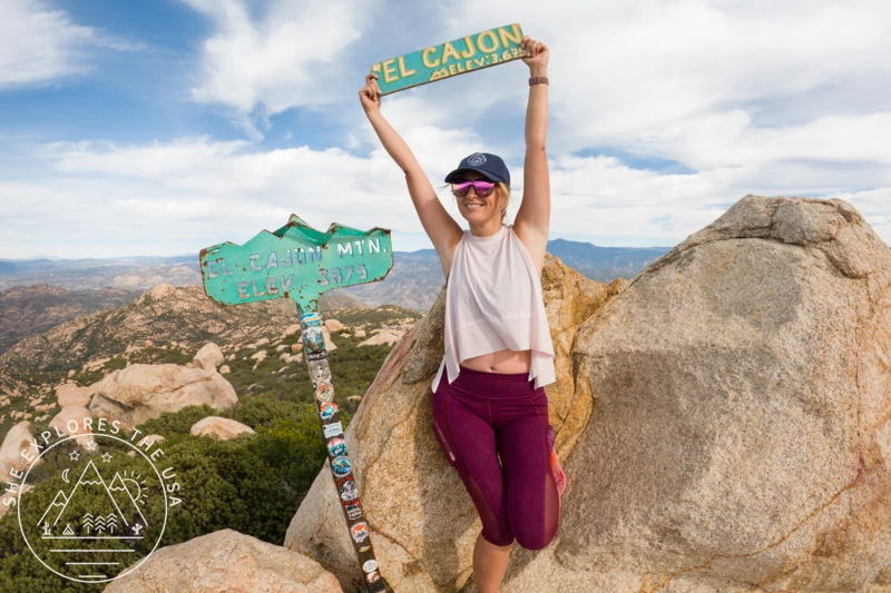
El Cajon Mountain Trail: Hardest Hike in San Diego
El Cajon Mountain was my mission last Sunday, taking on this last hike as part of the San Diego Six…

Oak Grove Trail to High Point: Hike & Lookout Guide
Embarking on the Oak Grove Trail to High Point hike is a journey through breathtaking landscapes, challenging […]…
Hot Springs Mountain Trail: San Diego’s Highest Peak
Tucked in the scenic landscapes of Warner Springs, California, the Hot Springs Mountain Trail provides a challenging […]…
Hiking Potato Chip Rock via Mount Woodson in San Diego
Situated in Poway, just northeast of San Diego, California, Potato Chip Rock is a favorite among local hikers and visiting…
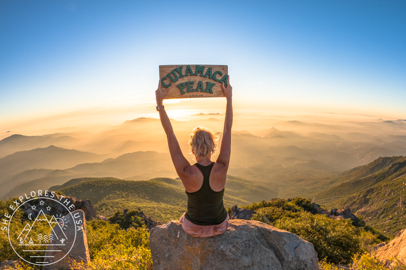
Cuyamaca Peak Hike: My New Favorite in San Diego
For my third hike in the San Diego Six Pack of Peaks challenge, I chose to climb Cuyamaca Peak on…
Post originally published on November 17, 2023, and last updated on April 4, 2026.