Hike Strawberry Peak in LA: Trail Tips & Epic Sunset
DISCLOSURE: This post may contain affiliate links. If you purchase after clicking one of my links, I may earn a small commission at no extra cost to you. As an Amazon Associate, I earn from qualifying purchases. For more information, see my disclaimer.
In my journey to conquer the peaks of the SoCal six-pack of peaks challenge, I aimed for the Strawberry Peak hike near Los Angeles for my latest adventure. This day turned out to be one of the highlights of the year so far. From the drive up to LA to reaching the summit and enjoying chocolate-covered strawberries against a breathtaking sunset, every moment exuded excitement and wonder. It was indeed a memorable day, blending the thrill of exploration with the simple joys of nature.
50% Off AllTrails Plus
Planning hikes, downloading maps, getting a little more off-grid without losing your way… this is the upgrade that actually gets used.
Strawberry Peak Trail Overview
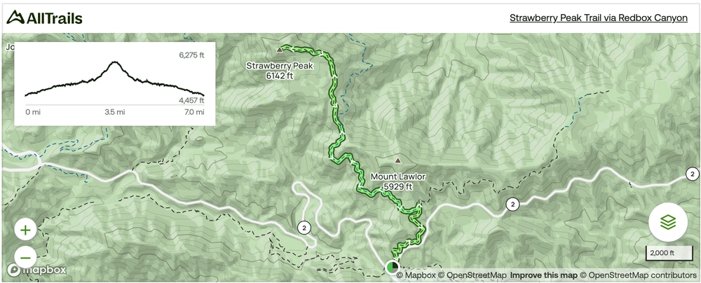
Located near Mount Wilson, California, the Strawberry Peak hike is a challenging 7.0-mile out-and-back trail with an elevation gain of 1,771 ft, offering hikers a fun adventure. With an average completion time of approximately 3 hours and 52 minutes (according to AllTrails), this route promises both excitement and endurance. At 6,164 feet, Strawberry Peak’s elevation offers sweeping views of its surrounding area.
Logistics & Parking for Strawberry Peak Trailhead
The trail’s peak times for exploration span from January to October, providing ample opportunities to immerse oneself in its natural splendor. While furry companions are welcome, it’s important to note that dogs must be leashed throughout the hike.
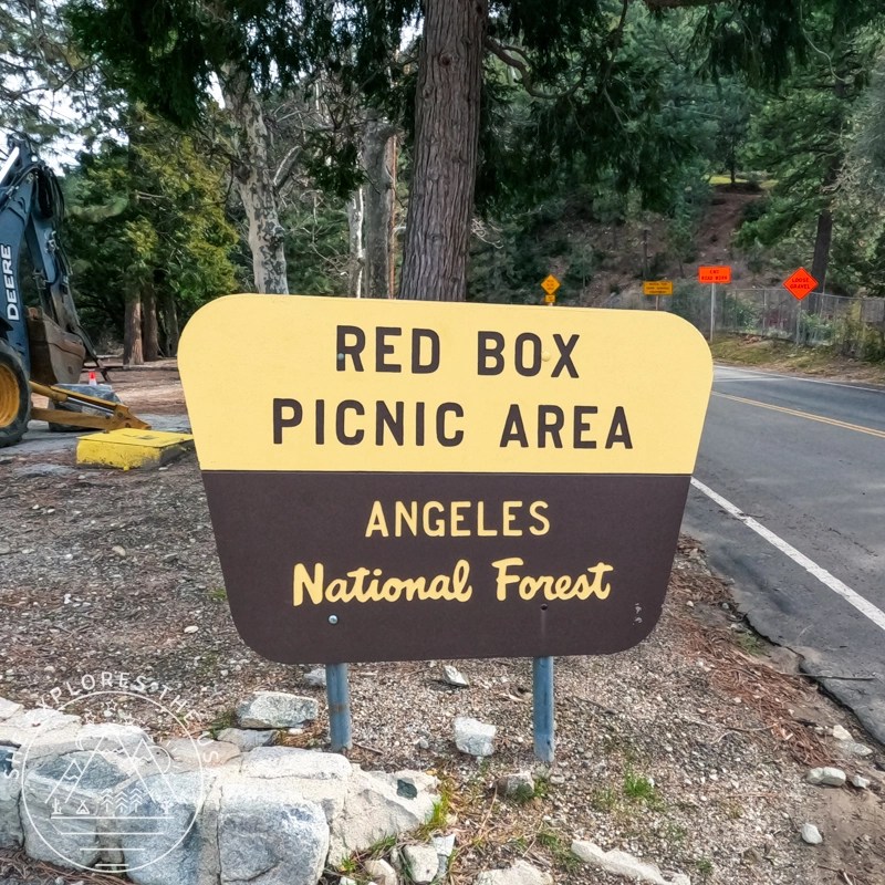
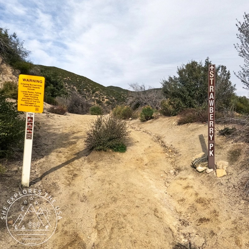
Before you venture into the forest, make sure to slap that adventure pass on your dashboard once you’ve parked at the Strawberry Peak trailhead parking lot (Red Box picnic area). It’s essential! Remember that rangers are vigilant about passes and parking, so be sure to follow the rules. On the bright side, you’ll find toilets conveniently located in the parking lot, making your pit stops hassle-free.

What to Expect on the Hike
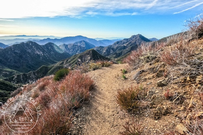
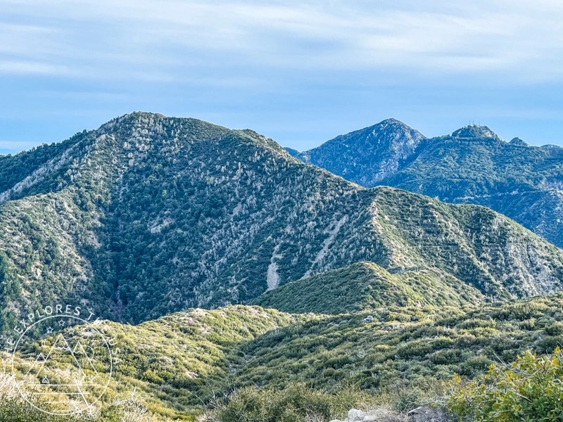
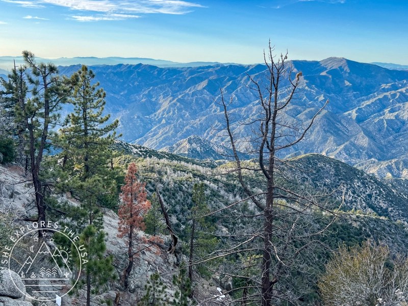
The trail starts with a clear path along the Strawberry Peak Trail, offering stunning landscapes. However, note that the final stretch diverges from the main trail, following a social path to the summit. Expect several false summits, but the breathtaking 360-degree views at the peak make the effort worthwhile. To navigate this tough terrain, it’s wise to download and study the trail map beforehand.
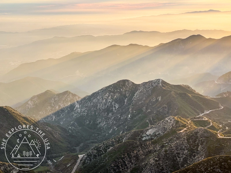
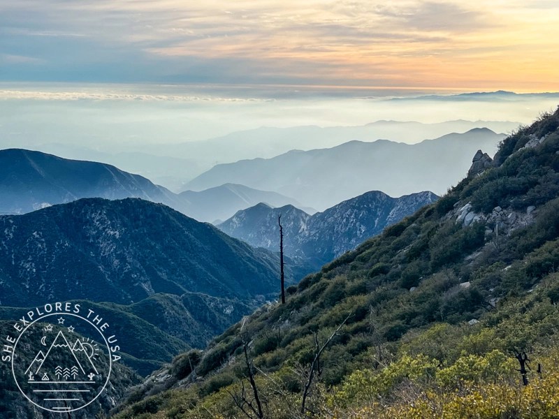
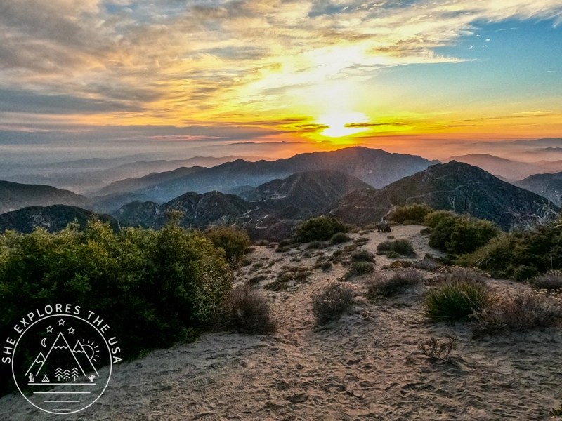
The breathtaking 360-degree views at the peak, especially at sunset, make Strawberry Peak one of the top sunset hiking spots in LA.
Strawberry Peak Fast Facts
🥾 Trail Length: 7.0 miles out-and-back
⛰️ Elevation Gain: 1,771 feet
📍 Trailhead: Red Box Picnic Area
🕒 Duration: 3 to 4 hours
🐕 Dog-Friendly: Yes (on leash)
🗺️ Best Time: Jan–Oct
🎟️ Pass Required: Adventure Pass
Strawberry Peak Trail Map
Explore the full route, elevation profile, and trail details using this interactive Strawberry Peak trail map from AllTrails.
🥾 Plan Smarter Hikes with AllTrails
AllTrails is my go-to for trip planning, from checking trail reviews to downloading maps, navigating from my phone, and sending routes straight to my Garmin 67i. Offline maps, alerts, and AI route planning make upgrading to Plus & Peak worth it!
Tips for Hiking Strawberry Peak
Prepare!
Before embarking on any hiking adventure, it’s crucial to prioritize preparation. Take the time to plan, check weather conditions, and familiarize yourself with the trail. Knowing what to expect can make all the difference in ensuring a safe and enjoyable experience. This trail can be covered in snow in winter, so preparation is key!
Leave no trace!
As stewards of the outdoors, it’s our responsibility to leave no trace. Respect nature by packing out all trash, staying on designated trails, and avoiding disturbing wildlife.
Stay healthy!
Lastly, prioritize safety at all times. Stay hydrated, especially in hot weather, and be mindful of signs of fatigue or injury. Keep an eye out for wildlife and know how to respond in case of emergency.
Essential Gear for Strawberry Peak
In conjunction with the famous ten essentials, explore the following gear recommendations. For more of my favorite trail-tested picks, head over to my curated outdoor gear shop.


How to Choose the Best Hiking Shoes (& Top Picks)
Choosing the right hiking shoes is key to comfort, performance, and safety. The right footwear prevents discomfort on rugged […]…

Garmin GPSMAP 67i Review & Which InReach Suits You?
Review of the Garmin GPSMAP 67i and comparison to the GPSMAP 66i, Mini 2 and InReach Messenger plus[…]…
My Strawberry Peak Hiking Experience
Reaching the trailhead
I drove up from San Diego on a Sunday, reaching the Red Box parking area by 3 pm. The parking was quite busy, but fortunately, I snagged one of the last two spots available. Vault toilets are accessible in the parking lot. The trailhead was conveniently located just a few steps up from the parking lot.
First two miles
The trail starts easily with gorgeous views of the San Gabriel Mountains range and is very easy to follow. About 0.9 mile into the hike, be sure to turn left to head towards Strawberry Peak. There is no sign posted, but there are rocks that mark the turn and lead you to the left instead of going straight. Just be aware of your surroundings.
You then reach a section with gorgeous views and a steep drop to one side, so be aware of that if you’re afraid of heights. the trail is wide enough that it doesn’t feel dangerous, but the trail is rocky at times, and it gets windy too.


Summit push
The last mile to the summit is the steepest, with some rock scrambling and increasingly stunning views.


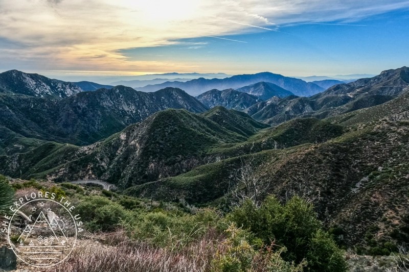
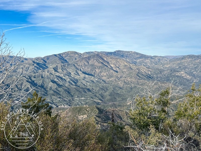
There were three wooden signs marking the summit when I went, and the summit offered amazing 360 views of the surroundings, including snow-capped San Antonio.
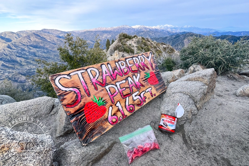
I spent nearly an hour at the summit, soaking in the scenery, snapping photos, and savoring strawberries dipped in Nutella as the sun set. As the temperature dropped and the wind picked up, I felt compelled to reluctantly leave the breathtaking view behind and begin my descent.


The descent
I found trekking poles helpful for descending the steep section, so I recommend bringing yours.
Overall, I finished the return trip in 2 hours and 52 minutes of moving time (3 hours and 44 minutes total). While I did not see any wildflowers, nor did I encounter any wildlife on this hike, the views were magnificent throughout. And the sunset was just exquisite at the summit. I really enjoyed this hike, and I am so glad I completed it!
Watch my Strawberry Peak Hike: Relive Video
Check out my Strawberry Peak hike on Relive! It’s a fantastic platform for adventure lovers to capture and share outdoor experiences like never before. With Relive, you can create custom videos that vividly depict your journeys, turning memories into captivating stories ready for sharing. Share the beauty of your adventures and inspire others to explore nature through Relive’s immersive storytelling.
Join this vibrant community today and turn every adventure into a captivating visual story. Embrace the adventure and seize the chance to immortalize it with Relive!
FAQs about the Strawberry Peak Hike
Q: How long is the Strawberry Peak hike?
A: The hike is approximately 7 miles round trip with an elevation gain of 1,771 feet.
Q: Can I bring my dog?
A: Yes! Dogs are allowed but must be kept on leash at all times.
Q: When is the best time to hike Strawberry Peak?
A: January through October offers the best weather and trail conditions.
Q: Do I need a permit or pass?
A: Yes, an Adventure Pass is required for parking at the Red Box Picnic Area trailhead.
Final Thoughts on Hiking Strawberry Peak
Reflecting on my hike to Strawberry Peak, I’m amazed by nature’s beauty and the excitement of reaching new heights. If you’re reading this, I strongly suggest hitting the trails yourself, whether it’s Strawberry Peak or another adventure. Believe me, the views and feeling of achievement are absolutely worth it. I appreciate every moment in nature and look forward to exploring more.
If you’re reading this, I strongly suggest hitting the trails yourself, whether it’s the Strawberry Peak hike near Los Angeles or another adventure.
Sawmill Mountain Hike via Mt Pinos (Six Pack of Peaks)
My first hike of the new year was to Mount Pinos and Sawmill Mountain, a trail I had planned to…

The Epic SoCal Six Pack of Peaks Hiking Challenge
I took on the SoCal Six Pack of Peaks Hiking Challenge, also known as the Southern California Six Pack of…
Ontario Peak Hike Guide: Trail Tips & Six Pack Challenge
Ontario Peak is a standout summit in the San Gabriel Mountains, offering panoramic views, alpine vibes, and a solid challenge…

Cucamonga Peak Hike via Icehouse Canyon Trail Guide
Cucamonga Peak stands out as one of the most iconic hikes in Southern California. Rising to 8,862 feet, it’s a…
Hiking San Bernardino Peak via the Angelus Oaks Trail
San Bernardino Peak is one of the original hikes in the SoCal Six Pack of Peaks challenge, and the Angelus…
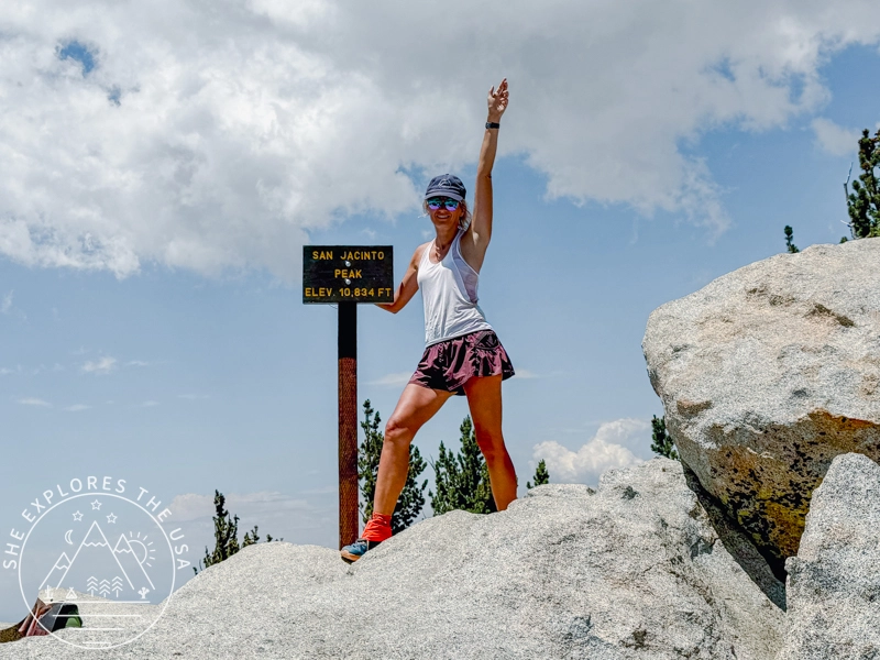
San Jacinto Peak Hike Via Marion Mountain Trail
San Jacinto via Marion Mountain Trail is one of the original SoCal Six Pack of Peaks challenge hikes, and I…
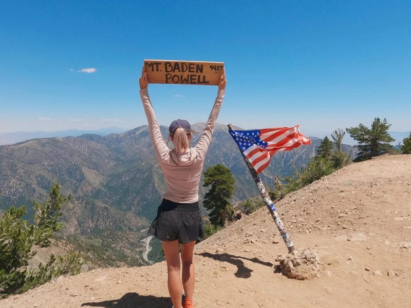
Mount Baden Powell Hike via Vincent Gap Trailhead
I took advantage of the July 4th holiday to drive up to LA and conquer Mt Baden Powell for my…
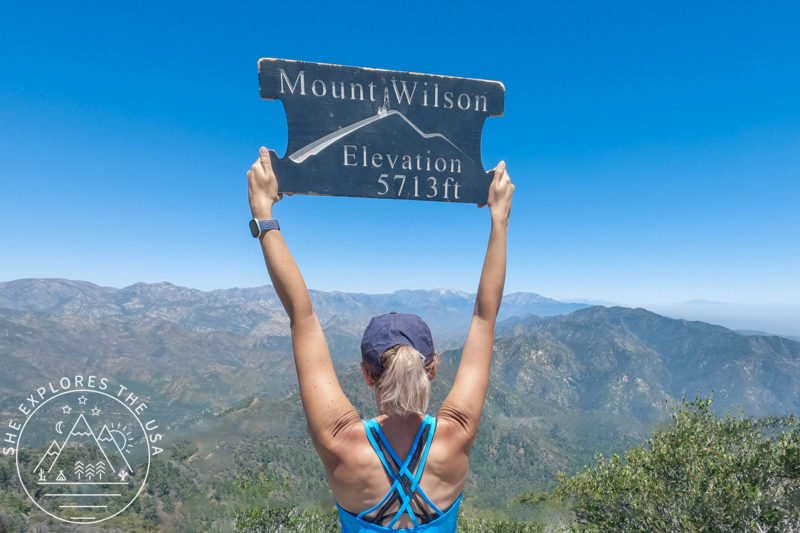
Mount Wilson Hike: Observatory, Trails & Views
Mount Wilson has a reputation, and it’s well earned. As part of the SoCal Six Pack of Peaks Challenge, this…
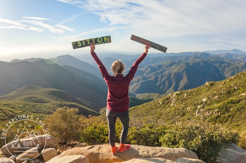
Sitton Peak Trail Guide: SoCal Six Pack’s Easiest Peak
Sitton Peak, nestled in the San Mateo Canyon Wilderness near Lake Elsinore, CA, is a hidden gem and an excellent…
Post originally published on February 28, 2024, and last updated on April 4, 2026.