
Hiking San Diego’s Mission Trails 5-Peak Challenge
DISCLOSURE: This post may contain affiliate links. If you purchase after clicking one of my links, I may earn a small commission at no extra cost to you. As an Amazon Associate, I earn from qualifying purchases. For more information, see my disclaimer.
Ready to hike five peaks in one day? The Mission Trails 5-Peak Challenge in San Diego’s Mission Trails Regional Park covers about 15 miles and over 4,000 feet of elevation gain, so it’s one of the best local tests of endurance and mindset. After recovering from two weeks of bronchitis, I decided this popular San Diego 5 Peaks challenge was the ideal way to ease back in. Because it’s close to home and offers flexible route options, it felt like the perfect low-pressure, high-reward comeback hike. In this post, I’ll share how I completed all five peaks in a single day, and what I’d recommend if you’re planning your own one-day peak challenge.
- 5 Peak Challenge Gear Recommendation
- Tips & Timing
- Hike-by-Hike Breakdown (5 Peak Challenge Map)
- Pretty Flowers found along the Mission Trails 5-Peak Challenge
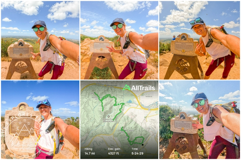
- My Stats for the Mission Trails 5-Peak Challenge
- Relive my Mission Trails 5‑Peak Challenge!
- FAQ About the Mission Trails 5-Peak Challenge
- Final Thoughts on Mission Trails 5-Peak Challenge
5 Peak Challenge Gear Recommendation
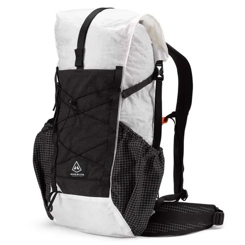
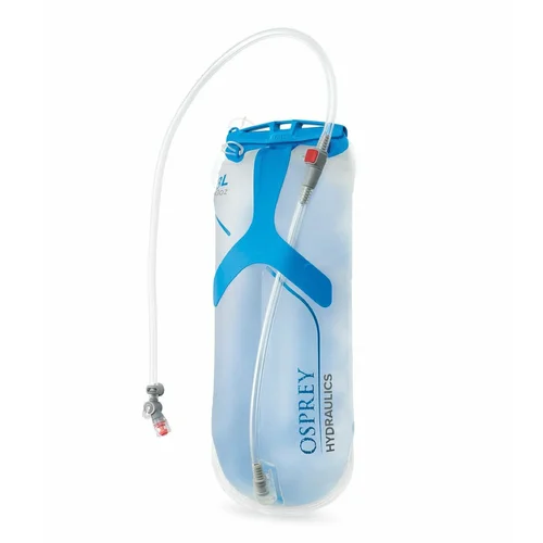
In addition to the famous ten essentials, take into account the following gear recommendations before embarking on this hike. For more gear I’ve tested and loved, check out my curated outdoor gear shop.


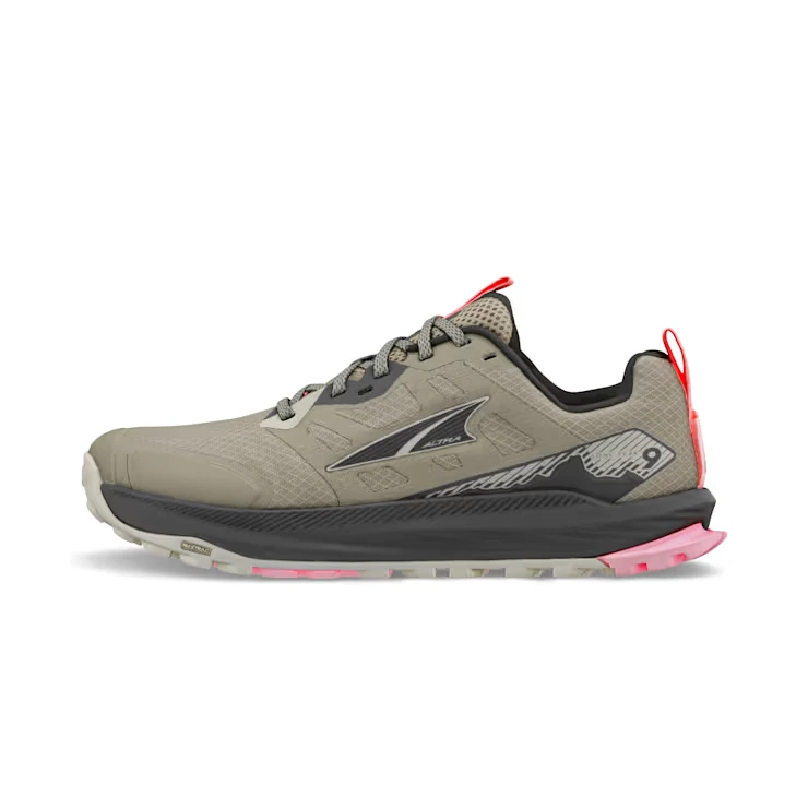
How to Choose the Best Hiking Shoes (& Top Picks)
Choosing the right hiking shoes is key to comfort, performance, and safety. The right footwear prevents discomfort on rugged […]…

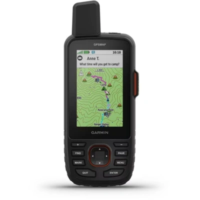
Garmin GPSMAP 67i Review & Which InReach Suits You?
Review of the Garmin GPSMAP 67i and comparison to the GPSMAP 66i, Mini 2 and InReach Messenger plus[…]…
Tips & Timing
When planning your Mission Trails 5-Peak Challenge, it’s important to keep timing and weather in mind. While you don’t necessarily need to start at sunrise, it’s a good idea to check the forecast and avoid hiking during the hottest part of the day, especially in summer. Generally, winter, spring, and fall offer the most comfortable conditions, while summer can get extremely hot on these exposed trails. If you’re bringing a dog, be sure to pack extra water and avoid hiking on days over 75°F. Finally, keep an eye out for wildlife along the way. Rattlesnakes are native to the area and tend to be more active in warm weather.
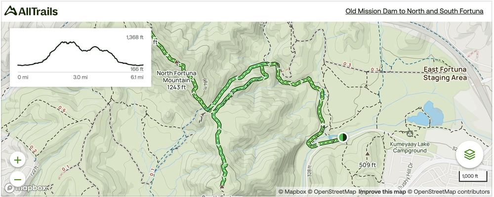
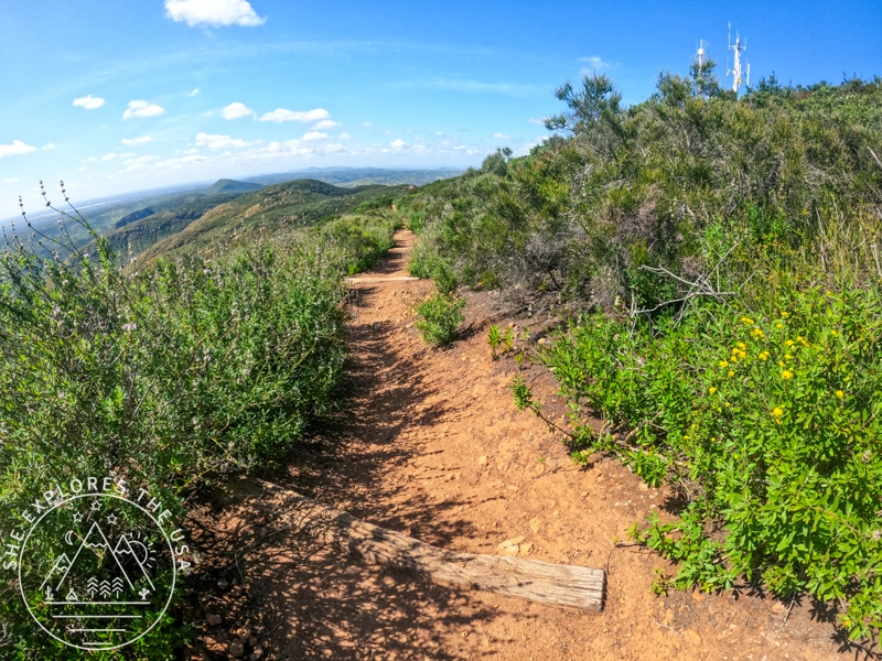
Hike-by-Hike Breakdown (5 Peak Challenge Map)
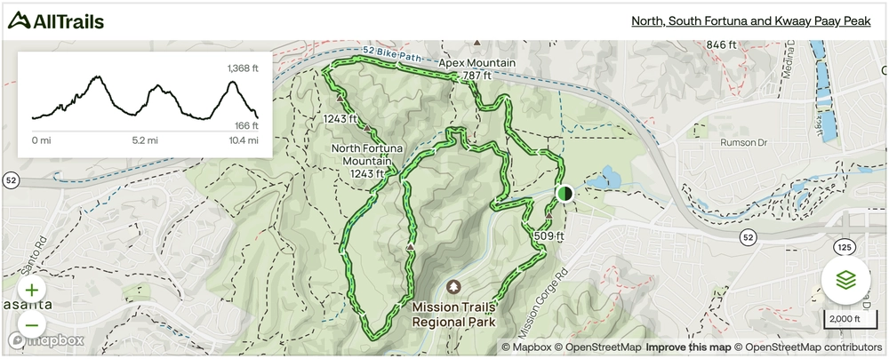
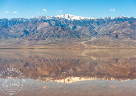
There are several hiking options to take on this challenge. I hiked up North Fortuna, South Fortuna, and Kwaay Paay. Then I drove to Cowles’ Barker Way trailhead and climbed up to Cowles and Pyles. Honestly, I think that’s the easiest option of them all. I chose this because it allows me to go back and do it with the more challenging options in the future. I could use my car as a food and water cache, it was a nice easy way to get back into hiking. And I still have more challenging options to hike in the future.
1. North Fortuna & South Fortuna
North Fortuna
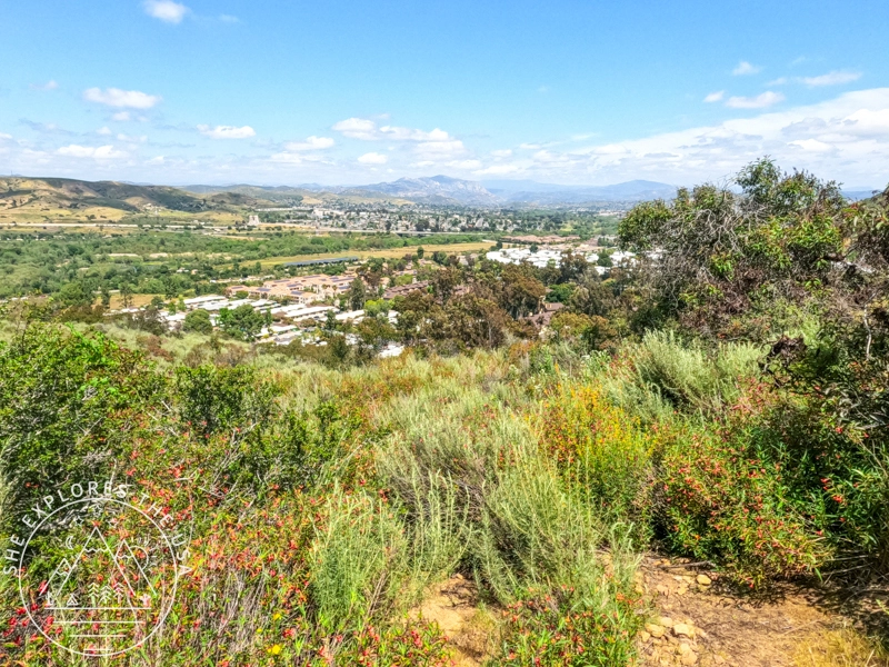
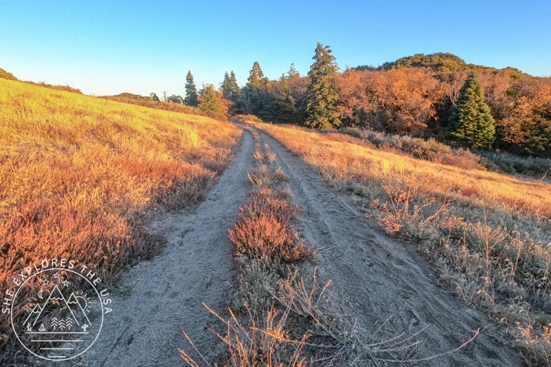
I began my ascent of the first two peaks by hitting the Old Mission Dam to the North and South Fortuna hiking trail. It’s a scenic 5.8-mile route, known to offer a moderate challenge. While there’s a small parking lot at the trailhead with toilets, it tends to fill up fast. However, finding parking along Father Junipero Serra Trail is relatively easy, albeit adding a few extra steps to your hike.
🥾 Plan Smarter Hikes with AllTrails
AllTrails is my go-to for trip planning, from checking trail reviews to downloading maps, navigating from my phone, and sending routes straight to my Garmin 67i. Offline maps, alerts, and AI route planning make upgrading to Plus & Peak worth it!
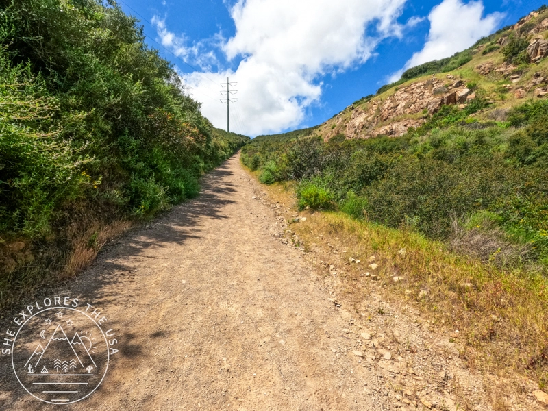
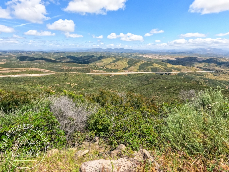
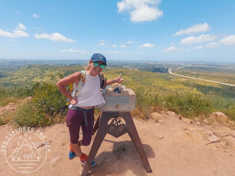
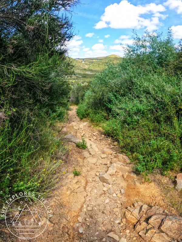
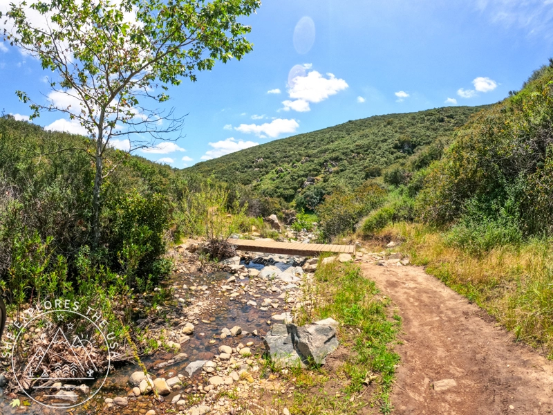
The adventure began with a hike to North Fortuna Peak, revealing beautiful sights along the way. At first, the trail is gentle, following a pretty river for about a mile. Then, things get tougher as you climb for another mile to reach the summit. You’ll find a short break at the saddle halfway up. From there, head north to keep going towards the top of North Fortuna.
Remember, while All Trails marks the summit on their map, you’ll need to walk a bit farther, about a quarter-mile more, to get to the North Fortuna summit sign for those perfect photo moments. One down, four to go!
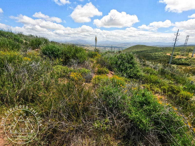
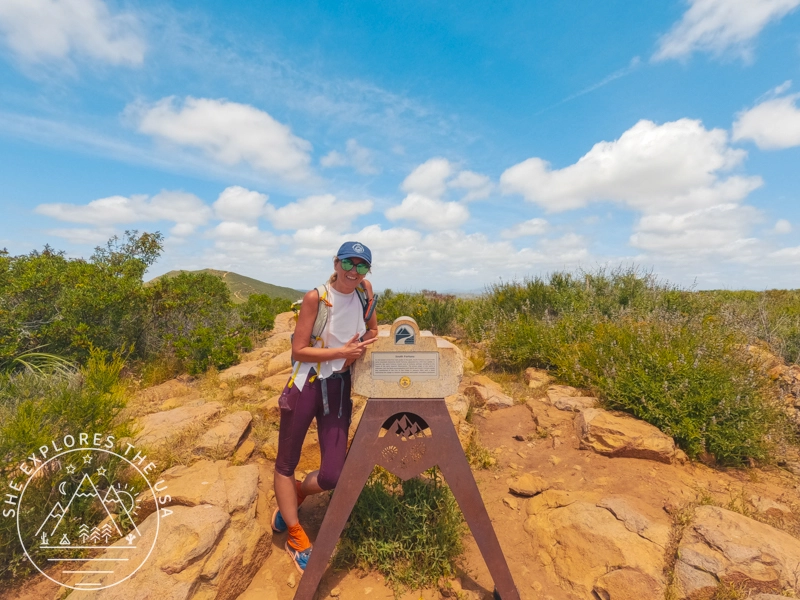
South Fortuna
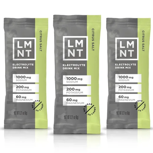
After returning to the saddle, I headed south towards South Fortuna Peak. The trail to the second summit was surprisingly easy from the saddle, almost feeling like cheating. It was a picturesque route, adorned with wildflowers everywhere, making the journey very pleasant. I took my obligatory photo and made my way back down to the trailhead and enjoyed a quick pit stop by my car to make lunch and drink some electrolytes.
Two down, three to go!
2. Kwaay Paay Peak
After lunch, I made my way to my third peak of the day: Kwaay Paay!
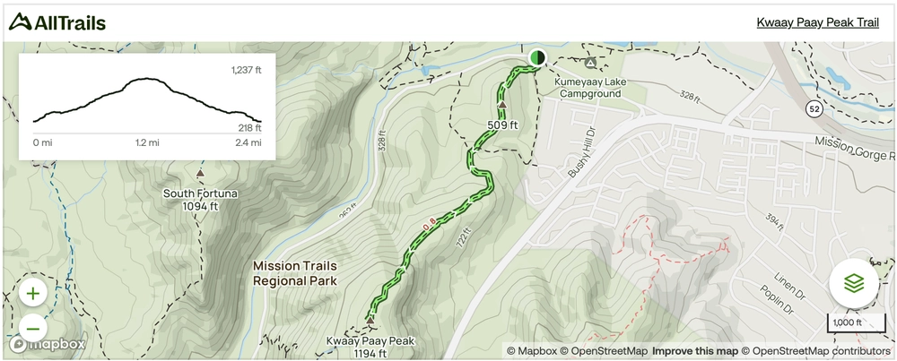
The Kwaay Paay Peak Trail spans about 2.4 miles round trip and is often seen as quite challenging, mainly due to the steep incline of the last quarter-mile, which hits around 30%.
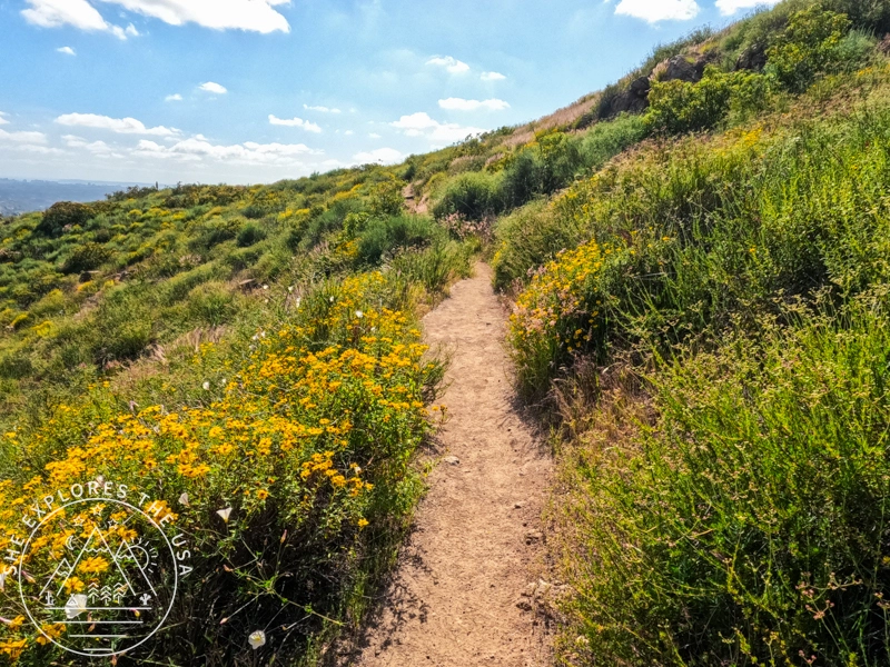
Once again, the trail was surrounded by beautiful wildflowers, making it a delightful return to my mission.
After snapping a photo at the summit, I descended back to my car and drove to the Barker Way trailhead to tackle the last two peaks. Feeling fantastic at that point, I was thrilled that this challenge seemed completely achievable now. I felt strong and eager for the final two peaks.
Three down, two to go!!
A more challenging option to hike the Fortunas and Kaay Paay
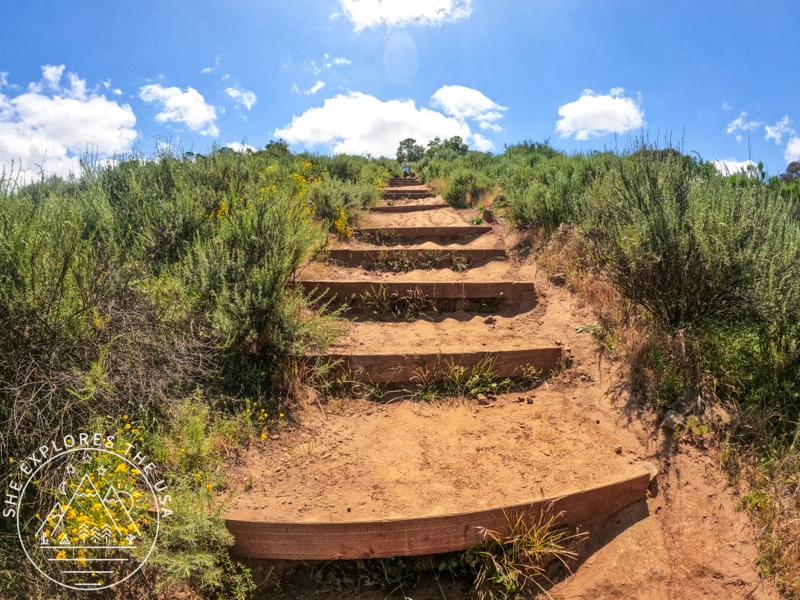
AllTrails offers another option, linking these three peaks into a single challenging route, as shown in the map below. This alternative makes the three-peak hike more demanding, especially because it involves climbing the stairs up to South Fortuna. This route forms a 10.4-mile loop with a 2,752 ft elevation gain. In contrast, combining the two hikes I did totals 8.2 miles with a 2,138 ft elevation gain!
3. Cowles Mountain & Pyles Peak
After enjoying a quick snack as I drove, the final push was to hike up to Cowles and then Pyles from Barker Way. I got there in the middle of the afternoon, so on-street parking was very easy to find.
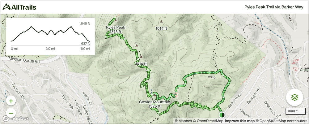
Cowles Mountain
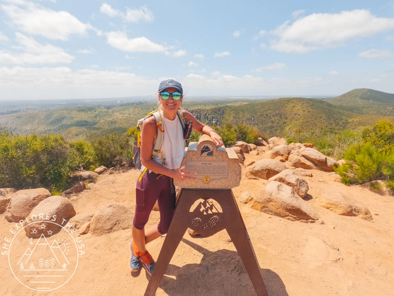
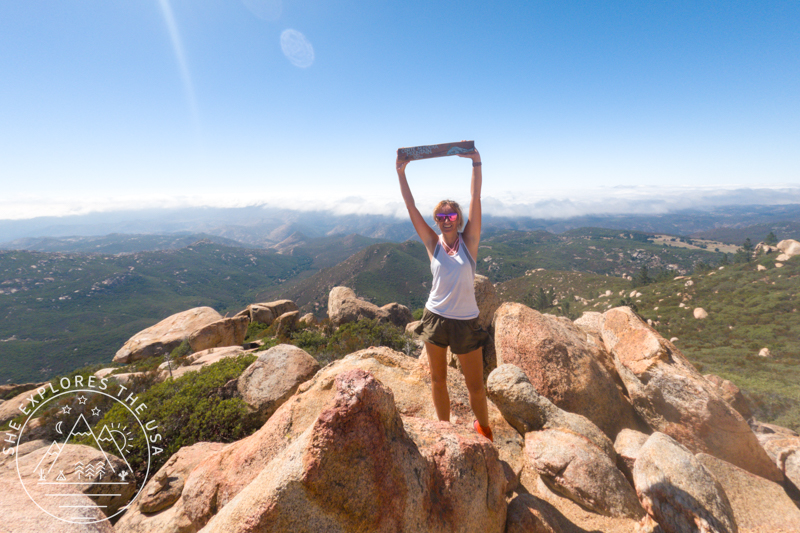
I started my ascent via Barker Way, a moderate switchback trail that eventually joins back to the main, more popular route up to Cowles Mountain, where even more switchbacks waited for me. Then, after a steady climb, I quickly snapped my summit photo at Cowles. At that point, I only had one peak left! I could hardly believe I was actually going to get this done.
Four down, one to go!!!
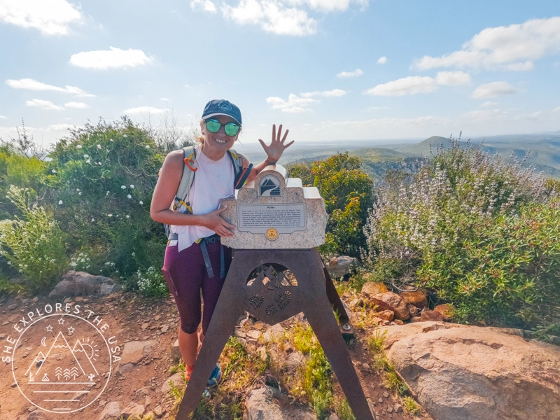
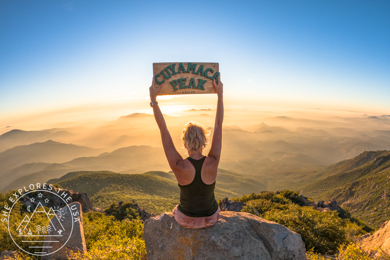
Pyles Peak: The Final Push
This was my first time hiking to Pyles Peak, and surprisingly, it brought the first moment of real uncertainty. From the top of Cowles Mountain, I wasn’t sure which way to go, but thankfully, the trail was well-marked. I felt good physically, but ran into a hiccup: I had been recording the hike from the Fortuna route, so I couldn’t see the elevation profile anymore to mentally prepare.
It hit me fast, this descent and climb to Pyles was no joke. The trail dips before climbing again, and knowing I’d have to hike back up to Cowles before descending to the trailhead had me second-guessing my route strategy. Next time, I might start with Cowles and Pyles first. Lesson learned!
A Quiet Finish to a Big Day
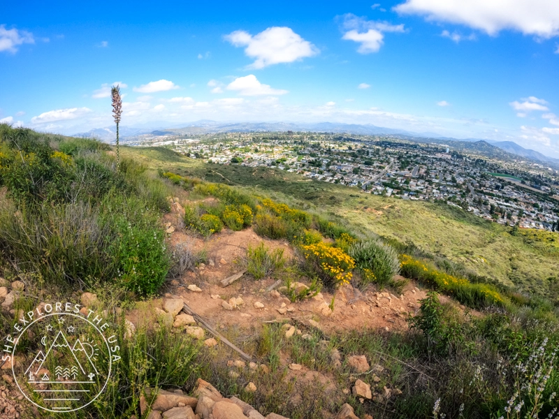
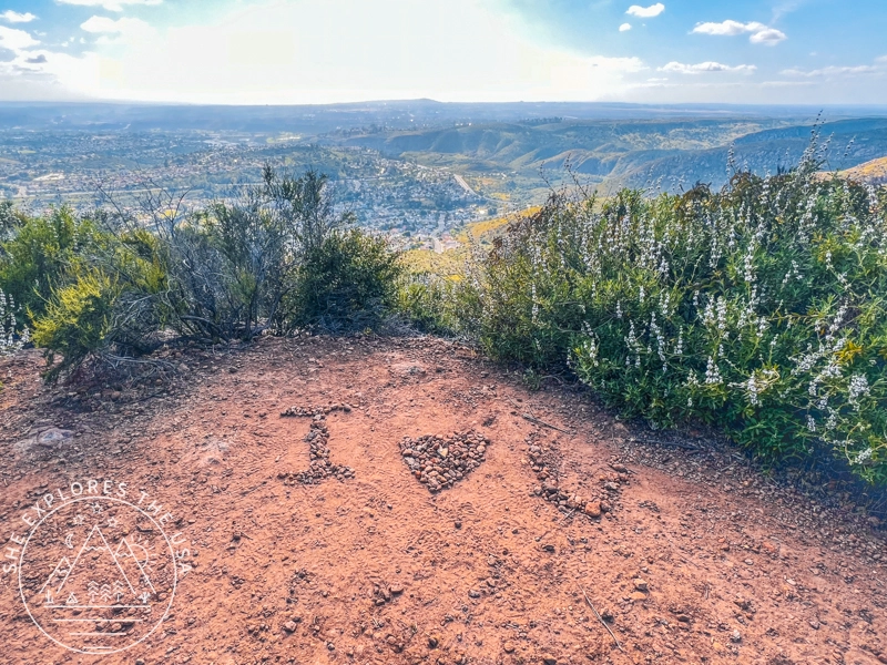
Still, the trail to Pyles was peaceful, with wildflowers everywhere and far fewer people than Cowles. It gave me space to reflect on the day, soak in the views, and appreciate what I was about to accomplish.
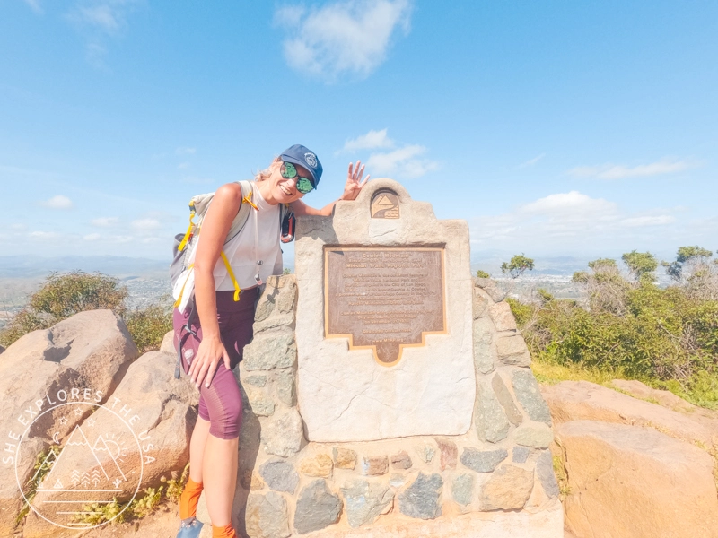
Reaching that final summit brought such a wave of joy and relief. I snapped my last summit photo, smiled like crazy, and began the final descent.
Five peaks down!!!!!! Wow, I did it!!!!!!!
As I descended via the service road, I couldn’t help but reflect on the highs and challenges of the day. The Mission Trails 5-Peak Challenge had not only pushed me physically and mentally, but also delivered stunning views, quiet moments, and a renewed appreciation for San Diego’s Mission Trails. Ultimately, it was the kind of day that reminds you why you hike and inspires you to start planning the next one.
Would I do it again? Absolutely!! It really wasn’t as bad as I anticipated, especially considering I was sick for the two weeks before the challenge. I started coughing my lungs out again after the fourth peak, but I am so glad I could complete the challenge. I also want to tackle the more challenging route options in the future!! This is a great training hike for those training for more challenging peaks beyond San Diego County.
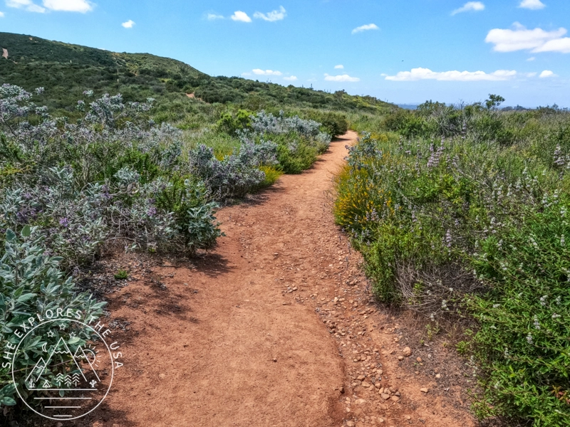
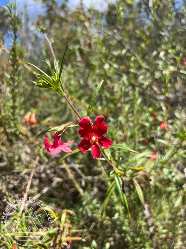
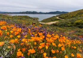
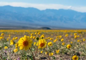
Pretty Flowers found along the Mission Trails 5-Peak Challenge


My Stats for the Mission Trails 5-Peak Challenge
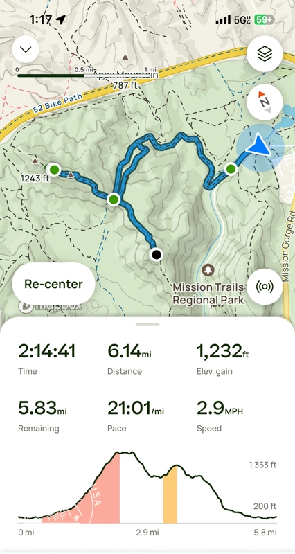
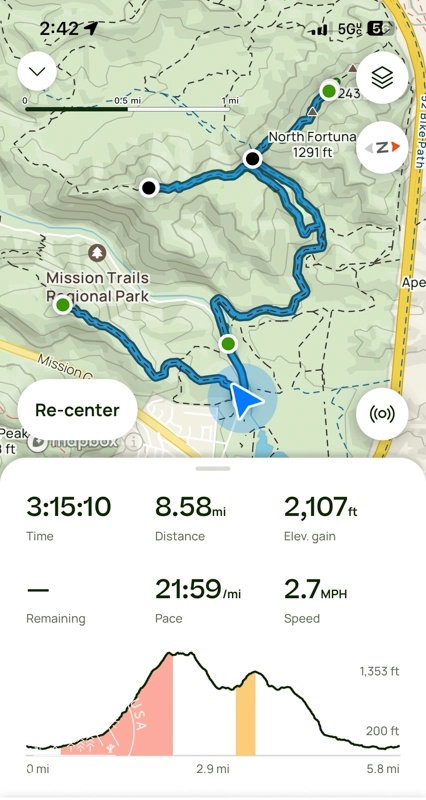
I conquered this 15-mile Mission Trails 5-Peak Challenge in 5 hours and 24 minutes, with a whopping elevation gain of 4,324 feet! I couldn’t be happier with my achievement, especially considering I had been coughing my lungs out for the two weeks leading up to it.


Relive my Mission Trails 5‑Peak Challenge!
Check out my Mission Trails 5-Peak Challenge hike on Relive! It’s a fantastic platform for adventure lovers to capture and share outdoor experiences like never before. With Relive, you can create custom videos that vividly depict your journeys, turning memories into captivating stories ready for sharing. Share the beauty of your adventures and inspire others to explore nature through Relive’s immersive storytelling.
FAQ About the Mission Trails 5-Peak Challenge
What is the Mission Trails 5-Peak Challenge?
The Mission Trails 5-Peak Challenge is a self-guided hiking route in San Diego’s Mission Trails Regional Park where you summit five popular peaks, Cowles Mountain, Pyles Peak, Kwaay Paay, North Fortuna, and South Fortuna, in one day or over multiple trips.
How long is the 5-Peak Challenge route?
The full challenge covers roughly 15 miles with about 4,000 feet of elevation gain, depending on the specific route you take.
Can I complete all five peaks in one day?
Yes, it’s doable with good fitness and proper planning. Many hikers break it into segments or do it over multiple days, but completing it in one day is a popular goal.
When is the best time to hike the 5-Peak Challenge?
The best seasons are winter, spring, and fall when temperatures are cooler. Summer hikes are possible but can be very hot on exposed trails, so plan accordingly.
Are dogs allowed on the Mission Trails 5-Peak Challenge?
Yes, dogs are allowed, but it’s important to bring plenty of water for them and avoid hiking on hot days (over 75°F) to keep them safe.
Is the Mission Trails 5-Peak Challenge an official event?
The 5-Peak Challenge was an official event from 2015 until around 2020, during which participants could earn a certificate and pin upon completion. However, the official challenge has since been discontinued, likely due to the COVID-19 pandemic, and now it continues as a popular self-guided hiking route without formal recognition.
What gear do I need for the 5-Peak Challenge?
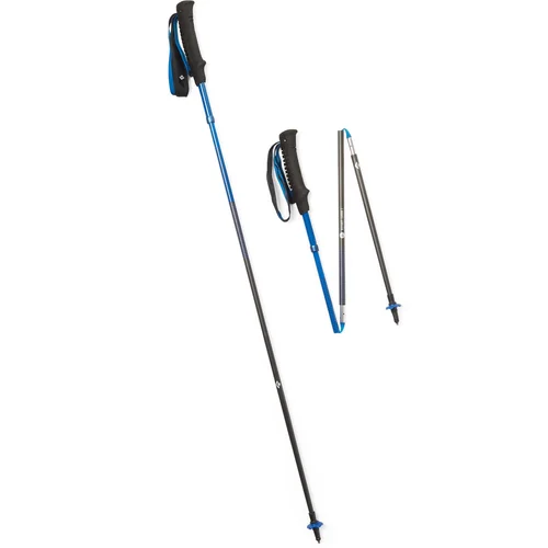
Essentials include plenty of water, electrolyte replacements, sturdy hiking shoes, sun protection, trekking poles (optional), snacks, and a map or GPS device.
Where can I park for the 5-Peak Challenge?
There are multiple trailheads with parking near the peaks, including Old Mission Dam for the Fortunas and Kwaay Paay, and Barker Way for Cowles Mountain and Pyles Peak.
Are there any safety concerns on this hike?
Yes, be aware of rattlesnakes, especially in warmer months. Also, prepare for steep sections and be cautious of heat exposure during summer.
Final Thoughts on Mission Trails 5-Peak Challenge
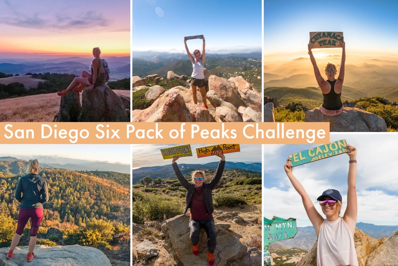
As I returned home, tired but fulfilled, I couldn’t help but smile at the memories of the day’s adventure. The Mission Trails 5-Peak Challenge had been more than just a hike; it had been a testament to the human spirit and the boundless beauty of our world. As I looked ahead to future adventures, I knew that the mountains would always call me back, whispering tales of untold wonders waiting to be discovered. And if you’re looking for another challenge, learn about the epic Six Pack of Peaks Challenge series here!!
Post originally published on May 15, 2024, and last updated on December 28, 2025.

Félicitations pour cette magnifique randonnée.