Big Pine Lakes: A Scenic 16-mile Hike in the Sierra
DISCLOSURE: This post may contain affiliate links. If you purchase after clicking one of my links, I may earn a small commission at no extra cost to you. As an Amazon Associate, I earn from qualifying purchases. For more information, see my disclaimer.
To celebrate my 10th anniversary of living in America, I wanted to do something unforgettable. I chose to hike the stunning 16-mile Big Pine Lakes trail in California’s Sierra Nevada, a trail often ranked among the most scenic in the state. While I backpacked this route two years ago, this time I challenged myself to complete it in a single day. Below, you’ll find my detailed trip report and hiking guide: from what to pack to tips for tackling the elevation gain, and of course, photos and moments from each of the seven lakes I reached.
Camping at the Big Pine Lakes Trailhead
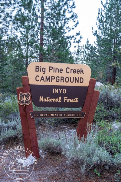
To make the most of my anniversary, I camped at Big Pine Creek campground the night before, just minutes from the trailhead.
Important tips
- Book early, this campground fills up quickly!
- It’s a dry campground: bring all your water for cooking, cleaning, and drinking.
- There are pit toilets and fire pits, and most campsites offer decent privacy.
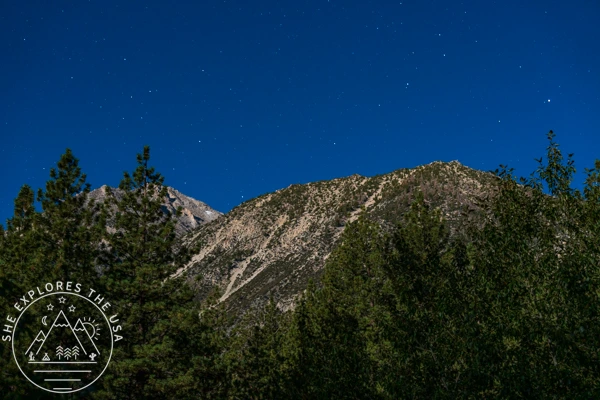
I was lucky to be there during a full moon. The light spilling over the surrounding mountains was pure magic, quiet, silver, and unforgettable.
Travel Insurance
Before any trip, I always recommend sorting out your travel insurance. World Nomads offers both single-trip and annual worldwide coverage, and you can get a free quote in just a few minutes to see what it would cost for your trip.
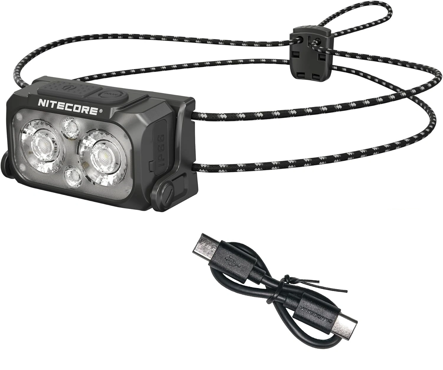
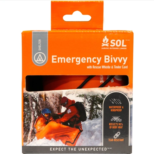
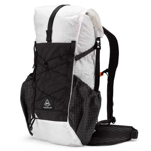
👉 Get Your Free QuoteGear Recommendation for Hiking Big Pine Lakes
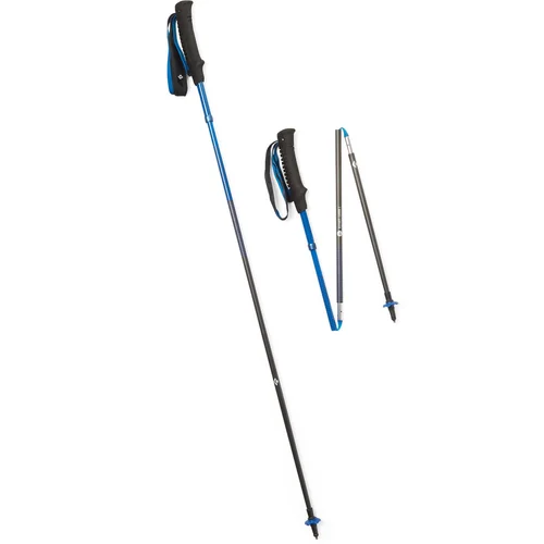
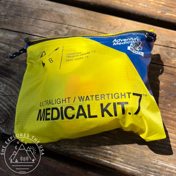
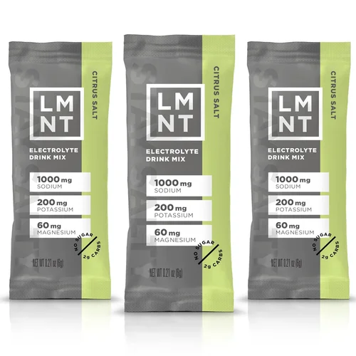
This is a 16-mile hike with over 4,000 ft of elevation gain, reaching 11,000ft, so come prepared. Start with the Ten Essentials, and consider these additional items, especially if you’re hiking in colder months or shoulder seasons.
For the full lineup of gear I personally recommend, visit my curated outdoor gear shop.


Big Pine Lakes Trail Report
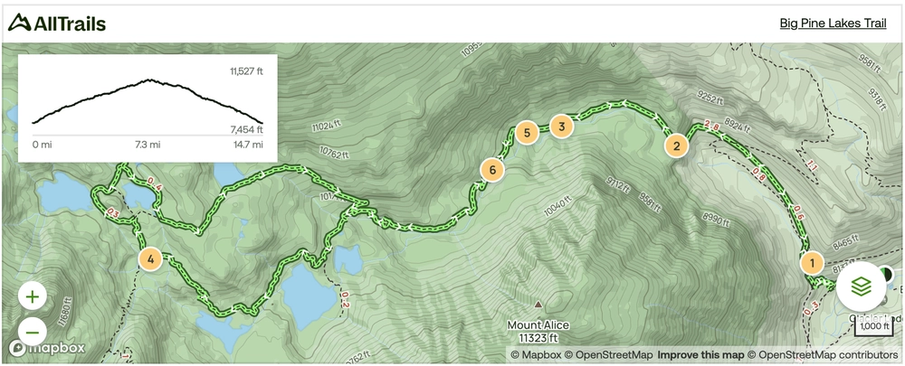
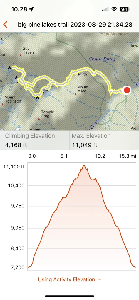
Big Pine Lakes Trail Map
Click the map to view the full route on AllTrails.
🥾 Plan Smarter Hikes with AllTrails
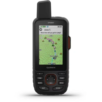
AllTrails is my go-to for trip planning, from checking trail reviews to downloading maps, navigating from my phone, and sending routes straight to my Garmin 67i. Offline maps, alerts, and AI route planning make upgrading to Plus & Peak worth it!
Parking for Day Hiking vs. Backpacking Big Pine Lakes
I walked from my campsite to the day hike trailhead, located right next to the campground entrance.
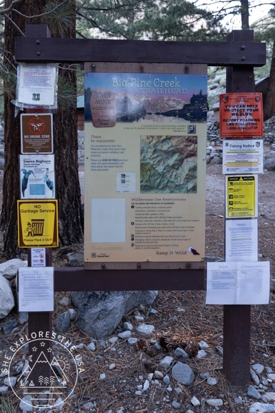
If you’re planning to backpack overnight instead of doing it as a day hike like I did, there’s overnight parking and a separate trailhead just down the road. You’ll need a wilderness permit, and it’s important to select the North Fork trailhead, which leads to the iconic glacier lakes. The South Fork trail also starts nearby; it’s less scenic overall but still worth exploring if you’re looking for a quieter route or a second day hike.
Trailhead to Lake One
I started from the day-use trailhead near the campground around 10:00 AM, moving slowly after a rough night’s sleep.
The day hike starts off easy from the Big Pine Creek trailhead, along Big Pine Creek. After crossing a wooden bridge over the creek, switchbacks start. This section of the trail is in the forest, so it’s very shaded. I crossed another wooden bridge and joined the main trail, which is basically the trail that started from the overnighters’ parking lot.


That section is very exposed for about two miles. It’s a steady uphill, and a few trees offer a little shade to catch your breath every so often. If you can see a waterfall towards the left in the distance, that’s where you’re headed. After about a mile and a half, you’ll encounter switchbacks (the first set if you started from the overnight parking lot), and after that is where you get easy access to the creek if you need to refill your water. This is also a popular pit stop as the trail now becomes more shaded, and obviously, there’s easy water access.


Keep walking and you’ll find the wilderness ranger cabin on your left. To me, that cabin marks halfway through to Lake Two. I don’t know if it’s exactly that, but it can’t be far off. I took a lunch break shortly after that house to eat a wrap with spicy tuna and salty chips.
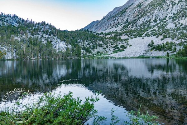
Started walking up again, and found more switchbacks, the trail was super muddy and a river at times. Had to hop on several stones to make my way across at times. Eventually got to the sign where Lakes 1-3 are to the left, and Black Lake to the right.
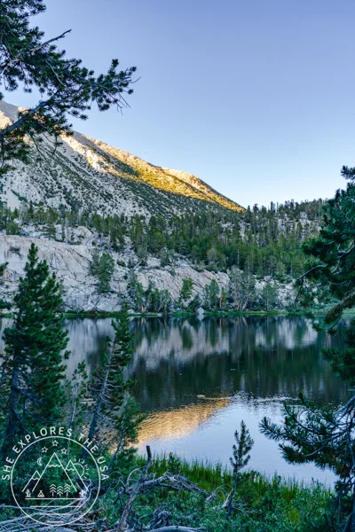
Big Pine Lakes – Lake One (1:30 PM)
I kept on walking, perhaps half a mile or so, and finally got to Lake One at 1:30 p.m.! I love that lake because it’s the beginning of the trail going by faster as it’s a more interesting scenery, and I also had that Lake to myself since I started late. Everyone was already further ahead at Lake Two and beyond.
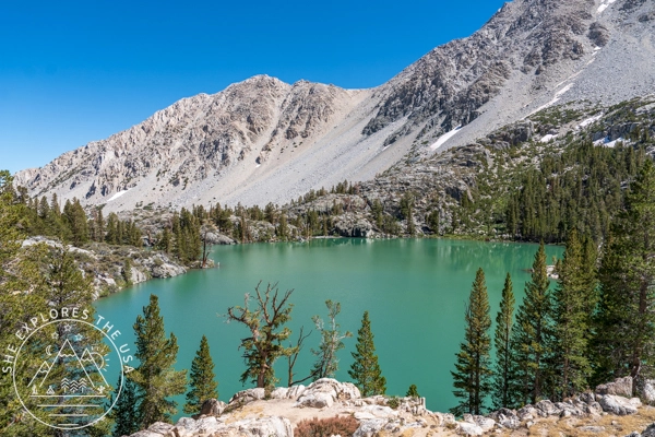
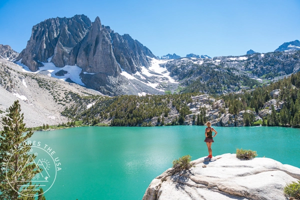
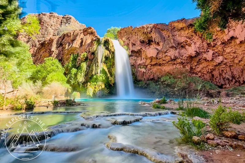
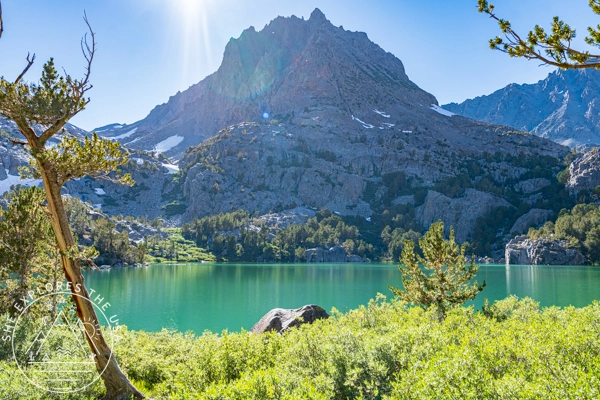
Big Pines Lakes – Lake Two (2:30 PM)
This one’s the most photographed and Instagram-famous lake in the area, and for good reason. Even though there were more hikers here, I still found solitude and snapped some beautiful photos.
Pro tip: Make your electrolyte drink here; it really helps restore energy for the next few miles.
Trail Fast Facts
- 🥾 Distance: 16 miles round-trip
- ⛰️ Elevation gain: ~4,000 ft (to 11,527 ft)
- ⏱️ Time: Took me 11.5 hours total (lots of breaks!)
- 🏕️ Most people stop at Lake 2 or 3
- 📍 Trail starts at Big Pine Creek (North Fork)
- 🐜 Bring bug spray, sunscreen, layers, electrolytes, and snacks
- 💧 Filtered creek water is available; bring a filter!
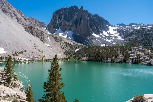
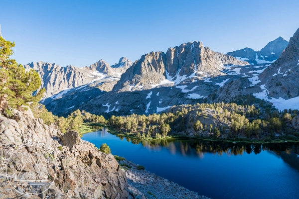
Big Pine Lakes – Lake Three
Next, I made my way to Lake Three and arrived around 3:40 p.m. That lake is beautiful too with the water being very clear. By that point, it was getting late so I started only taking a couple of photos of the lakes and moving on. I really needed to save my energy for walking.
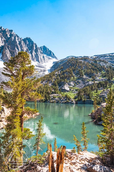
Big Pine Lakes – Lakes Five, Six, and Seven
More switchbacks greeted me as I made my way up to the remaining lakes from Lake Three. Urgh, did I mention I hate switchbacks? By that time, I was walking so slowly because the elevation was hitting me hard, but I was determined to make it to the seven lakes. I got to a point where Lake Five was one way and Lake Four another. After checking my map, I chose to go to Lake Five, then Six and Seven, and walk by Lake Four on the way back down.
I made it to Lake Five around 4:40 pm. Again, I only took a photo and walked towards Lakes Six and Seven. By then, going uphill was becoming excruciating, and I had to work on my positive self-talk to keep going. I kept telling myself this was the last uphill, and then it’ll all be downhill for eight miles back. But unfortunately, the trail knocked that right off with a downhill on the way to Lakes Six and Seven, which meant I would have an uphill on the way back. And that really knocked my mental fortitude a bit. But I was so close to seeing those two lakes that I couldn’t just give up and turn around.
I kept pushing through and finally made it to those two lakes around 6:00 p.m. The sun was just setting behind the mountains on the right, so it made such a magnificent landscape. I chilled on a rock, observing the wildlife on the lake before making my way back.
Big Pine Lakes – Summit Lake, Lake Four, and Black Lake
I had the option of going to Summit Lake at that point, but I was so tired that I chose to skip it. From there, I reached Lake Four around 6:40 pm, and as the sun was still setting, I got to see some alpenglow and beautiful mountain reflections over the lake.
And with that, I had seen all seven lakes in one day!! Though it didn’t feel like the most gracious hike I have ever done, and it was far from being over, I was already proud of myself.
Shortly after leaving Lake Four, the trail became a calf-deep creek. It was 7 pm, the sun was gone, it was getting chilly, and I had to walk through that, so I knew it meant I would have wet feet all the way back down. I was surprised to see two fish swimming in front of me as I stepped in the water, but the frigid water actually gave my legs a much-needed recharge. I felt so refreshed and had a new lease on life after these few steps in that water section. It was so refreshing, energizing, and just what I needed actually, to have enough energy to make my way all the way back down to camp.
Soon I arrived at Black Lake around 7.10 pm. That lake is definitely not a glacier lake either given its color, but it was very serene and scenic at dusk, surrounded by trees and mountains, and to me, it was a bonus lake! I would come back and camp by that lake if the opportunity comes up.
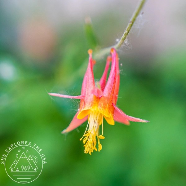
Some flowers I found along the way


Hiking back down to camp
From Black Lake to the intersection with Lakes One through Three, it was what felt like steep and endless switchbacks back down. I was glad I was going downhill because that section would be challenging going uphill. But it was so steep that my right knee started hurting and just kept on hurting back down.
As I walked back down, it was also time for the full moon to rise and light up the path and the surrounding mountains. It was such a magnificent sight. By then, the trail was also full of night critters, and I even saw a scorpion!
At 9:30 p.m., after hiking for 11.5 hours, including lots of breaks!, I finally made it back to camp, feeling very accomplished. After a few static stretches, I was ready for bed!

Garmin Tracking + Relive Video
Relive Video output
I love using Relive to bring my hikes to life visually. For example, I sync it with my Garmin Connect account, and it auto-generates a 3D video from my route. Additionally, you can add photos, switch to terrain mode, or even narrate your hike with the paid version.
Overall, it’s a fun way to relive the adventure and is totally worth trying out!
Garmin Inreach tracking
FAQ About Hiking Big Pine Lakes
What is the distance of the Big Pine Lakes hike?
In total, the full hike to Lakes 1 through 7 and back is approximately 16 miles round-trip, with over 4,000 feet of elevation gain.
How long does it take to hike Big Pine Lakes?
That depends on your pace, fitness level, and how far you go. For example, I’m an experienced hiker, but it still took me 11.5 hours to complete the full 16-mile trail. I stopped often to take photos, and the elevation slowed me down since I live at sea level. Many hikers just visit the first or second lake, which makes for a 10-mile round trip and can be done much faster, usually in 4 to 5 hours.
Do I need a permit for Big Pine Lakes?
If you’re day hiking, no permit is needed. However, if you plan to backpack and camp overnight, you’ll need a wilderness permit for the North Fork of Big Pine Creek.
Where does the Big Pine Lakes trail start?
To start your adventure, head to the Big Pine Creek Trailhead (North Fork), located near the Big Pine Creek Campground just west of Big Pine, California.
What is the elevation at Big Pine Lakes?
As you hike higher, the trail eventually reaches about 11,500 feet near Lakes Six and Seven.
Which Big Pine Lake is the most scenic?
Lake Two is widely considered the most scenic and most photographed. That said, Lakes Six and Seven at sunset were absolutely stunning, peaceful, remote, and full of golden alpine light.
Can I filter water on the Big Pine Lakes trail?
Yes, and it’s a big help on a long day hike. You can refill your water from the creek, but just make sure to bring a good water filter or purification tablets.
Is the Big Pine Lakes trail good for beginners?
The full 16-mile route is challenging due to the distance, steep elevation gain, and high altitude. Still, beginners can enjoy the first one or two lakes (a 5-mile one-way trip), which offer a great experience without overcommitting.
When is the best time to hike Big Pine Lakes?
June through October is typically the best window. However, early in the season, you may encounter snow, so always check trail reports before your trip.
Are dogs allowed on the Big Pine Lakes trail?
Yes! Dogs are allowed on the Big Pine Lakes trail, but they must be kept on a leash at all times.
Final Thoughts on Hiking Big Pine Lakes
This was one of the most intense day hikes I’ve done so far: 16 miles, 4,000 feet of elevation gain, high altitude, and all completed in a single day. Still, I’m so glad I went for it. Not only did this hike push me mentally and physically, but finishing it filled me with a deep sense of pride. That night, I slept for 12 solid hours, and the following day, I focused on recovery with yoga, quiet time at camp, and a mellow hike along the South Fork trail.
Altogether, it was the perfect way to celebrate my 10th anniversary of living in the U.S., and I know I’ll carry the memory of this day with me for years to come.
Post originally published on September 3, 2023, and last updated on May 30, 2026.